Argyll and Kintyre 275kV Substations
- Type:
- Transmission reinforcement
- Location:
- Argyll & Bute
Upgrading Argyll's transmission network to support increased renewable generation and drive forward an energy secure future.

Overview
Section 37 Application Update
The applications under Section 37 of the Electricity Act 1989, relating to the Argyll substations An Suidhe, Crarae, Craig Murrail and Crossaig North, have now been determined and we welcome the decision by Scottish Ministers to approve the four applications.
About the Project
Due to the projected increase in renewable energy generation in Argyll, a need has been identified for the upgrade and reinforcement of the electricity transmission network on the Argyll peninsula to ensure security of supply and support the transition to Net Zero.
As described during the development process for the Inveraray – Crossaig Overhead Line rebuild, the replacement overhead line is being built at a higher 275kV voltage, initially operating at 132kV between Inveraray and Crossaig.
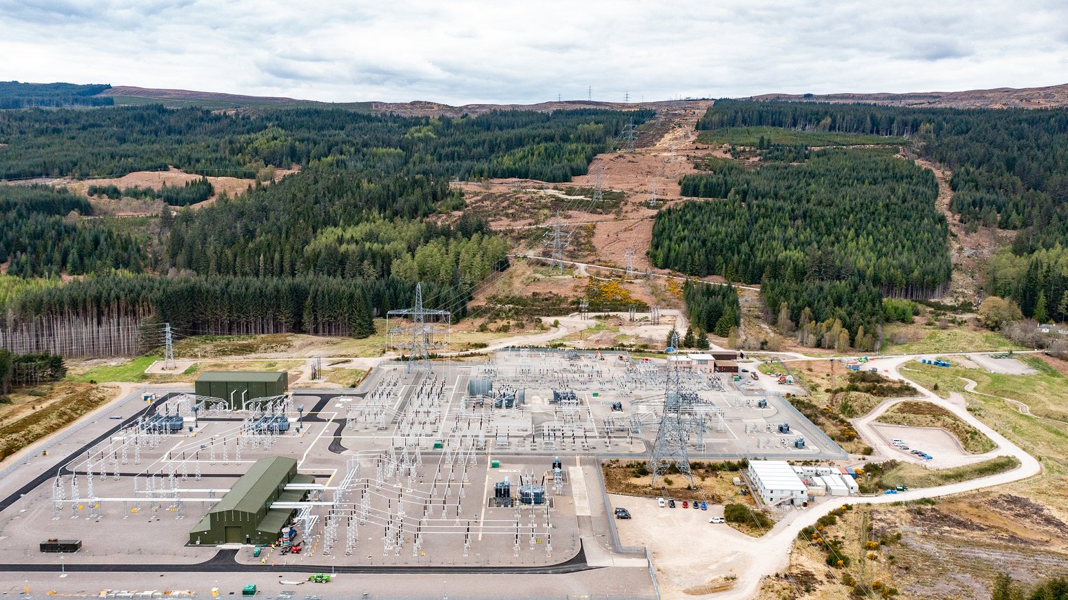
As future renewable generation connects to the electricity network and the operating voltage is required to increase to 275kV, substations along the route will also require to be replaced in order to accommodate this voltage increase. We are therefore proposing to construct and operate four new 275kV electricity substations. Once the 275kV substations are constructed, the existing 132kV An Suidhe, Crarae and Crossaig Substations will be decommissioned.
Find Out More About An Suidhe 275kV Substation
Find Out More About Crarae 275kV Substation
Find Out More About Craig Murrail 275kV Substation
Find Out More About Crossaig 275kV Substation
Find Out More About Creag Dhubh Substation
Webinar: Argyll and Kintyre 27kV Substations and Sheirdrim Wind Farm Connection Project 2021
As part of our Winter 2021 project consultation we held a webinar on 14th December 2021, inviting statutory consultees, community council members and local elected members to discuss our proposals ahead of our planning application process. Watch this recording of the webinar for more information:
Find Out More About Argyll and Kintyre 275kV Strategy
Find Out More About Inveraray - Crossaig 275kV Overhead Line
How we’re embracing artificial intelligence (AI)
We intend to use AI to assist our experienced teams in the analysis of your feedback, so we can categorise key points raised more quickly. You can learn more about how we’re utilising AI on this dedicated web page.
Project Updates
Project updates
-
We're here to lend a helping hand
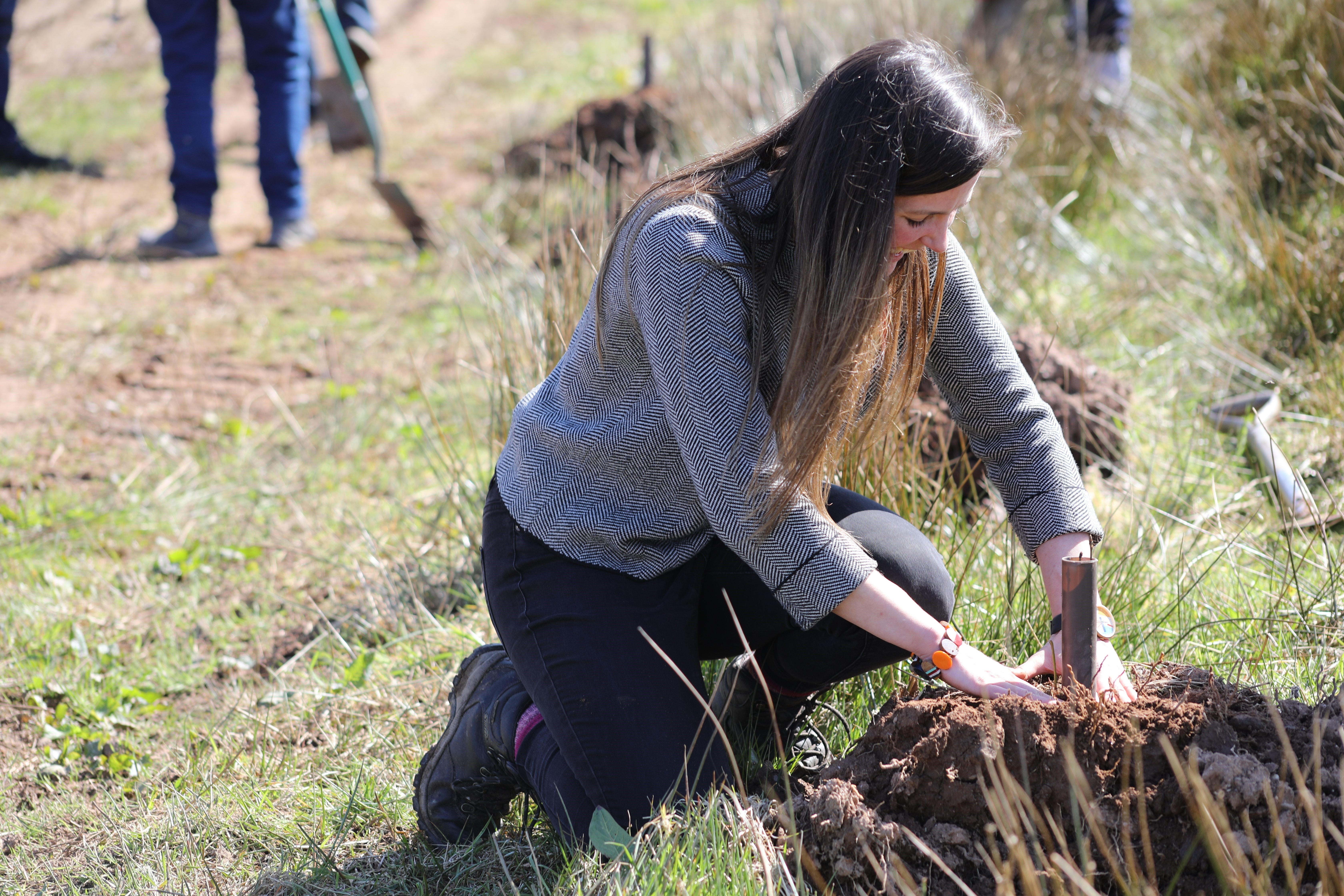
We are committed to supporting the communities in the north of Scotland where we operate, both now and in the future. As part of our ongoing efforts to make a difference and have a positive impact on local communities, we are proud to offer volunteering days to local groups and charities, particularly in the areas that host our electricity infrastructure or where our proposed projects are located.
This month, we’re excited to announce the launch of our new Volunteering Webpage, designed to make it easier for local communities to request volunteering support from us. To request our help, simply complete the ‘Volunteering Nomination Form’ linked at the bottom of our new webpage. Please note, as our team works on a voluntary basis, it may take us some time to coordinate our people and match them with opportunities. We kindly ask for your patience as we work to keep up with volunteering demand.
Thank you for considering SSEN Transmission as a partner in your community efforts. Together, we can leave a positive, lasting legacy and help transform communities across the north of Scotland.
-
Meet the Buyer Events
SSEN Transmission will soon begin construction on the Argyll and Kintyre 275kV substations.
As part of these projects and our ongoing commitment to ensure that where possible, opportunities are advertised locally in the first instance, we are welcoming local businesses to attend informal drop-in meetings to engage with our principal contractors and to exchange details to discuss the possible opportunities for the local supply chain.
These projects have the potential to create local business and employment opportunities in the following fields: Accommodation, fencing, skip hire, catering, cleaning services, plant hire, general operations workers, groundworkers, electricians and more. We would encourage any relevant local businesses to attend these events and discuss what possible business opportunities there are with our principal contractors.
These drop events will be held at the following dates and locations;
An Suidhe, Crarae, Craig Murrail substations:
Wednesday 24 January 2024, 2–6pm
Furnace Village Hall, Furnace,
Inveraray, Argyll, PA32 8XN
Crossaig North Substation
Thursday 15 February 2024, 2–6pm
Carradale Village Hall, Carradale, PA28 6QG
Creag Dhubh Substation
Wednesday 6 March 2024, 2–6pm
Dalmally Village Hall, 31 Glenview,
Dalmally PA33 1AX -
Argyll and Kintyre project - Final Needs Case consultation
The GB electricity regulator Ofgem has provisionally approved SSEN Transmission’s proposals to upgrade the electricity transmission network in Argyll and Kintyre.
In its minded-to approve consultation on SSEN Transmission’s Final Needs Case, Ofgem has recognised the clear need for the Argyll and Kintyre Reinforcement Strategy, which will secure future electricity supplies in the area and enable the connection of new renewable electricity generation in the region. It will support the connection of at least 970MW of new renewable electricity generation, enough to power more than 500,000 homes.
As well as supporting the transition to net zero emissions, the investment will also help secure the country’s future energy independence by removing the country’s dependence and price exposure to volatile, global wholesale gas markets, with the deployment of low carbon, affordable, renewable electricity generation.The project will also unlock hundreds of skilled jobs throughout the construction phase and provide a significant economic boost to local and national economies, all while playing a key role in supporting the transition to net zero emissions and helping secure the country’s future energy independence.
Ofgem’s minded-to decision and consultation on the Argyll and Kintyre Final Needs Case can be found here: https://www.ofgem.gov.uk/publications/argyll-and-kintyre-project-final-needs-case-consultation.
As a stakeholder led business SSEN Transmission would like to encourage all interested and relevant stakeholders to contribute to this important consultation before the closing date on 15th of September 2023. -
Argyll and Kintyre 275kV Substation Town and Country planning consent granted
We recently recieved town planning country planning consent for An Suidhe, Crarae, Craig Murrail and Crossaig North substations . We are currently still awaiting decision on our Section 37 applications for these projects from Scottish ministers. Once we receive notification of their outcome we will provide an update to public stakeholders and also publish this information and next steps on our project webpage. -
Craig Murrail Town and Country Planning Application submitted
A planning application has been submitted by Scottish Hydro Electric Transmission plc (operating and known as SSEN Transmission) for detailed planning permission under The Town and Country Planning (Scotland) Act 1997 for the Erection of High Voltage Electricity Substation and Formation of Associated Access, Landscaping, Drainage and Means of Enclosure (the Craig Murrail Substation), approximately 2.5 km north east of Lochgilphead and 2.9 km south west of Loch Glashan, Argyll and Bute.
The Proposed substation forms part of SSEN Transmission’s Argyll and Kintyre Strategy and is required to manage the transportation of renewable energy generation from Argyll to the wider electricity network. The substation would connect into the existing 275 kV Overhead Line (OHL) from Inveraray to Crossaig. An Environmental Appraisal (EA) has been carried out as a non-statutory assessment to allow appropriate environmental management and mitigation measures to be identified.
The relating documents for this application can be found on the project documents section of this webpage.Written comments may be made by e-mail: planning.hq@argyll-bute.gov.uk or Argyll and Bute Council, Development Management, Kilmory Castle, Lochgilphead, Argyll, PA31 8RT.
Crossaig North Town and Country Planning Application submitted
A planning application has been submitted by Scottish Hydro Electric Transmission plc (operating and known as SSEN Transmission) for detailed planning permission under The Town and Country Planning (Scotland) Act 1997 for the Erection of High Voltage Electricity Substation and Formation of Associated Access, Landscaping, Drainage and Means of Enclosure (the Crossaig North Substation) and an Extension to the Platform at the existing Crossaig substation, at land adjacent to the existing Crossaig Substation, approximately 8 km southwest of the village of Claonaig and approximately 6 km north of Grogport, Argyll and Bute.
The Proposed substation forms part of SSEN Transmission’s Argyll and Kintyre Strategy and is required to manage the transportation of renewable energy generation from Argyll to the wider electricity network. The substation would connect into the existing 275 kV Overhead Line (OHL) from Inveraray to Crossaig. An Environmental Appraisal (EA) has been carried out as a non-statutory assessment to allow appropriate environmental management and mitigation measures to be identified.
The relating documents for this application can be found on the project documents section of this webpage.Written comments may be made by e-mail: planning.hq@argyll-bute.gov.uk or Argyll and Bute Council, Development Management, Kilmory Castle, Lochgilphead, Argyll, PA31 8RT.
-
Crossaig North Substation S37 application submitted
SSEN Transmission have submitted their application for consent to the Scottish Ministers for consent under Section 37 of the Electricity Act 1989 1989 to install and keep installed approximately 372m of 275 kV overhead line supported on two new steel towers (one terminal tower and one angle tower) to connect the proposed 275 kV Crossaig North Substation to the existing 275kV Inveraray to Crossaig overhead line. The proposed development is located approximately 8 kilometres (km) southwest of the village of Claonaig and approximately 6 km north of Grogport in the Argyll and Bute local authority area.
Should you wish to view the documents contained within our Section 37 application in full, these are available within the project documents section of this webpage. These can also be viewed on the Scottish Government Energy Consents website at www.energyconsents.scot under application reference ECU00004763.Any representations on the application may be submitted to Scottish Ministers via the Energy Consents Unit website at www.energyconsents.scotAll representations should be made such that they are received by Scottish Ministers not later than 24th April 2023, although Scottish Ministers may consider representations received after this date.As a result of a statutory objection from the relevant planning authority, or where Scottish Ministers decide to exercise their discretion to do so, Scottish Ministers can also cause a Public Inquiry (PI) to be held.
-
Craig Murrail Update to SuDS design, landscape mitigation, access track layout and noise assessment January 2023
The following chapters and annexes have been updated due to a redesign of the drainage system, landscape mitigation plan and access track layout at the proposed substation. In addition, the noise assessment has been updated to take account of revised noise emission data:
- Chapter 1 – Project description and Figure 1.1
- Chapter 2 – Project description and Figure 2.2
- Chapter 3 – Landscape and Visual Appraisal to take account of additional infrastructure
- Chapter 4 – Removal of reference to replanting on site
- Chapter 5 – Forestry to account for changes to felling and replanting (landscape mitigation)
- Chapter 8 – Update to project description and noise emission data for proposed plant
- Chapter 10 – Removal of reference to replanting on site
- Annex E – Landscape Mitigation Plan to account for changes to replanting
- Annex J – Forestry (Woodland Report) to account for changes to felling and replanting (landscape mitigation)
- Annex K – Drainage Impact Assessment to account for different SuDS system
- Annex O – Peat Management Plan to account for additional peat removal
- Annex P – Peat Landslide Hazard Risk Assessment with new track layout
- Annex S – Updated plant noise spectrum and modelling plots
Also attached are Figures 1a, 1b and 2 which have the updated limit of deviation (LOD) to match the text in Chapter 2 of the Environmental Appraisal.
Crarae Subsation S37 update to noise assessment and temporary access track layout January 2023
The following chapters and annexes of the Environmental Appraisal have been updated:
- Chapter 8 – Updated noise emission data for proposed plant – no material change to outcome of assessment
- Chapter 10 – To remove reference to replanting at the site (site to be reinstated as bog/mire habitat)
- Annex S – Updated plant noise spectrum and modelling plots
Figures 1b and 2 have also been amended with some minor changes to the proposed temporary access track layout in the vicinity of the existing substation.
-
An Suidhe Town and Country Planning Application
A planning application has been submitted by Scottish Hydro Electric Transmission plc (operating and known as SSEN Transmission) for detailed planning permission under The Town and Country Planning (Scotland) Act 1997 for the Erection of High Voltage Electricity Substation and Formation of Associated Access, Landscaping, Drainage and Means of Enclosure (the An Suidhe Substation), approximately 4 km south west of Inveraray, Argyll and Bute.
The Proposed substation forms part of SSEN Transmission’s Argyll and Kintyre Strategy and is required to manage the transportation of renewable energy generation from Argyll to the wider electricity network. The substation would connect into the existing 275 kV Overhead Line (OHL) from Inveraray to Crossaig. An Environmental Appraisal (EA) has been carried out as a non-statutory assessment to allow appropriate environmental management and mitigation measures to be identified.
The relating documents for this application can be found on the project documents section of this webpage.Written comments may be made by e-mail: planning.hq@argyll-bute.gov.uk or Argyll and Bute Council, Development Management, Kilmory Castle, Lochgilphead, Argyll, PA31 8RT by 17.02.2023.
Crarae Substation Town and Country Planning Application
A planning application has been submitted by Scottish Hydro Electric Transmission plc (operating and known as SSEN Transmission) for detailed planning permission under The Town and Country Planning (Scotland) Act 1997 for the Erection of High Voltage Electricity Substation and Formation of Associated Access, Landscaping, Drainage and Means of Enclosure (the Crarae Substation), approximately 1.6km north west of Minard, Argyll and Bute.
The Proposed substation forms part of SSEN Transmission’s Argyll and Kintyre Strategy and is required to manage the transportation of renewable energy generation from Argyll to the wider electricity network. The substation would connect into the existing 275 kV Overhead Line (OHL) from Inveraray to Crossaig. An Environmental Appraisal (EA) has been carried out as a non-statutory assessment to allow appropriate environmental management and mitigation measures to be identified.
If you wish to view the documents relating to this submission you can do so by clicking on the project documents section of this webpage.Written comments may be made by e-mail: planning.hq@argyll-bute.gov.uk or Argyll and Bute Council, Development Management, Kilmory Castle, Lochgilphead, Argyll, PA31 8RT by 24.02.2023.
-
An Suidhe update to SuDS design December 2022
The following chapter and annexes have been updated due to a redesign of the drainage system at the proposed substation. The updated docuements are available to be viewed and/or downloaded from the project documents section of this website.
Chapter 1 – Project description and Figure 1.1
Chapter 2 – Project description and Figure 2.2
Chapter 3 – Landscape and Visual Appraisal to take account of additional infrastructure
Chapter 5 – Forestry to account for changes to felling and replanting (landscape mitigation)
Annex E – Landscape Mitigation Plan to account for changes to replanting
Annex J – Drainage Impact Assessment to account for different SuDS system
Annex I – Forestry (Woodland Report) to account for changes to felling and replanting (landscape mitigation)
Annex N – Peat Management Plan to account for additional peat removal
Figures 1a, 1b and 2 have also been amended with a limit of deviation (LOD) to match the text in Chapter 2 of the Environmental Appraisal.Crarae Substation Section 37 planning application
SSEN Transmission have submitted their application for consent to the Scottish Ministers for consent under Section 37 of the Electricity Act 1989 1989 to install and keep installed approximately 45m of 275 kV overhead line supported on two new steel towers to connect the proposed 275 kV Crarae Substation via downleads to the existing 275kV Inveraray to Crossaig overhead line and to install and keep installed approximately 285m of realigned 275kV overhead line supported with one new steel tower in the vicinity of the existing 132 kV Crarae Substation. Temporary overhead line diversions with three towers and temporary overhead line diversions with two towers or masts for a period of no more than three years will also be required, approximately 1.6 km north west of Minard in the Argyll and Bute local authority area.
Any representations on the application may be submitted to Scottish Ministers via the Energy Consents Unit website at www.energyconsents.scot using reference ECU00004664. All representations should be made such that they are received by Scottish Ministers not later than 30th January 2023 although Scottish Ministers may consider representations received after this date. As a result of a statutory objection from the relevant planning authority, or where Scottish Ministers decide to exercise their discretion to do so, Scottish Ministers can also cause a Public Inquiry (PI) to be held.
Should you wish to view the documents contained within our Section 37 application in full, these are available within the project documents section of this webpage.
-
An Suidhe substation section 37 planning application
SSEN Transmission have submitted an application to the Scottish Ministers for consent under Section 37 of the Electricity Act 1989 to install and keep installed approximately 1.34 km of realigned 275kV overhead line supported on six new steel towers to connect the proposed An Suidhe substation via downleads to the existing 275kV Inveraray to Crossaig overhead line, approximately 4 km south west of Inveraray.
Any representations on the application may be submitted to Scottish Ministers via the Energy Consents Unit website at www.energyconsents.scot using reference ECU000004620. All representations should be made such that they are received by Scottish Ministers not later than 19th December 2022 although Scottish Ministers may consider representations received after this date. As a result of a statutory objection from the relevant planning authority, or where Scottish Ministers decide to exercise their discretion to do so, Scottish Ministers can also cause a Public Inquiry (PI) to be held.
Should you wish to view the documents contained within our Section 37 application in full, these are available within the project documents section of this webpage.
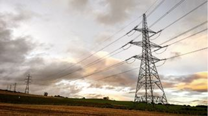
Craig Murrail substation Section 37 planning application
SSEN Transmission have submitted an application to the Scottish Ministers for consent under Section 37 of the Electricity Act 1989 for construction of two temporary steel towers to support the temporary realignment of 668m of the existing 275kV Inveraray to Crossaig overhead line between OS Grid Ref NR8780091128 and OS Grid Ref NR8758790820 during construction of the proposed Craig Murrail substation for a period of no more than 3 years.
Following construction, the overhead line will be realigned to its existing alignment and connected into the new substation via downleads, and the temporary towers will be removed.
The proposed development is located approximately 2.5 km northeast of Lochgilphead and 2.9 km south west of Loch Glashan in the Argyll and Bute Local Authority Area.
Any representations on the application may be submitted to Scottish Ministers via the Energy Consents Unit website at www.energyconsents.scot using reference ECU00004621. All representations should be made such that they are received by Scottish Ministers not later than 12th December 2022 although Scottish Ministers may consider representations received after this date. As a result of a statutory objection from the relevant planning authority, or where Scottish Ministers decide to exercise their discretion to do so, Scottish Ministers can also cause a Public Inquiry (PI) to be held.
Should you wish to view the documents contained within our Section 37 application in full, these are available within the project documents section of this webpage. -
Argyll and Bute Information Sharing Webinar 2022
Please click to view our 2022 Argyll and Bute regional webinar where some of the SSEN team have given an overview of ongoing and upcoming projects across the area. -
Submission of our Initial Needs Case for the Argyll and Kintyre 275kV Strategy
We have submitted to the energy regulator, Ofgem, robust proposals to reinforce the Argyll transmission network from 132kV to 275kV operation. At an estimated cost of around £400m, this investment is being taken forward as part of the SSE Group’s Net Zero Acceleration Programme, which will see £12.5bn invested in the five years to 2026, or £7m every day. SSEN Transmission alone expects to invest around £4bn over this period as it delivers a network for net zero emissions. The Argyll 275kV strategy is required to support the connection of several new renewable electricity generation schemes across Argyll and to transport that power to areas of demand across Scotland and beyond. It will support the connection of at least 560MW of new renewable electricity generation, enough to power more than 500,000 homes. -
Pre- Application Consultation Closed
Thank you to those who participated in our Winter 2021 online pre-application consultation and provided feedback on our proposals for the Argyll and Kintyre 275kV Substations project. Our consultation period closed on 10th January and all feedback received will be collated, reviewed and included in the Pre-Application Consultation (PAC) Report which will accompany the Planning Applications submission to Argyll and Bute Council in Spring 2022. As part of our consultation we held a webinar on 14th December 2021, inviting statutory consultees, community council members and local elected members to discuss our proposals ahead of our planning application process. Please see a recording of the webinar adjacent for more information. -
Argyll and Bute Information Sharing Webinar
On Wednesday 17th March 2021, SSEN Transmission hosted an Argyll and Bute Information Sharing Webinar, to provide local stakeholders with an interest in future electricity network plans for Argyll and Bute the chance to join us to hear about our stakeholder-led plans for the future and receive an update on the current construction and operation activities in the region. For those who were unable to attend, we have uploaded a recording of the session which you can view by clicking on the adjacent video.
Documents
-
Argyll and Kintyre Mailer
- Type:
- Date:
- 27 October 2023
- Size:
- 161.3 KB
This document provides an update to our stakeholders about the project.
-
Argyll and Kintyre Reinforcement Strategy LOTI Final Needs Case 2023
- Type:
- Date:
- 13 June 2023
- Size:
- 3.4 MB
This is an initial or final needs case submitted to Ofgem, seeking support and approval for the recommended reinforement strategy. Submitted 10 May 2023.
-
Pre_Application Consultation Report
- Type:
- Date:
- 26 January 2023
- Size:
- 6.5 MB
This material provides information to our stakeholders about the project.
-
Planning Statement
- Type:
- Date:
- 26 January 2023
- Size:
- 775.3 KB
This document provides the Planning Statement for the Proposed Development at Crarae Substation produced in November 2022.
-
Appendix-1-figures 1-2
- Type:
- Date:
- 18 September 2022
- Size:
- 7.7 MB
These maps provide information to our stakeholders about the study area and natural heritage present within the project, produced 07 June 2021.
-
Appendix 1- figures-3-4
- Type:
- Date:
- 18 September 2022
- Size:
- 7.4 MB
These maps provide information to our stakeholders about the surface water features and peatland classifications present within the project, produced 07 June 2021.
-
Appendix 1 - figures 5-7
- Type:
- Date:
- 18 September 2022
- Size:
- 6.9 MB
This map provides information to our stakeholders about the Topography and preferred site locations present within the project, produced 07 June 2021.
-
Argyll and Kintyre 275kv Strategy Consultation Brochure 2021
- Type:
- Date:
- 18 September 2022
- Size:
- 10.2 MB
This document provides information to our stakeholders about the project and was provided during our consultation in July 2021.
-
Argyll and Kintyre 275kv Strategy Consultation Poster 2021
- Type:
- Date:
- 18 September 2022
- Size:
- 100.7 KB
This document provides information to our stakeholders about our consultation events in July 2021.
-
Argyll and Kintyre 275kv Substations Pre-application Consultation Booklet
- Type:
- Date:
- 18 September 2022
- Size:
- 23.3 MB
This material provides information to our stakeholders about the project.
-
Report on Consultation Argyll Substations
- Type:
- Date:
- 18 September 2022
- Size:
- 9.4 MB
This Report on Consultation (and associated appendices/maps) documents the consultation process which has been undertaken for the project at substation site selection stage. It describes the key responses received and provides detail on the actions proposed in response to the issues raised.
-
Substation Site Selection Consultation Document
- Type:
- Date:
- 18 September 2022
- Size:
- 6.4 MB
This material provides information to our stakeholders about the project or consultation events in July 2021.
Crossaig North Town and Country Planning Application
-
21_01325_PREAPP Crossaig North PAC Report.pdf
- Type:
- Date:
- 15 May 2023
- Size:
- 9.8 MB
-
Annex A - General Environmental Management Plans.pdf
- Type:
- Date:
- 15 May 2023
- Size:
- 4.3 MB
-
Annex B - EIA Screening.pdf
- Type:
- Date:
- 15 May 2023
- Size:
- 384.3 KB
-
Annex C - LVA Methodology.pdf
- Type:
- Date:
- 15 May 2023
- Size:
- 474.8 KB
-
Annex D - Landscape Character Sensitivity.pdf
- Type:
- Date:
- 15 May 2023
- Size:
- 245.5 KB
-
Annex E Part 1 - Landscape Figures 3.1-3.4 .pdf
- Type:
- Date:
- 15 May 2023
- Size:
- 4.2 MB
-
Annex E Part 2 - Landscape Figure 3.5.pdf
- Type:
- Date:
- 15 May 2023
- Size:
- 879.8 KB
-
Annex E Part 3 - Photomontages.pdf
- Type:
- Date:
- 15 May 2023
- Size:
- 3.4 MB
-
Annex F - Ornithology Consultation.pdf
- Type:
- Date:
- 15 May 2023
- Size:
- 920.7 KB
-
Annex G Part 1 - Extended Phase 1 Survey Report.pdf
- Type:
- Date:
- 15 May 2023
- Size:
- 3.5 MB
-
Annex G Part 2 - Extended Phase 1 Survey Report.pdf
- Type:
- Date:
- 15 May 2023
- Size:
- 4.4 MB
-
Annex H - Species Protection Plans.pdf
- Type:
- Date:
- 15 May 2023
- Size:
- 3.6 MB
-
Annex I - HRA.pdf
- Type:
- Date:
- 15 May 2023
- Size:
- 3.6 MB
-
Annex J - Forestry.pdf
- Type:
- Date:
- 15 May 2023
- Size:
- 3.9 MB
-
Annex K - Drainage Strategy and Drainage Plans.pdf
- Type:
- Date:
- 15 May 2023
- Size:
- 1.7 MB
-
Annex L - Hydrology Methodology.pdf
- Type:
- Date:
- 15 May 2023
- Size:
- 320.7 KB
-
Annex M - Private Water Supply Risk Assessment.pdf
- Type:
- Date:
- 15 May 2023
- Size:
- 1 MB
-
Annex N - Water Construction Management Plan.pdf
- Type:
- Date:
- 15 May 2023
- Size:
- 2.7 MB
-
Annex O - Peat Management Plan (PMP).pdf
- Type:
- Date:
- 15 May 2023
- Size:
- 1.6 MB
-
Annex P - Peat Slide Risk Assessment (PSRA).pdf
- Type:
- Date:
- 15 May 2023
- Size:
- 4 MB
-
Annex Q Part 1 - Routing Report.pdf
- Type:
- Date:
- 15 May 2023
- Size:
- 4.1 MB
-
Annex Q Part 2 - Routing Report.pdf
- Type:
- Date:
- 15 May 2023
- Size:
- 4.5 MB
-
Annex R Part 1 - Cultural Heritage Appraisal and Site Gazetteer.pdf
- Type:
- Date:
- 15 May 2023
- Size:
- 2.4 MB
-
Annex R Part 2 - Cultural Heritage Appraisal and Site Gazetteer.pdf
- Type:
- Date:
- 15 May 2023
- Size:
- 3.4 MB
-
Annex S - Noise.pdf
- Type:
- Date:
- 15 May 2023
- Size:
- 1.8 MB
-
Chapter 1 Contents, Introduction and Scope.pdf
- Type:
- Date:
- 15 May 2023
- Size:
- 910.9 KB
-
Chapter 10 Mitigation Summary.pdf
- Type:
- Date:
- 15 May 2023
- Size:
- 465.4 KB
-
Chapter 2 Project Description.pdf
- Type:
- Date:
- 15 May 2023
- Size:
- 7.7 MB
-
Chapter 3 Landscape and Visual.pdf
- Type:
- Date:
- 15 May 2023
- Size:
- 423.9 KB
-
Chapter 4 Ecology and Ornithology.pdf
- Type:
- Date:
- 15 May 2023
- Size:
- 4.5 MB
-
Chapter 5 Forestry.pdf
- Type:
- Date:
- 15 May 2023
- Size:
- 1.5 MB
-
Chapter 6 Hydrology, Hydrogeology and Geology.pdf
- Type:
- Date:
- 15 May 2023
- Size:
- 2.5 MB
-
Chapter 7 Archaeology and Cultural Heritage.pdf
- Type:
- Date:
- 15 May 2023
- Size:
- 3.5 MB
-
Chapter 8 Noise.pdf
- Type:
- Date:
- 15 May 2023
- Size:
- 307 KB
-
Chapter 9 Traffic and Transport.pdf
- Type:
- Date:
- 15 May 2023
- Size:
- 544.2 KB
-
Crossaig North Planning Statement.pdf
- Type:
- Date:
- 15 May 2023
- Size:
- 1.1 MB
-
Figure 10 - Proposed Site Profiles.pdf
- Type:
- Date:
- 15 May 2023
- Size:
- 3.2 MB
-
Figure 11 - Proposed Site Access Profiles.pdf
- Type:
- Date:
- 15 May 2023
- Size:
- 1.2 MB
-
Figure 13 - Septic Tank and Borehole Plan.pdf
- Type:
- Date:
- 15 May 2023
- Size:
- 2.3 MB
-
Figure 4b - 275kV GIS Control Building Elevations.pdf
- Type:
- Date:
- 15 May 2023
- Size:
- 555.7 KB
-
Figure 4d- 132kV GIS Control Building Elevations.pdf
- Type:
- Date:
- 15 May 2023
- Size:
- 504 KB
-
Figure 4e - Transformer Building Layout.pdf
- Type:
- Date:
- 15 May 2023
- Size:
- 567.2 KB
-
Figure 4f - Transformer Building Elevations.pdf
- Type:
- Date:
- 15 May 2023
- Size:
- 466.6 KB
-
Figure 5 - Generator Building Elevations.pdf
- Type:
- Date:
- 15 May 2023
- Size:
- 426.1 KB
-
Figure 6 - Electrical Layout Elevations.pdf
- Type:
- Date:
- 15 May 2023
- Size:
- 568.6 KB
-
Figure 7 - Typical Deer Fence & Gate.pdf
- Type:
- Date:
- 15 May 2023
- Size:
- 301.2 KB
-
Figure 9 - Site Access Detail.pdf
- Type:
- Date:
- 15 May 2023
- Size:
- 545.7 KB
-
Red Line Boundary - Crossaig North.pdf
- Type:
- Date:
- 15 May 2023
- Size:
- 3.1 MB
-
Site Location Plan - Crossaig North.pdf
- Type:
- Date:
- 15 May 2023
- Size:
- 3.3 MB
Crossaig North Section 37
-
Cover Letter s.37 Crossaig North.pdf
- Type:
- Date:
- 15 March 2023
- Size:
- 184 KB
-
Chapter 1 Contents, Introduction and Scope.pdf
- Type:
- Date:
- 15 March 2023
- Size:
- 910.9 KB
-
Chapter 10 Mitigation Summary.pdf
- Type:
- Date:
- 15 March 2023
- Size:
- 465.4 KB
-
Chapter 2 Project Description.pdf
- Type:
- Date:
- 15 March 2023
- Size:
- 7.7 MB
-
Chapter 3 Landscape and Visual.pdf
- Type:
- Date:
- 15 March 2023
- Size:
- 423.9 KB
-
Chapter 4 Ecology and Ornithology.pdf
- Type:
- Date:
- 15 March 2023
- Size:
- 4.5 MB
-
Chapter 5 Forestry.pdf
- Type:
- Date:
- 15 March 2023
- Size:
- 1.5 MB
-
Chapter 6 Hydrology, Hydrogeology and Geology.pdf
- Type:
- Date:
- 15 March 2023
- Size:
- 2.5 MB
-
Chapter 7 Archaeology and Cultural Heritage.pdf
- Type:
- Date:
- 15 March 2023
- Size:
- 3.5 MB
-
Chapter 8 Noise.pdf
- Type:
- Date:
- 15 March 2023
- Size:
- 307 KB
-
Chapter 9 Traffic and Transport.pdf
- Type:
- Date:
- 15 March 2023
- Size:
- 544.2 KB
-
Annex A - General Environmental Management Plans.pdf
- Type:
- Date:
- 15 March 2023
- Size:
- 4.3 MB
-
Annex B - EIA Screening.pdf
- Type:
- Date:
- 15 March 2023
- Size:
- 384.3 KB
-
Annex C - LVA Methodology.pdf
- Type:
- Date:
- 15 March 2023
- Size:
- 474.8 KB
-
Annex D - Landscape Character Sensitivity.pdf
- Type:
- Date:
- 15 March 2023
- Size:
- 245.5 KB
-
Annex E Part 1 - Landscape Figures 3.1-3.4 .pdf
- Type:
- Date:
- 15 March 2023
- Size:
- 4.2 MB
-
Annex E Part 2 - Landscape Figure 3.5.pdf
- Type:
- Date:
- 15 March 2023
- Size:
- 879.8 KB
-
Annex E Part 3 - Photomontages.pdf
- Type:
- Date:
- 15 March 2023
- Size:
- 3.4 MB
-
Annex F - Ornithology Consultation.pdf
- Type:
- Date:
- 15 March 2023
- Size:
- 920.7 KB
-
Annex G Part 1 - Extended Phase 1 Survey Report.pdf
- Type:
- Date:
- 15 March 2023
- Size:
- 3.5 MB
-
Annex G Part 2 - Extended Phase 1 Survey Report.pdf
- Type:
- Date:
- 15 March 2023
- Size:
- 4.4 MB
-
Annex H - Species Protection Plans.pdf
- Type:
- Date:
- 15 March 2023
- Size:
- 3.6 MB
-
Annex I - HRA.pdf
- Type:
- Date:
- 15 March 2023
- Size:
- 3.6 MB
-
Annex J - Forestry.pdf
- Type:
- Date:
- 15 March 2023
- Size:
- 3.9 MB
-
Annex K - Drainage Strategy and Drainage Plans.pdf
- Type:
- Date:
- 15 March 2023
- Size:
- 1.7 MB
-
Annex L - Hydrology Methodology.pdf
- Type:
- Date:
- 15 March 2023
- Size:
- 320.7 KB
-
Annex M - Private Water Supply Risk Assessment.pdf
- Type:
- Date:
- 15 March 2023
- Size:
- 1 MB
-
Annex N - Water Construction Management Plan.pdf
- Type:
- Date:
- 15 March 2023
- Size:
- 2.7 MB
-
Annex O - Peat Management Plan (PMP).pdf
- Type:
- Date:
- 15 March 2023
- Size:
- 1.6 MB
-
Annex P - Peat Slide Risk Assessment (PSRA).pdf
- Type:
- Date:
- 15 March 2023
- Size:
- 4 MB
-
Annex Q Part 1 - Routing Report.pdf
- Type:
- Date:
- 15 March 2023
- Size:
- 4.1 MB
-
Annex Q Part 2 - Routing Report.pdf
- Type:
- Date:
- 15 March 2023
- Size:
- 4.5 MB
-
Annex R Part 1 - Cultural Heritage Appraisal and Site Gazetteer.pdf
- Type:
- Date:
- 15 March 2023
- Size:
- 2.4 MB
-
Annex R Part 2 - Cultural Heritage Appraisal and Site Gazetteer.pdf
- Type:
- Date:
- 15 March 2023
- Size:
- 3.4 MB
-
Annex S - Noise.pdf
- Type:
- Date:
- 15 March 2023
- Size:
- 1.8 MB
-
Figure 1 Site Location and Layout Plan Overview.pdf
- Type:
- Date:
- 15 March 2023
- Size:
- 2.5 MB
-
Figure 2 Site Layout Plan.pdf
- Type:
- Date:
- 15 March 2023
- Size:
- 1.6 MB
-
Figure 3 OHL Tower Elevations.pdf
- Type:
- Date:
- 15 March 2023
- Size:
- 734.2 KB
-
Figure 4 - Site Access Detail.pdf
- Type:
- Date:
- 15 March 2023
- Size:
- 758.7 KB
Crarae Section 37
-
Cover letter s.37 Crarae.pdf
- Type:
- Date:
- 07 December 2022
- Size:
- 558 KB
-
Environmental Appraisal Chapter 1 - Contents Introduction and Scope.pdf
- Type:
- Date:
- 13 October 2023
- Size:
- 1.3 MB
-
Environmental Appraisal Chapter 10 - Mitigation Summary.pdf
- Type:
- Date:
- 13 October 2023
- Size:
- 292.1 KB
-
Environmental Appraisal Chapter 2 - Project Description.pdf
- Type:
- Date:
- 13 October 2023
- Size:
- 1 MB
-
Environmental Appraisal Chapter 3 - LVIA.pdf
- Type:
- Date:
- 13 October 2023
- Size:
- 366.7 KB
-
Environmental Appraisal Chapter 4 - Ecology.pdf
- Type:
- Date:
- 13 October 2023
- Size:
- 4 MB
-
Environmental Appraisal Chapter 5 - Forestry.pdf
- Type:
- Date:
- 13 October 2023
- Size:
- 603.1 KB
-
Environmental Appraisal Chapter 6 - Hydrology.pdf
- Type:
- Date:
- 13 October 2023
- Size:
- 1.8 MB
-
Environmental Appraisal Chapter 7 - Archaeology.pdf
- Type:
- Date:
- 13 October 2023
- Size:
- 1.4 MB
-
Environmental Appraisal Chapter 8 - Noise.pdf
- Type:
- Date:
- 13 October 2023
- Size:
- 306 KB
-
Environmental Appraisal Chapter 9 - Traffic.pdf
- Type:
- Date:
- 13 October 2023
- Size:
- 343.8 KB
-
Figure 1a - Site Location and Context Plan.pdf
- Type:
- Date:
- 13 October 2023
- Size:
- 4 MB
-
Figure 1b Site Location Plan - revised.pdf
- Type:
- Date:
- 13 October 2023
- Size:
- 3.9 MB
-
Figure 2 - Site Layout - revised.pdf
- Type:
- Date:
- 13 October 2023
- Size:
- 1.5 MB
-
Figure 3 - OHL Tower Elevations.pdf
- Type:
- Date:
- 13 October 2023
- Size:
- 499.8 KB
-
Figure 4a - Typical Access Track Sections Sheet 1.pdf
- Type:
- Date:
- 13 October 2023
- Size:
- 258.6 KB
-
Figure 4b - Typical Access Track Sections Sheet 2.pdf
- Type:
- Date:
- 13 October 2023
- Size:
- 266.1 KB
-
Figure 5 - Site Access Details.pdf
- Type:
- Date:
- 13 October 2023
- Size:
- 300.3 KB
-
Environmental Appraisal Annex A - General Environmental Management Plans.pdf
- Type:
- Date:
- 13 October 2023
- Size:
- 4.3 MB
-
Environmental Appraisal Annex B - EIA Screening Opinion.pdf
- Type:
- Date:
- 13 October 2023
- Size:
- 322 KB
-
Environmental Appraisal Annex C - LVA Methodology.pdf
- Type:
- Date:
- 13 October 2023
- Size:
- 280.5 KB
-
Environmental Appraisal Annex D - Landscape Character Sensitivity.pdf
- Type:
- Date:
- 13 October 2023
- Size:
- 288.8 KB
-
Environmental Appraisal Annex E - Part 1 Landscape Figures.pdf
- Type:
- Date:
- 13 October 2023
- Size:
- 4.2 MB
-
Environmental Appraisal Annex E - Part 2 Photomontages.pdf
- Type:
- Date:
- 13 October 2023
- Size:
- 1.4 MB
-
Environmental Appraisal Annex F - Ornithology Consultation.pdf
- Type:
- Date:
- 13 October 2023
- Size:
- 896.1 KB
-
Environmental Appraisal Annex G - Extended Phase 1 Survey Report.pdf
- Type:
- Date:
- 13 October 2023
- Size:
- 2.3 MB
-
Environmental Appraisal Annex H - Species Protection Plans.pdf
- Type:
- Date:
- 13 October 2023
- Size:
- 3.6 MB
-
Environmental Appraisal Annex I - Habitat Regulations Appraisal.pdf
- Type:
- Date:
- 13 October 2023
- Size:
- 679.5 KB
-
Environmental Appraisal Annex J - Forestry.pdf
- Type:
- Date:
- 13 October 2023
- Size:
- 3.6 MB
-
Environmental Appraisal Annex K - Drainage Strategy and Drainage Plans.pdf
- Type:
- Date:
- 13 October 2023
- Size:
- 1.5 MB
-
Environmental Appraisal Annex L - Hydrology Methodology.pdf
- Type:
- Date:
- 13 October 2023
- Size:
- 369.5 KB
-
Environmental Appraisal Annex M - Private Water Supply Risk Assessment.pdf
- Type:
- Date:
- 13 October 2023
- Size:
- 990.7 KB
-
Environmental Appraisal Annex N - Water Construction Management Plan.pdf
- Type:
- Date:
- 13 October 2023
- Size:
- 1.4 MB
-
Environmental Appraisal Annex O - Peat Management Plan.pdf
- Type:
- Date:
- 13 October 2023
- Size:
- 4.6 MB
-
Environmental Appraisal Annex P - Peat Slide Risk Assessment.pdf
- Type:
- Date:
- 13 October 2023
- Size:
- 3.1 MB
-
Environmental Appraisal Annex Q - Routing Report.pdf
- Type:
- Date:
- 13 October 2023
- Size:
- 4 MB
-
Environmental Appraisal Annex R - Cultural Heritage Site Gazetteer and Walkover Survey Report.pdf
- Type:
- Date:
- 13 October 2023
- Size:
- 2.5 MB
-
Environmental Appraisal Annex S - Noise and Vibration.pdf
- Type:
- Date:
- 13 October 2023
- Size:
- 1.3 MB
Crarae Substation Town and Country planning application
-
Environmental Appraisal Annex A - General Environmental Management Plans.pdf
- Type:
- Date:
- 12 October 2023
- Size:
- 4.3 MB
-
Environmental Appraisal Annex B - EIA Screening Opinion.pdf
- Type:
- Date:
- 12 October 2023
- Size:
- 322 KB
-
Environmental Appraisal Annex C - LVA Methodology.pdf
- Type:
- Date:
- 12 October 2023
- Size:
- 280.5 KB
-
Environmental Appraisal Annex D - Landscape Character Sensitivity.pdf
- Type:
- Date:
- 12 October 2023
- Size:
- 288.8 KB
-
Environmental Appraisal Annex E - Part 1 Landscape Figures.pdf
- Type:
- Date:
- 12 October 2023
- Size:
- 4.2 MB
-
Environmental Appraisal Annex E - Part 2 Photomontages.pdf
- Type:
- Date:
- 12 October 2023
- Size:
- 1.4 MB
-
Environmental Appraisal Annex F - Ornithology Consultation.pdf
- Type:
- Date:
- 12 October 2023
- Size:
- 896.1 KB
-
Environmental Appraisal Annex G - Extended Phase 1 Survey Report.pdf
- Type:
- Date:
- 12 October 2023
- Size:
- 2.3 MB
-
Environmental Appraisal Annex H - Species Protection Plans.pdf
- Type:
- Date:
- 12 October 2023
- Size:
- 3.6 MB
-
Environmental Appraisal Annex I - Habitat Regulations Appraisal.pdf
- Type:
- Date:
- 12 October 2023
- Size:
- 679.5 KB
-
Environmental Appraisal Annex J - Forestry.pdf
- Type:
- Date:
- 12 October 2023
- Size:
- 3.6 MB
-
Environmental Appraisal Annex K - Drainage Strategy and Drainage Plans.pdf
- Type:
- Date:
- 12 October 2023
- Size:
- 1.5 MB
-
Environmental Appraisal Annex L - Hydrology Methodology.pdf
- Type:
- Date:
- 12 October 2023
- Size:
- 369.5 KB
-
Environmental Appraisal Annex M - Private Water Supply Risk Assessment.pdf
- Type:
- Date:
- 12 October 2023
- Size:
- 990.7 KB
-
Environmental Appraisal Annex N - Water Construction Management Plan.pdf
- Type:
- Date:
- 12 October 2023
- Size:
- 1.4 MB
-
Environmental Appraisal Annex O - Peat Management Plan.pdf
- Type:
- Date:
- 12 October 2023
- Size:
- 4.6 MB
-
Environmental Appraisal Annex P - Peat Slide Risk Assessment.pdf
- Type:
- Date:
- 12 October 2023
- Size:
- 3.1 MB
-
Environmental Appraisal Annex Q - Routing Report.pdf
- Type:
- Date:
- 12 October 2023
- Size:
- 4 MB
-
Environmental Appraisal Annex R - Cultural Heritage Site Gazetteer and Walkover Survey Report.pdf
- Type:
- Date:
- 12 October 2023
- Size:
- 2.5 MB
-
Environmental Appraisal Annex S - Noise and Vibration.pdf
- Type:
- Date:
- 12 October 2023
- Size:
- 1.3 MB
-
Environmental Appraisal Chapter 1 - Contents Introduction and Scope.pdf
- Type:
- Date:
- 12 October 2023
- Size:
- 1.3 MB
-
Environmental Appraisal Chapter 10 - Mitigation Summary.pdf
- Type:
- Date:
- 12 October 2023
- Size:
- 292.1 KB
-
Environmental Appraisal Chapter 3 - LVIA.pdf
- Type:
- Date:
- 12 October 2023
- Size:
- 366.7 KB
-
Environmental Appraisal Chapter 4 - Ecology.pdf
- Type:
- Date:
- 12 October 2023
- Size:
- 4 MB
-
Environmental Appraisal Chapter 5 - Forestry.pdf
- Type:
- Date:
- 12 October 2023
- Size:
- 603.1 KB
-
Environmental Appraisal Chapter 6 - Hydrology.pdf
- Type:
- Date:
- 12 October 2023
- Size:
- 1.8 MB
-
Environmental Appraisal Chapter 7 - Archaeology.pdf
- Type:
- Date:
- 12 October 2023
- Size:
- 1.4 MB
-
Environmental Appraisal Chapter 8 - Noise.pdf
- Type:
- Date:
- 12 October 2023
- Size:
- 306 KB
-
Environmental Appraisal Chapter 9 - Traffic.pdf
- Type:
- Date:
- 12 October 2023
- Size:
- 343.8 KB
-
Figure 10 - Proposed Site Profiles.pdf
- Type:
- Date:
- 12 October 2023
- Size:
- 2.5 MB
-
Figure 11 - Proposed Site Access Profiles.pdf
- Type:
- Date:
- 12 October 2023
- Size:
- 1.1 MB
-
Figure 4b - Substation Building Elevations.pdf
- Type:
- Date:
- 12 October 2023
- Size:
- 339.6 KB
-
Figure 4d - Transformer Building Elevations.pdf
- Type:
- Date:
- 12 October 2023
- Size:
- 341.1 KB
-
Figure 5 - Generator Building Elevations.pdf
- Type:
- Date:
- 12 October 2023
- Size:
- 256 KB
-
Figure 6 - Electrical Layout Elevations.pdf
- Type:
- Date:
- 12 October 2023
- Size:
- 651.5 KB
-
Figure 7 - Typical Deer Fence and Gate.pdf
- Type:
- Date:
- 12 October 2023
- Size:
- 287.3 KB
-
Figure 8a - Typical Access Track Sections Sheet 1.pdf
- Type:
- Date:
- 12 October 2023
- Size:
- 259 KB
-
Figure 8b - Typical Access Track Sections Sheet 2.pdf
- Type:
- Date:
- 12 October 2023
- Size:
- 266.7 KB
-
Figure 9 - Site Access Details.pdf
- Type:
- Date:
- 12 October 2023
- Size:
- 283.7 KB
-
Pre Application Consultation Report.pdf
- Type:
- Date:
- 12 October 2023
- Size:
- 6.5 MB
-
Red Line Boundary Plan.pdf
- Type:
- Date:
- 12 October 2023
- Size:
- 1.9 MB
-
Septic Tank and Private Water Supply Location Plan.pdf
- Type:
- Date:
- 12 October 2023
- Size:
- 2.6 MB
-
Site Location Plan.pdf
- Type:
- Date:
- 12 October 2023
- Size:
- 3.7 MB
An Suidhe substation update to SuDS design December 2022
-
Annex J - Drainage Strategy and Drainage Plans.pdf
- Type:
- Date:
- 19 December 2022
- Size:
- 3.7 MB
-
Contents and Chapter 1.pdf
- Type:
- Date:
- 19 December 2022
- Size:
- 2.2 MB
-
Chapter 2 - Project Description.pdf
- Type:
- Date:
- 19 December 2022
- Size:
- 4.9 MB
-
Chapter 3 - Landscape and Visual Appraisal.pdf
- Type:
- Date:
- 19 December 2022
- Size:
- 377.9 KB
-
Chapter 5 - Forestry .pdf
- Type:
- Date:
- 19 December 2022
- Size:
- 3.4 MB
-
Figure 1a - Site Location and Context Plan.pdf
- Type:
- Date:
- 19 December 2022
- Size:
- 3.3 MB
-
Figure 1b - Site Location Plan.pdf
- Type:
- Date:
- 19 December 2022
- Size:
- 1.7 MB
-
Figure 2 - Site Layout Plan.pdf
- Type:
- Date:
- 19 December 2022
- Size:
- 1.8 MB
-
Annex E (Part 1) - Landscape Figures.pdf
- Type:
- Date:
- 19 December 2022
- Size:
- 2.6 MB
-
Annex I - Forestry.pdf
- Type:
- Date:
- 19 December 2022
- Size:
- 4.9 MB
-
Annex N - Peat Management Plan (PMP).pdf
- Type:
- Date:
- 19 December 2022
- Size:
- 2.3 MB
An Suidhe substation section 37
-
Cover Letter_s.37 Application_AS Substation_Final.pdf
- Type:
- Date:
- 10 November 2022
- Size:
- 236.1 KB
-
Chapter 10 - Mitigation Proposals.pdf
- Type:
- Date:
- 10 November 2022
- Size:
- 165.3 KB
-
Chapter 9 - Traffic and Transport.pdf
- Type:
- Date:
- 10 November 2022
- Size:
- 307.8 KB
-
Chapter 8 - Noise Assessment AS.pdf
- Type:
- Date:
- 10 November 2022
- Size:
- 366.1 KB
-
Chapter 7 Archaeology and Cultural Heritage.pdf
- Type:
- Date:
- 10 November 2022
- Size:
- 6 MB
-
Chapter 6 - Geology, Hydrology and Hydrogeology.pdf
- Type:
- Date:
- 10 November 2022
- Size:
- 2.1 MB
-
Chapter 5 - Forestry.pdf
- Type:
- Date:
- 10 November 2022
- Size:
- 404.7 KB
-
Chapter 4 - Ecology & Ornothology.pdf
- Type:
- Date:
- 10 November 2022
- Size:
- 2.1 MB
-
Chapter 3 - Landscape and Visual Appraisal.pdf
- Type:
- Date:
- 10 November 2022
- Size:
- 306.5 KB
-
Chapter 2 - Project Description.pdf
- Type:
- Date:
- 10 November 2022
- Size:
- 1.5 MB
-
Chapter 1 - Introduction & Scope.pdf
- Type:
- Date:
- 10 November 2022
- Size:
- 651.7 KB
-
Figure 1a - Site Location and Context Plan.pdf
- Type:
- Date:
- 10 November 2022
- Size:
- 4 MB
-
Figure 1b - Site Location Plan.pdf
- Type:
- Date:
- 10 November 2022
- Size:
- 2 MB
-
Figure 2 - Site Layout Plan.pdf
- Type:
- Date:
- 10 November 2022
- Size:
- 2.1 MB
-
Figure 3 - OHL Tower Elevations (4534a-DR-P-0003).pdf
- Type:
- Date:
- 10 November 2022
- Size:
- 567.6 KB
-
Figure 4a - Typical Access Track Sections Sheet 1 (4534a-DR-P-0007).pdf
- Type:
- Date:
- 10 November 2022
- Size:
- 276.5 KB
-
Figure 4b - Typical Access Track Sections Sheet 2 (4534a-DR-P-0012).pdf
- Type:
- Date:
- 10 November 2022
- Size:
- 283.1 KB
-
Figure 5 - Site Access Details (4534a-DR-P-0008).pdf
- Type:
- Date:
- 10 November 2022
- Size:
- 241.2 KB
-
Annex R - Noise Assessment Report AS.pdf
- Type:
- Date:
- 10 November 2022
- Size:
- 354.7 KB
-
Annex Q - Cultural Heritage & Site Gazetteer.pdf
- Type:
- Date:
- 10 November 2022
- Size:
- 2.5 MB
-
Annex P - Routing Report.pdf
- Type:
- Date:
- 10 November 2022
- Size:
- 2.3 MB
-
Annex O - Peat Slide Risk Assessment (PSRA).pdf
- Type:
- Date:
- 10 November 2022
- Size:
- 2.3 MB
-
Annex N - Peat Management Plan (PMP).pdf
- Type:
- Date:
- 10 November 2022
- Size:
- 1.1 MB
-
Annex M - Water Construction Management Plan.pdf
- Type:
- Date:
- 10 November 2022
- Size:
- 961.3 KB
-
Annex L - Private Water Supply Risk Assessment.pdf
- Type:
- Date:
- 10 November 2022
- Size:
- 287.4 KB
-
Annex K - Hydrology Methodology.pdf
- Type:
- Date:
- 10 November 2022
- Size:
- 165.5 KB
-
Annex J - Drainage Strategy and Drainage Plans.pdf
- Type:
- Date:
- 10 November 2022
- Size:
- 847.2 KB
-
Annex I - Forestry.pdf
- Type:
- Date:
- 10 November 2022
- Size:
- 3 MB
-
Annex H - Species Protection Plans.pdf
- Type:
- Date:
- 10 November 2022
- Size:
- 1.1 MB
-
Annex G - Ext Phase 1 Survey Report.pdf
- Type:
- Date:
- 10 November 2022
- Size:
- 2 MB
-
Annex F - Ornithology Consultation.pdf
- Type:
- Date:
- 10 November 2022
- Size:
- 269.2 KB
-
Annex E - Landscape Figures.pdf
- Type:
- Date:
- 10 November 2022
- Size:
- 2.2 MB
-
Annex D - Landscape Character Sensitivity.pdf
- Type:
- Date:
- 10 November 2022
- Size:
- 176.5 KB
-
Annex C - LVA Methodology.pdf
- Type:
- Date:
- 10 November 2022
- Size:
- 165.7 KB
-
Annex B - EIA Screening Opinion.pdf
- Type:
- Date:
- 10 November 2022
- Size:
- 182.7 KB
-
Annex A - General Environmental Management Plans.pdf
- Type:
- Date:
- 10 November 2022
- Size:
- 620.6 KB
An Suidhe Town and Country Planning Application
-
Elevations - Electrical Layout 01.pdf
- Type:
- Date:
- 08 November 2023
- Size:
- 496.2 KB
-
Elevations - Electrical Layout 02.pdf
- Type:
- Date:
- 08 November 2023
- Size:
- 529.8 KB
-
Elevations - Generator Building.pdf
- Type:
- Date:
- 08 November 2023
- Size:
- 256.1 KB
-
Elevations - Substation Building.pdf
- Type:
- Date:
- 08 November 2023
- Size:
- 338.9 KB
-
Elevations - Transformer Building.pdf
- Type:
- Date:
- 08 November 2023
- Size:
- 317 KB
-
Floor Plan - Transformer Building.pdf
- Type:
- Date:
- 08 November 2023
- Size:
- 1 MB
-
Floor Plan Generator Building.pdf
- Type:
- Date:
- 08 November 2023
- Size:
- 526.3 KB
-
Inset Site Plan - Layout 1500.pdf
- Type:
- Date:
- 08 November 2023
- Size:
- 1.1 MB
-
Location Plan 15,000 110,000.pdf
- Type:
- Date:
- 08 November 2023
- Size:
- 2.2 MB
-
Location Plan 150,000 175,000.pdf
- Type:
- Date:
- 08 November 2023
- Size:
- 981.4 KB
-
Proposed Site Access Profiles.pdf
- Type:
- Date:
- 08 November 2023
- Size:
- 1.2 MB
-
Proposed Site Profiles.pdf
- Type:
- Date:
- 08 November 2023
- Size:
- 1.5 MB
-
Site Access Details.pdf
- Type:
- Date:
- 08 November 2023
- Size:
- 242.5 KB
-
Site Plan - Septic Tank and Private Water Supply Location.pdf
- Type:
- Date:
- 08 November 2023
- Size:
- 209.6 KB
-
Typical Access Track Sections Sheet 1.pdf
- Type:
- Date:
- 08 November 2023
- Size:
- 259 KB
-
Typical Access Track Sections Sheet 2.pdf
- Type:
- Date:
- 08 November 2023
- Size:
- 266.5 KB
-
Typical Deer Fence and Gate.pdf
- Type:
- Date:
- 08 November 2023
- Size:
- 287.3 KB
-
Environmental Appraisal - Chapter 1 - Contents and Introduction.pdf
- Type:
- Date:
- 08 November 2023
- Size:
- 2.2 MB
-
Environmental Appraisal - Chapter 10 - Mitigation Summary.pdf
- Type:
- Date:
- 08 November 2023
- Size:
- 159.1 KB
-
Environmental Appraisal - Chapter 2 - Project Description.pdf
- Type:
- Date:
- 08 November 2023
- Size:
- 4.9 MB
-
Environmental Appraisal - Chapter 3 - Landscape and Visual Appraisal.pdf
- Type:
- Date:
- 08 November 2023
- Size:
- 377.9 KB
-
Environmental Appraisal - Chapter 4 - Ecology and Ornithology.pdf
- Type:
- Date:
- 08 November 2023
- Size:
- 2.5 MB
-
Environmental Appraisal - Chapter 5 - Forestry.pdf
- Type:
- Date:
- 08 November 2023
- Size:
- 3.4 MB
-
Environmental Appraisal - Chapter 6 - Geology Hydrology And Hydrogeology.pdf
- Type:
- Date:
- 08 November 2023
- Size:
- 1.8 MB
-
Environmental Appraisal - Chapter 7 - Archaeology and Cultural Heritage.pdf
- Type:
- Date:
- 08 November 2023
- Size:
- 3.2 MB
-
Environmental Appraisal - Chapter 8 - Noise.pdf
- Type:
- Date:
- 08 November 2023
- Size:
- 311.7 KB
-
Environmental Appraisal - Chapter 9 - Traffic and Transport.pdf
- Type:
- Date:
- 08 November 2023
- Size:
- 394.3 KB
-
Annex A - General Environmental Management Plans.pdf
- Type:
- Date:
- 08 November 2023
- Size:
- 4.1 MB
-
Annex B - EIA Screening Opinion.pdf
- Type:
- Date:
- 08 November 2023
- Size:
- 612.9 KB
-
Annex C - LVA Methodology.pdf
- Type:
- Date:
- 08 November 2023
- Size:
- 462.3 KB
-
Annex D - Landscape Character Sensitivity Table.pdf
- Type:
- Date:
- 08 November 2023
- Size:
- 460 KB
-
Annex E Part 1 - Landscape Figures.pdf
- Type:
- Date:
- 08 November 2023
- Size:
- 2.6 MB
-
Annex E Part 2 - Photomontages.pdf
- Type:
- Date:
- 08 November 2023
- Size:
- 1.4 MB
-
Annex F - Ornithology Consultation.pdf
- Type:
- Date:
- 08 November 2023
- Size:
- 922.9 KB
-
Annex G - Ext Phase 1 Survey Report.pdf
- Type:
- Date:
- 08 November 2023
- Size:
- 4.2 MB
-
Annex H - Species Protection Plans.pdf
- Type:
- Date:
- 08 November 2023
- Size:
- 3.6 MB
-
Annex I - Forestry.pdf
- Type:
- Date:
- 08 November 2023
- Size:
- 4.9 MB
-
Annex J - Drainage Strategy and Drainage Plans.pdf
- Type:
- Date:
- 08 November 2023
- Size:
- 3.7 MB
-
Annex K - Hydrology Methodology.pdf
- Type:
- Date:
- 08 November 2023
- Size:
- 700.4 KB
-
Annex L - Private Water Supply Risk Assessment.pdf
- Type:
- Date:
- 08 November 2023
- Size:
- 1.1 MB
-
Annex M - Water Construction Management Plan.pdf
- Type:
- Date:
- 08 November 2023
- Size:
- 3.3 MB
-
Annex N - Peat Management Plan.pdf
- Type:
- Date:
- 08 November 2023
- Size:
- 2.3 MB
-
Annex O - Peat Slide Risk Assessment.pdf
- Type:
- Date:
- 08 November 2023
- Size:
- 3.4 MB
-
Annex P - Routing Report.pdf
- Type:
- Date:
- 08 November 2023
- Size:
- 7.4 MB
-
Annex Q - Cultural Heritage Site Gazetteer and Walkover Survey Report.pdf
- Type:
- Date:
- 08 November 2023
- Size:
- 2.5 MB
-
Annex R - Noise.pdf
- Type:
- Date:
- 08 November 2023
- Size:
- 2.5 MB
Craig Murrail section 37
-
Cover Letter_s.37 Application_CM Substation_Final_Redacted.pdf
- Type:
- Date:
- 31 October 2022
- Size:
- 198.9 KB
-
Chapter 10 - Summary of Mitigation.pdf
- Type:
- Date:
- 31 October 2022
- Size:
- 180.9 KB
-
Chapter 9 - Traffic & Transport.pdf
- Type:
- Date:
- 31 October 2022
- Size:
- 316.4 KB
-
Chapter 8 - Noise CM.pdf
- Type:
- Date:
- 31 October 2022
- Size:
- 286.2 KB
-
Chapter 7 - Archaeology & Cultural Heritage.pdf
- Type:
- Date:
- 31 October 2022
- Size:
- 1 MB
-
Chapter 6 - Hydrology, Hydrogeology & Geology.pdf
- Type:
- Date:
- 31 October 2022
- Size:
- 2.3 MB
-
Chapter 5 - Forestry.pdf
- Type:
- Date:
- 31 October 2022
- Size:
- 641.4 KB
-
Chapter 4 - Ecology.pdf
- Type:
- Date:
- 31 October 2022
- Size:
- 2.7 MB
-
Chapter 3 - LVA.pdf
- Type:
- Date:
- 31 October 2022
- Size:
- 388.5 KB
-
Chapter 2 Project Description.pdf
- Type:
- Date:
- 31 October 2022
- Size:
- 4.7 MB
-
Contents and Chapter 1 Introduction and Scope.pdf
- Type:
- Date:
- 31 October 2022
- Size:
- 1.1 MB
-
Figure 1 a - Site Location and Context Plan.pdf
- Type:
- Date:
- 31 October 2022
- Size:
- 4.7 MB
-
Figure 1b - Site Location Plan .pdf
- Type:
- Date:
- 31 October 2022
- Size:
- 2.4 MB
-
Figure 2 - Site Layout Plan.pdf
- Type:
- Date:
- 31 October 2022
- Size:
- 4.6 MB
-
Figure 3 - OHL Tower Elevations (4534b-DR-P-0003).pdf
- Type:
- Date:
- 31 October 2022
- Size:
- 411.4 KB
-
Figure 4a - Typical Access Track Sections Sheet 1 (4534b-DR-P-0007).pdf
- Type:
- Date:
- 31 October 2022
- Size:
- 258.6 KB
-
Figure 4b - Typical Access Track Sections Sheet 2 (4534b-DR-P-0012).pdf
- Type:
- Date:
- 31 October 2022
- Size:
- 266.1 KB
-
Figure 5 - Site Access Details (4534b-DR-P-0008).pdf
- Type:
- Date:
- 31 October 2022
- Size:
- 323.8 KB
-
Annex S - Noise CM.pdf
- Type:
- Date:
- 31 October 2022
- Size:
- 846.3 KB
-
Annex R - Cultural Heritage Appraisal and Site Gazetter.pdf
- Type:
- Date:
- 31 October 2022
- Size:
- 2.8 MB
-
Annex Q - Routing Report.pdf
- Type:
- Date:
- 31 October 2022
- Size:
- 2.8 MB
-
Annex P - Peat Slide Risk Assessment (PSRA).pdf
- Type:
- Date:
- 31 October 2022
- Size:
- 3.6 MB
-
Annex O - Peat Management Plan (PMP).pdf
- Type:
- Date:
- 31 October 2022
- Size:
- 1.8 MB
-
Annex N - Water Construction Management Plan.pdf
- Type:
- Date:
- 31 October 2022
- Size:
- 3.3 MB
-
Annex M - Private Water Supply Risk Assessment.pdf
- Type:
- Date:
- 31 October 2022
- Size:
- 931.5 KB
-
Annex L - Hydrology Methodology.pdf
- Type:
- Date:
- 31 October 2022
- Size:
- 340.8 KB
-
Annex K - Drainage.pdf
- Type:
- Date:
- 31 October 2022
- Size:
- 2.5 MB
-
Annex J - Forestry.pdf
- Type:
- Date:
- 31 October 2022
- Size:
- 2.2 MB
-
Annex I - HRA.pdf
- Type:
- Date:
- 31 October 2022
- Size:
- 1 MB
-
Annex H - Species Protection Plans.pdf
- Type:
- Date:
- 31 October 2022
- Size:
- 3.6 MB
-
Annex G - Extended Phase 1 Survey Report.pdf
- Type:
- Date:
- 31 October 2022
- Size:
- 2.7 MB
-
Annex F - Ornithology Consultation.pdf
- Type:
- Date:
- 31 October 2022
- Size:
- 855.5 KB
-
Annex E (Part 1) - Landscape Figures.pdf
- Type:
- Date:
- 31 October 2022
- Size:
- 2.1 MB
-
Annex E (Part 2) - Photomontages.pdf
- Type:
- Date:
- 31 October 2022
- Size:
- 2.5 MB
-
Annex E (Part 3) - Photomontages.pdf
- Type:
- Date:
- 31 October 2022
- Size:
- 1.3 MB
-
Annex D - Landscape Character Sensitivity.pdf
- Type:
- Date:
- 31 October 2022
- Size:
- 271.2 KB
-
Annex C - LVA Methodology.pdf
- Type:
- Date:
- 31 October 2022
- Size:
- 352.4 KB
-
Annex B - EIA Screening Opinion.pdf
- Type:
- Date:
- 31 October 2022
- Size:
- 370.3 KB
-
Annex A - General Environmental Management Plans.pdf
- Type:
- Date:
- 31 October 2022
- Size:
- 4.2 MB
-
Annex E Part 1 - Landscape Figures.
- Type:
- Date:
- 07 February 2023
- Size:
- 2.1 MB
This material provides information to our stakeholders about the project and/or consultation events.
-
Annex J - Forestry.
- Type:
- Date:
- 07 February 2023
- Size:
- 3.8 MB
This material provides information to our stakeholders about the project and/or consultation events.
-
Annex K - Drainage Impact Assessment.
- Type:
- Date:
- 07 February 2023
- Size:
- 2.8 MB
This material provides information to our stakeholders about the project and/or consultation events.
-
Annex O - Peat Management Plan PMP.
- Type:
- Date:
- 07 February 2023
- Size:
- 2.6 MB
This material provides information to our stakeholders about the project and/or consultation events.
-
Annex P - Peat Landslide Hazard and Risk Assessment.
- Type:
- Date:
- 07 February 2023
- Size:
- 3.1 MB
This material provides information to our stakeholders about the project and/or consultation events.
-
Annex S - Noise.
- Type:
- Date:
- 07 February 2023
- Size:
- 2.3 MB
This material provides information to our stakeholders about the project and/or consultation events.
-
hapter 1 - Contents and Introduction.
- Type:
- Date:
- 07 February 2023
- Size:
- 2.8 MB
This material provides information to our stakeholders about the project and/or consultation events.
-
Chapter 10 Mitigation Summary.
- Type:
- Date:
- 07 February 2023
- Size:
- 285.5 KB
This material provides information to our stakeholders about the project and/or consultation events.
-
Chapter 2 - Project Description .
- Type:
- Date:
- 07 February 2023
- Size:
- 3.3 MB
This material provides information to our stakeholders about the project and/or consultation events.
-
Chapter 3 - LVA.
- Type:
- Date:
- 07 February 2023
- Size:
- 405.6 KB
This material provides information to our stakeholders about the project and/or consultation events.
-
Chapter 4 - Ecology and Ornithology.
- Type:
- Date:
- 07 February 2023
- Size:
- 4.8 MB
This material provides information to our stakeholders about the project and/or consultation events.
-
Chapter 5 - Forestry.
- Type:
- Date:
- 07 February 2023
- Size:
- 365.3 KB
This material provides information to our stakeholders about the project and/or consultation events.
-
Chapter 8 - Noise.
- Type:
- Date:
- 07 February 2023
- Size:
- 313.3 KB
This material provides information to our stakeholders about the project and/or consultation events.
-
Figure 1a - Site Location and Context Plan.
- Type:
- Date:
- 07 February 2023
- Size:
- 4 MB
This material provides information to our stakeholders about the project and/or consultation events.
-
Figure 1b - Site Location Plan.
- Type:
- Date:
- 07 February 2023
- Size:
- 2 MB
This material provides information to our stakeholders about the project and/or consultation events.
-
Figure 2 - Site Layout Plan.
- Type:
- Date:
- 07 February 2023
- Size:
- 2.2 MB
This material provides information to our stakeholders about the project and/or consultation events.
-
21_01324_PREAPP Craig Murrail PAC Report.pdf
- Type:
- Date:
- 15 May 2023
- Size:
- 9.7 MB
-
Annex A - General Environmental Management Plans.pdf
- Type:
- Date:
- 15 May 2023
- Size:
- 4.2 MB
-
Annex B - EIA Screening Opinion.pdf
- Type:
- Date:
- 15 May 2023
- Size:
- 370.3 KB
-
Annex C - LVA Methodology.pdf
- Type:
- Date:
- 15 May 2023
- Size:
- 352.4 KB
-
Annex D - Landscape Character Sensitivity.pdf
- Type:
- Date:
- 15 May 2023
- Size:
- 271.2 KB
-
Annex E Part 1 - Landscape Figures.pdf
- Type:
- Date:
- 15 May 2023
- Size:
- 2.1 MB
-
Annex E Part 2 - Photomontages.pdf
- Type:
- Date:
- 15 May 2023
- Size:
- 4.8 MB
-
Annex E Part 3 - Photomontages.pdf
- Type:
- Date:
- 15 May 2023
- Size:
- 3.5 MB
-
Annex F - Ornithology Consultation.pdf
- Type:
- Date:
- 15 May 2023
- Size:
- 894 KB
-
Annex G - Extended Phase 1 Survey Report.pdf
- Type:
- Date:
- 15 May 2023
- Size:
- 3.9 MB
-
Annex H - Species Protection Plans.pdf
- Type:
- Date:
- 15 May 2023
- Size:
- 3.6 MB
-
Annex I - HRA .pdf
- Type:
- Date:
- 15 May 2023
- Size:
- 1.3 MB
-
Annex J - Forestry.pdf
- Type:
- Date:
- 15 May 2023
- Size:
- 3.8 MB
-
Annex K - Drainage Impact Assessment.pdf
- Type:
- Date:
- 15 May 2023
- Size:
- 2.8 MB
-
Annex L - Hydrology Methodology.pdf
- Type:
- Date:
- 15 May 2023
- Size:
- 340.8 KB
-
Annex M - Private Water Supply Risk Assessment.pdf
- Type:
- Date:
- 15 May 2023
- Size:
- 931.5 KB
-
Annex N - Water Construction Management Plan.pdf
- Type:
- Date:
- 15 May 2023
- Size:
- 3.3 MB
-
Annex O - Peat Management Plan PMP.pdf
- Type:
- Date:
- 15 May 2023
- Size:
- 2.6 MB
-
Annex P - Peat Landslide Hazard and Risk Assessment.pdf
- Type:
- Date:
- 15 May 2023
- Size:
- 3.1 MB
-
Annex Q - Routing Report.pdf
- Type:
- Date:
- 15 May 2023
- Size:
- 9.1 MB
-
Annex R - Cultural Heritage Appraisal and Site Gazetter.pdf
- Type:
- Date:
- 15 May 2023
- Size:
- 7.6 MB
-
Annex S Noise January 2023.pdf
- Type:
- Date:
- 15 May 2023
- Size:
- 2.3 MB
-
Chapter 1 - Contents and Introduction.pdf
- Type:
- Date:
- 15 May 2023
- Size:
- 2.8 MB
-
Chapter 10 Mitigation Summary.pdf
- Type:
- Date:
- 15 May 2023
- Size:
- 285.5 KB
-
Chapter 2 - Project Description .pdf
- Type:
- Date:
- 15 May 2023
- Size:
- 3.3 MB
-
Chapter 3 - LVA.pdf
- Type:
- Date:
- 15 May 2023
- Size:
- 405.6 KB
-
Chapter 4 - Ecology and Ornithology.pdf
- Type:
- Date:
- 15 May 2023
- Size:
- 4.8 MB
-
Chapter 5 - Forestry.pdf
- Type:
- Date:
- 15 May 2023
- Size:
- 365.3 KB
-
Chapter 6 - Hydrology Hydrogeology and Geology.pdf
- Type:
- Date:
- 15 May 2023
- Size:
- 2.1 MB
-
Chapter 7 - Archaeology and Cultural Heritage.pdf
- Type:
- Date:
- 15 May 2023
- Size:
- 3 MB
-
Chapter 8 Noise January 2023.pdf
- Type:
- Date:
- 15 May 2023
- Size:
- 313.3 KB
-
Chapter 9 - Traffic and Transport.pdf
- Type:
- Date:
- 15 May 2023
- Size:
- 316.4 KB
-
Craig Murrail -Generator Building Floorplans.pdf
- Type:
- Date:
- 15 May 2023
- Size:
- 588.3 KB
-
Fig 10 Proposed Site Profiles.pdf
- Type:
- Date:
- 15 May 2023
- Size:
- 2.8 MB
-
Fig 11 Proposed Site Access Profiles.pdf
- Type:
- Date:
- 15 May 2023
- Size:
- 2.6 MB
-
Fig 12 Septic Tank and Borehole Plan.pdf
- Type:
- Date:
- 15 May 2023
- Size:
- 2.5 MB
-
Fig 4b Substation Building Elevations.pdf
- Type:
- Date:
- 15 May 2023
- Size:
- 388.1 KB
-
Fig 4d 33kv SwitchRoom Elevations.pdf
- Type:
- Date:
- 15 May 2023
- Size:
- 977.9 KB
-
Fig 4f Transformer Building Elevations.pdf
- Type:
- Date:
- 15 May 2023
- Size:
- 315.4 KB
-
Fig 5 Generator Building Elevations.pdf
- Type:
- Date:
- 15 May 2023
- Size:
- 256.1 KB
-
Fig 6a Electrical Layout Elevations.pdf
- Type:
- Date:
- 15 May 2023
- Size:
- 495.1 KB
-
Fig 6b Electrical Layout Elevations.pdf
- Type:
- Date:
- 15 May 2023
- Size:
- 643.7 KB
-
Fig 6c Electrical Layout Elevations.pdf
- Type:
- Date:
- 15 May 2023
- Size:
- 591.7 KB
-
Fig 8a Typical Access Track Sections Sheet.pdf
- Type:
- Date:
- 15 May 2023
- Size:
- 259 KB
-
Fig 8b Typical Access Track Selections Sheet 2.pdf
- Type:
- Date:
- 15 May 2023
- Size:
- 266.5 KB
-
Fig 9 Site Access Details (1).pdf
- Type:
- Date:
- 15 May 2023
- Size:
- 323 KB
-
Location Plan.pdf
- Type:
- Date:
- 15 May 2023
- Size:
- 4 MB
-
Planning Statement Final.pdf
- Type:
- Date:
- 15 May 2023
- Size:
- 752 KB
-
Red Line Boundary Plan.pdf
- Type:
- Date:
- 15 May 2023
- Size:
- 2.1 MB
Project FAQs
FAQs
-
SSEN Transmission is responsible for maintaining and investing in the electricity transmission network in the north of Scotland and our network extends over a quarter of the UK’s land mass, crossing some of its most challenging terrain.
Our operating area is home to vast renewable energy resources, and this is being harnessed by wind, hydro and marine generation. Working closely with National Grid Electricity System Operator (the 'ESO'), we enable electricity generators to connect to the transmission system, allowing the electricity generated by them to be transported to areas of demand across the country. -
Following a minority stake sale which completed in November 2022, SSEN Transmission is now owned 75% by SSE plc and 25% by Ontario Teachers’ Pension Plan Board.
SSE plc sold its UK domestic electricity and gas retail business, along with domestic energy services to OVO Energy in January 2020 and no longer manages these customer accounts.
-
It’s the highest voltage electricity network in the UK – the ‘motorway network’ of the energy world. It transmits large quantities of electricity over long distances via wires carried on a system of mainly metal towers (pylons) and large substations. Transmission voltages in Scotland are 132kV, 275kV and 400kV. Larger generation schemes usually connect to the Transmission system.
The lower voltage parts of the system are called distribution networks. In Scotland, these local networks operate below 132kV whereas in England the distribution network includes 132kV.
-
As a stakeholder-led business, throughout the life of our projects, we aim to work positively with local communities and keep people informed about what we are doing. This is particularly important when we are developing new projects, we want to understand what local people think about our plans.
We always endeavour to take the time to discuss our proposals with local community councils and the wider affected community and to carry out engagement throughout each of the development stages, listening to feedback before finalising project plans. The feedback we receive is vital to help us develop proposals that reflect the views of a variety of stakeholder.
-
To find out more about a project, visit our project web pages which can be searched by location or area. Each project has a dedicated Community Liaison Manager that you can contact. You can find their contact details in the individual project pages, where you can also sign up to project updates.
Project Contacts
Carolyn Thompson | Lead Land Manager
Telephone: 07721 407968
Address: Grampian House, 200 Dunkeld Road, Perth, PH1 3GH
Caitlin Marini | Community Liaison Manager
Martha Smart | Community Liaison Manager
Recite me
To make use of this function please click on the 3 'A's' button at the bottom left of the website.
