Emmock 400kV Substation
- Type:
- New Substation
- Location:
- Angus
- Rating:
- 400kV
A new substation that will convert high voltage, clean, renewable power and connect it to homes and businesses across the UK.
Overview
Status: Project Refinement
Stage 3 of 5
-
Stage 1: Project Assessment: (Completed)
During the Project Assessment stage, we’re committed to evaluating potential project strategies. At this stage, we provide information about the proposed project plans on our website for stakeholders to review and provide feedback on, as well as holding in-person events within the local community demonstrating our collaborative approach to the project's development.
-
Stage 2: Early Development: (Completed)
During Early Development, we concentrate on refining the project details, based on our initial assessment of key environmental, technical, and economic factors to identify the best performing approach. We would like to gain further input from communities through accessible in-person and in some cases online consultations, which are crucial in refining our plans and strategies before advancing to the application stage.
-
Stage 3: Project Refinement: (In progress)
The Project Refinement stage is where we finalise project plans and submit the required planning applications to the relevant planning authorities. Communities and other key stakeholders can provide feedback directly to the appropriate body such as their local council and constituent representatives.
-
Stage 4: Construction Phase:
Within the construction phase we mobilise our workforce, contractors, and necessary equipment to begin construction. We maintain open channels of communication, allowing communities and stakeholders to submit feedback on the construction activities to our dedicated Community Liaison Managers, ensuring ongoing engagement to any thoughts or concerns while we carry out work in the area.
-
Stage 5: Operational Phase:
At this final stage, the project successfully moves into the operational phase, with the surrounding environment restored to its original state or better. Our Community Liaison Mangers continue to be available to address any questions or concerns, ensuring a lasting positive impact and strong community relations even after the construction activities conclude.
Planning Application Update
About the Project
To avoid confusion with the nearby Tealing 275kV substation, the new name of Emmock 400kV substation was chosen which recognises the proximity to the nearby Emmock Road.
Going forward, for the submission of our planning application, the name of the Tealing (Emmock) 400kV substation will be formally changed to Emmock 400kV substation.
In order to support the continued growth in onshore and offshore renewables across the north of Scotland, supporting the country's drive towards Net Zero, investment in network infrastructure is needed to connect this renewable power and transport it from source to areas of demand across the country.
Extensive studies have confirmed the need to reinforce the onshore transmission infrastructure between Kintore and Tealing. A new 400kV substation is therefore required in Tealing to enable connection of the new 400kV overhead line between Kintore and Tealing.
This is part of the East Coast 400kV projects, a scheme consisting of several onshore reinforcement projects on the east coast of Scotland.
Find Out More About Kintore to Tealing 400kV Connection
This video outlines how the project contributes to our role in delivering Net Zero.
Pathway to 2030
The Pathway to 2030, published by National Energy System Operator NESO, the electricity system operator for Great Britain, sets the blueprint for the electricity transmission network infrastructure required to enable the forecasted growth in renewable electricity across Great Britain.
The projects identified within the Pathway to 2030 are critical to delivering the UK and Scottish Government’s offshore wind targets. To deliver these targets, we are investing over £20bn to upgrade the network infrastructure across the north of Scotland as the region plays a leading role in the clean energy transition.
As part of this investment, there is a requirement for a new 400kV substation near the existing Tealing Substation.
Stakeholder Engagement
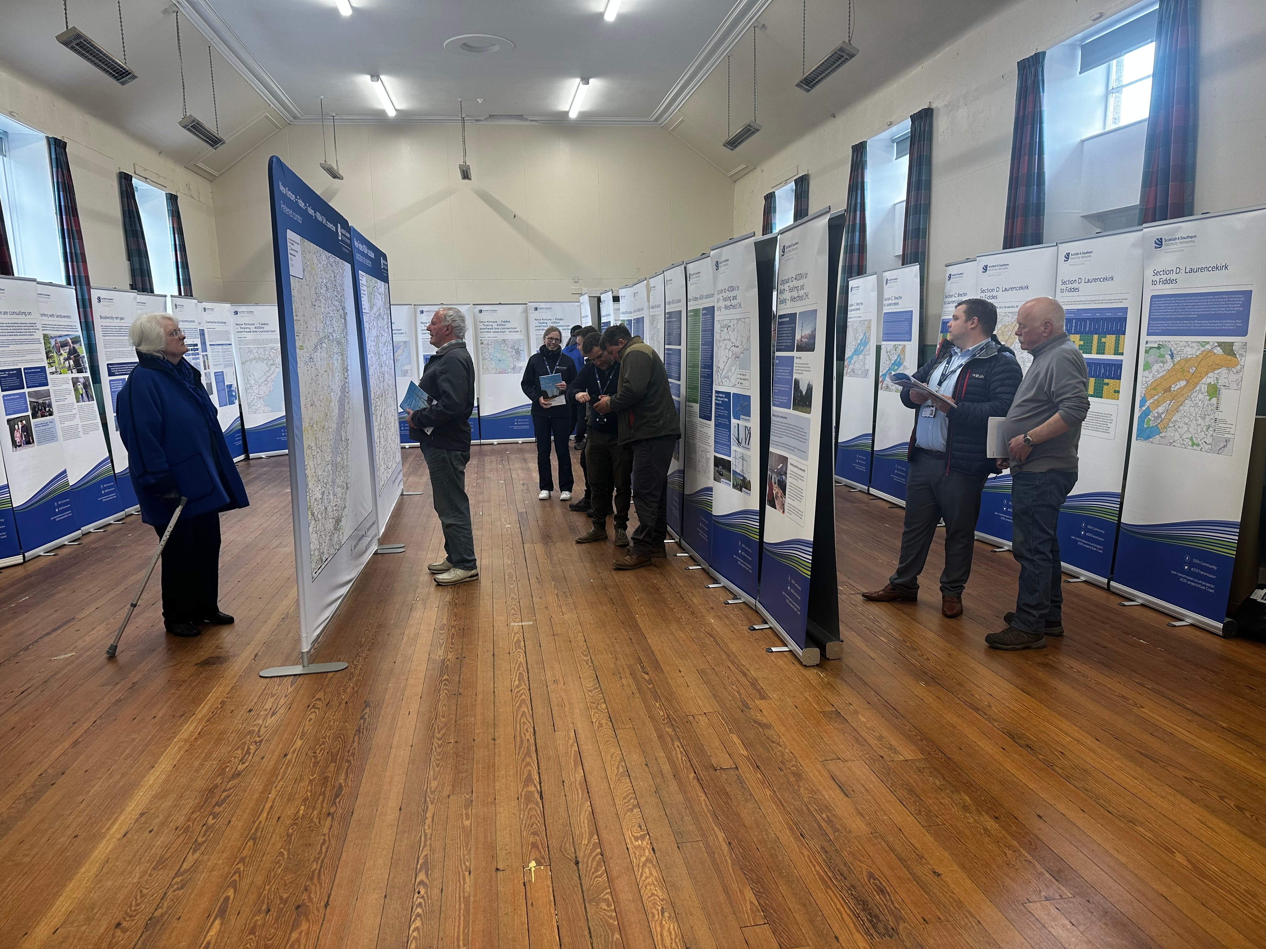
Public consultations took place in May 2023 as well as March and June 2024 to inform the community on progress to date with the East Coast 400kV Projects. We sought feedback from local communities and all interested parties on the interim preferred sites for the proposed Tealing 400kV Substation.
Access the 2023 Virtual Exhibition
In the video below, Senior Project Manager Calum Grant describes the approach we are taking to develop our proposals and the opportunities that are available for stakeholders to feed into the design process. This process aims to progress towards an optimal site in a systematic manner, which is technically feasible, economically viable, and could be anticipated to cause the least disturbance to the environment and to those who live, work, and visit the area.
The East Coast 400kV Projects
The East Coast 400kV Projects are a scheme consisting of several onshore reinforcement projects on the east coast of Scotland, comprising of new and upgrades of existing infrastructure. The majority of the infrastructure projects are within our operational area in the north of Scotland.
To provide the full 400kV capability that the scheme intends to deliver, there are several projects that contribute to the full scheme:
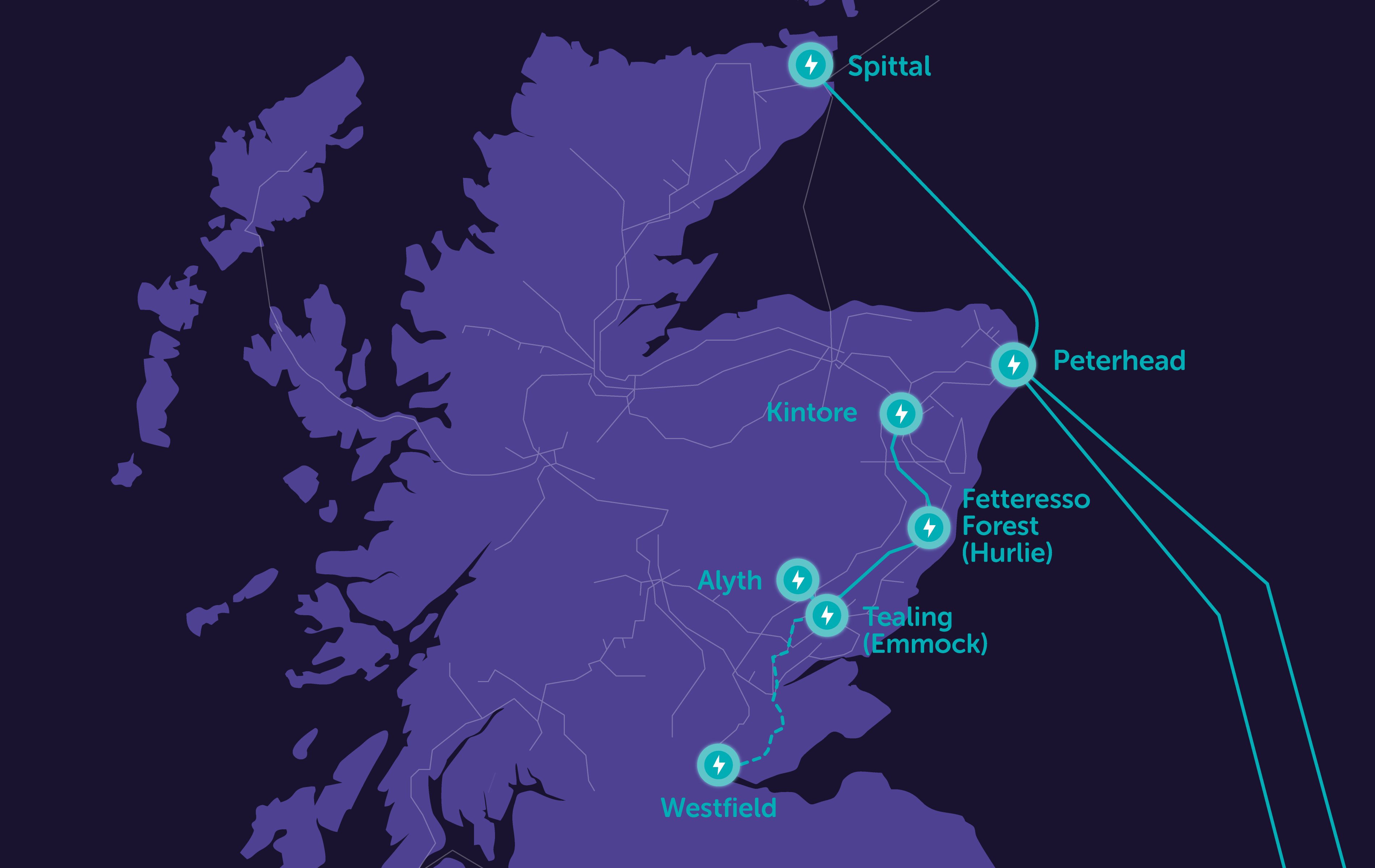
- An extension to Kintore 400kV Substation (currently under construction)
-
A new 400kV substation within the vicinity of the existing Fetteresso substation
-
A new 400kV substation within the vicinity of the existing Tealing substation
-
A new 400kV connection between Kintore, Fetteresso and Tealing
-
An upgrade to the existing Alyth - Tealing 275kV Overhead Line
-
An upgrade to the existing Tealing - Westfield 275kV Overhead Line (to the Scottish Power Transmission operational border)
-
Connection of the upgraded Alyth - Tealing and Tealing - Westfield Overhead Lines into the proposed Tealing Substation
Find out more about Kintore 400kV substation
Find out more about Hurlie 400kV substation
Find out more about Kintore - Tealing 400kV connection
How we’re embracing artificial intelligence (AI)
We intend to use AI to assist our experienced teams in the analysis of your feedback, so we can categorise key points raised more quickly. You can learn more about how we’re utilising AI on this dedicated web page.
Project Updates
Featured updates
Featured updates for this project
Archaeological site investigation works
Ground Investigation works
Planning Application Update
Planning Application
Project updates
-
SSEN Transmission publishes new economic analysis highlighting transformative growth potential of £29bn grid investment programme
We have today published a new economic report setting out the significant economic benefits associated with our planned £29bn investment in new and upgraded electricity transmission infrastructure across the north of Scotland.
The report, titled ‘Re‑energising the North: Transforming Scotland’, provides an update on our previously outlined economic analysis on plans to invest billions in mission-critical grid infrastructure, providing further insight into the scale of economic opportunity associated with the investment programme.
The report reaffirms our programme as one of the largest private infrastructure investments in Scotland’s history, with around £29bn of planned investment across the north of Scotland in the next five years, and it details the extent of the economic opportunity across the region.Using advanced economic modelling to analyse the impact of clean power infrastructure investment, the report’s findings conclude that our investment:
- Will support up to 10,000 jobs in the north of Scotland, and 24,000 across Scotland;
- When added to investment by other transmission operators and investment in generation will add around £60bn to UK economic output - with the Scottish economy up to 3% larger over the long term;
- Will deliver long-term improvements in productivity, wages and economic resilience, with employees moving into higher-value roles and key sectors expanding permanently; and
- Will create unique opportunities for Scottish suppliers, businesses and communities across multiple sectors, including forestry, peatland restoration, aggregates and concrete too.
The findings highlight the importance of ensuring that the benefits of investment are felt locally, with thousands of skilled jobs, increased supply chain activity, and investment flowing into communities across the north of Scotland.
Read the full News and Views article to find out more. -
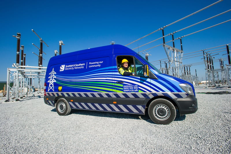
Archaeological site investigation works
Following completion of ground investigation works, archaeological site investigation works will take place at the site of our proposed Emmock 400kV substation, near Balkemback Farm, Kirkton of Tealing, due to start on 7 April and be completed by June.
The continuation of on-site works is not a pre-determination of the appeal process underway, rather that should the appeal be granted, we need to be able to progress the construction works efficiently. These temporary investigative works may be undertaken before planning consent has been granted, under permitted development rights.
The works will help ensure that we have accurate information to support any potential design changes, mitigation measures or future planning/construction considerations. Pausing certain works at this point would also risk having to repeat specialist work later if consent is granted, so completing them now ensures we maintain efficiency without advancing any irreversible work.
The works, which will be undertaken by our contractor Omexom, involve the careful excavation of trial trenches under archaeological supervision, with each trench being excavated, inspected and then reinstated before moving on to the next. Two excavators will be used across the site for the duration of the works and will be removed once investigations have been completed. These works are required to identify if there are any archaeological features on the proposed site. We don’t anticipate excessive noise in relation to these works, but some construction activity will be noticeable. The works will take place during daylight hours.
Throughout this process, our commitment to open, positive and constructive engagement with local communities and stakeholders remains unchanged. If you have any questions or concerns regarding the investigative works, please contact us directly at tkup@sse.com.
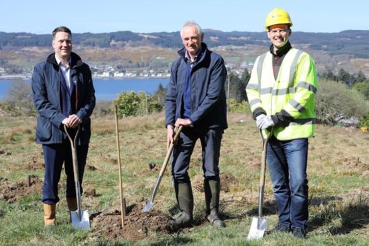
Ground Investigation works
Further ground investigation works will take place at the site of our proposed Emmock 400kV substation, near Balkemback Farm, Kirkton of Tealing, from 23 March.
The continuation of these works is not considered to be a pre-determination of the appeal process underway, rather more that should the appeal be granted, we need to be able to progress the construction works efficiently and this is therefore being undertaken at our own risk. These ground investigation works may be undertaken before planning consent has been granted, under permitted development rights.
The works will help ensure that we have accurate information to support any potential design changes, mitigation measures or future planning/construction considerations. Pausing certain works at this point would also risk having to repeat specialist work later if consent is granted, so completing them now ensures we maintain efficiency without advancing any irreversible work.
The works, which will be undertaken by our contractor Omexom, will include taking samples using boreholes and will last for approximately two weeks. Excavators and drilling rigs will be used during the works, which will need to be transported to and from the site. We don’t anticipate excessive noise in relation to these works, but some construction activity will be noticeable. The works will take place during daylight hours.
Throughout this process, our commitment to open, positive and constructive engagement with local communities and stakeholders remains unchanged. If you have any questions or concerns regarding the ground investigation works, please do not hesitate to contact us directly at tkup@sse.com
-
Planning Application Update
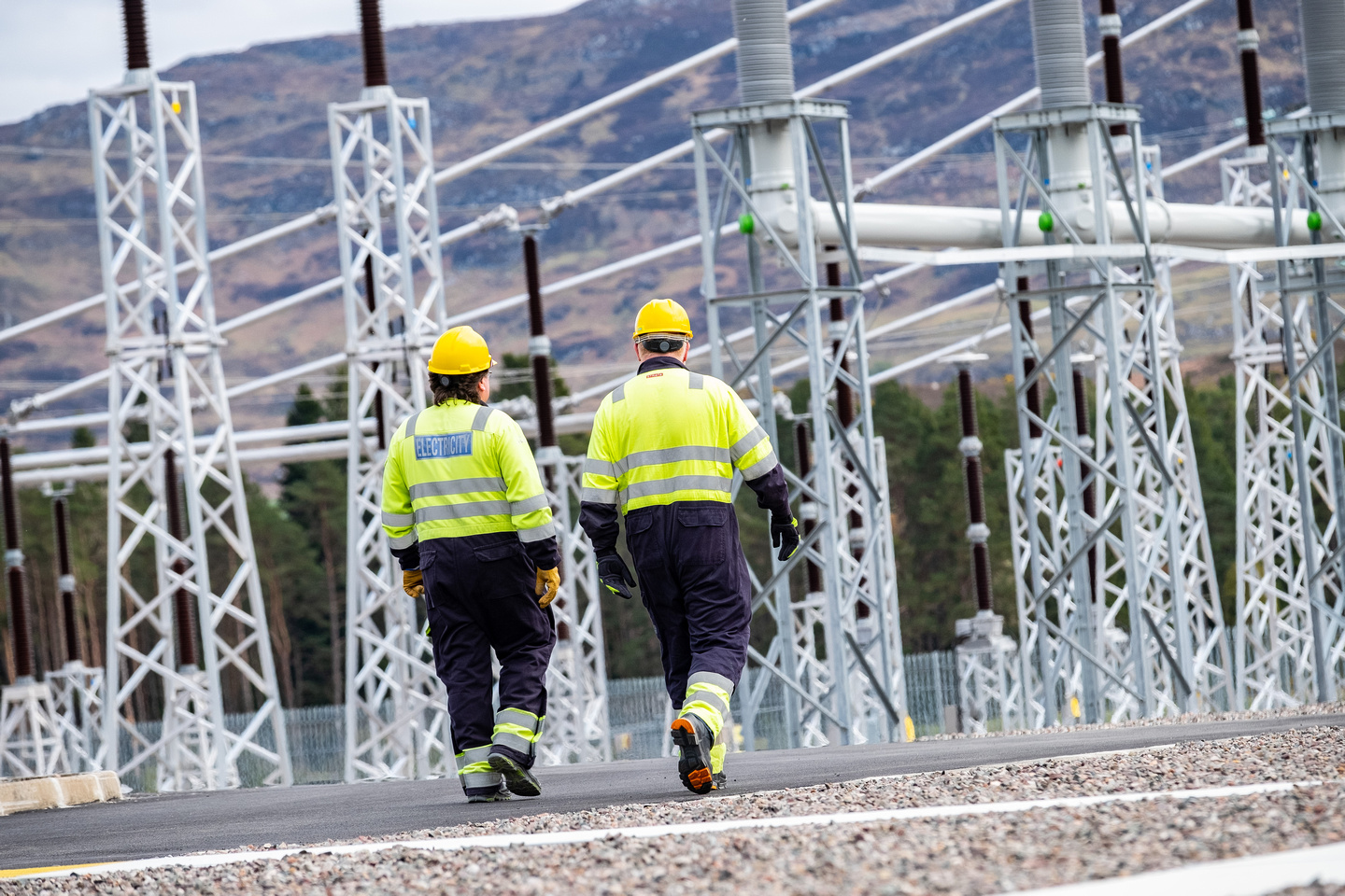
Our planning application for our proposed Emmock 400kV substation was refused by Angus Council at a special meeting on 16 December 2025, against the recommendation of the council’s Chief Planning Officer. We submitted an appeal against Angus Council’s decision on 30 January 2026, which has now been registered by the Scottish Government's Planning and Environmental Appeals Division (DPEA), and can be reviewed on its website under the reference PPA-120-2074. We’d like to thank everyone who has taken the time to share their views on our proposals up to this point. -

Ground Investigation Works
In advance of the planning determination for our proposed Emmock 400kV substation, we will be undertaking ground investigations on the site, near Balkemback Farm, Kirkton of Tealing, from Wednesday 19 November 2025.
Our contractor Omexom will be conducting the works for approximately 4 weeks. This will include the mobilisation of construction plant to site and setting up a temporary compound.
Ground investigation works are required to understand the ground conditions of the proposed site. This will help us to inform the detailed design of the substation and understand earthwork movements associated with creating the substation platform.
The works will include taking samples using boreholes. Excavators and drilling rigs will be used during the works, which will need to be transported to and from the site. We don’t anticipate excessive noise in relation to these works, but some construction activity will be noticeable. The works will take place during daylight hours, and the compound will have lights for safe access and egress, but these will not be left on overnight.
If you have any questions or concerns regarding the ground investigation works, please do not hesitate to contact us directly at tkup@sse.com -
Planning Application - Updated Documents
Following feedback from Angus Council on the planning application for our Emmock 400kV substation proposals, submitted in December 2024, we have updated and re-submitted the Transport and Access chapter of the EIA Report, along with an associated figure, appendices, a file note summarising the changes, and the Non-Technical Summary. We have also submitted new transport-related passing place and visibility splay drawings. Following feedback from Angus Council and various consultees, we have also submitted further information on other topics in response to comments on landscape and visual impacts, project need, and specific clarifications requested by NatureScot.
All the updated documents that make up the re-submission can be found within the documents section of this website as well as on the Angus Council planning portal using the original planning reference of 24/00699/FULN. -
We're here to lend a helping hand
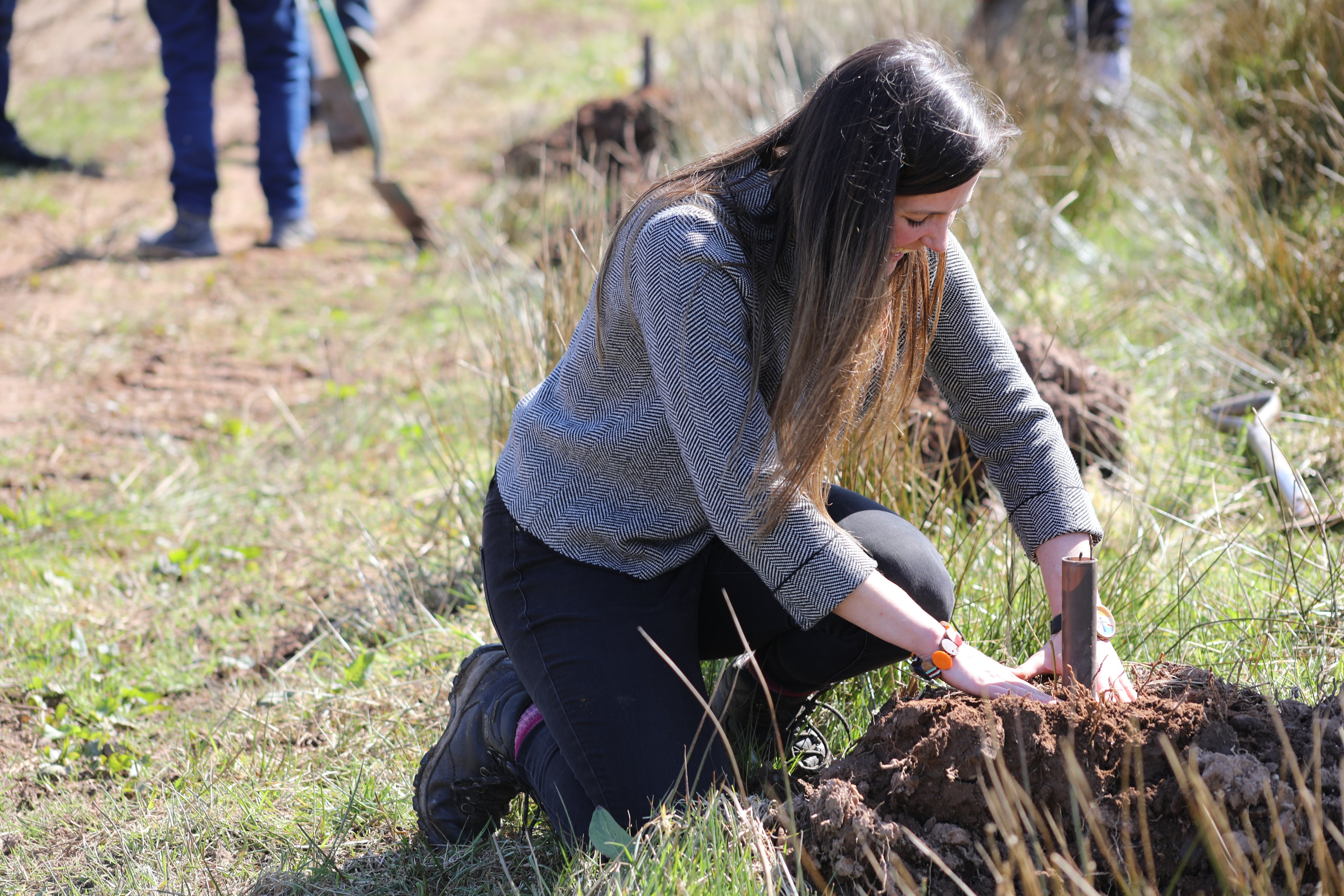
We are committed to supporting the communities in the north of Scotland where we operate, both now and in the future. As part of our ongoing efforts to make a difference and have a positive impact on local communities, we are proud to offer volunteering days to local groups and charities, particularly in the areas that host our electricity infrastructure or where our proposed projects are located.
This month, we’re excited to announce the launch of our new Volunteering Webpage, designed to make it easier for local communities to request volunteering support from us. To request our help, simply complete the ‘Volunteering Nomination Form’ linked at the bottom of our new webpage. Please note, as our team works on a voluntary basis, it may take us some time to coordinate our people and match them with opportunities. We kindly ask for your patience as we work to keep up with volunteering demand.
Thank you for considering SSEN Transmission as a partner in your community efforts. Together, we can leave a positive, lasting legacy and help transform communities across the north of Scotland.
-
Planning Application
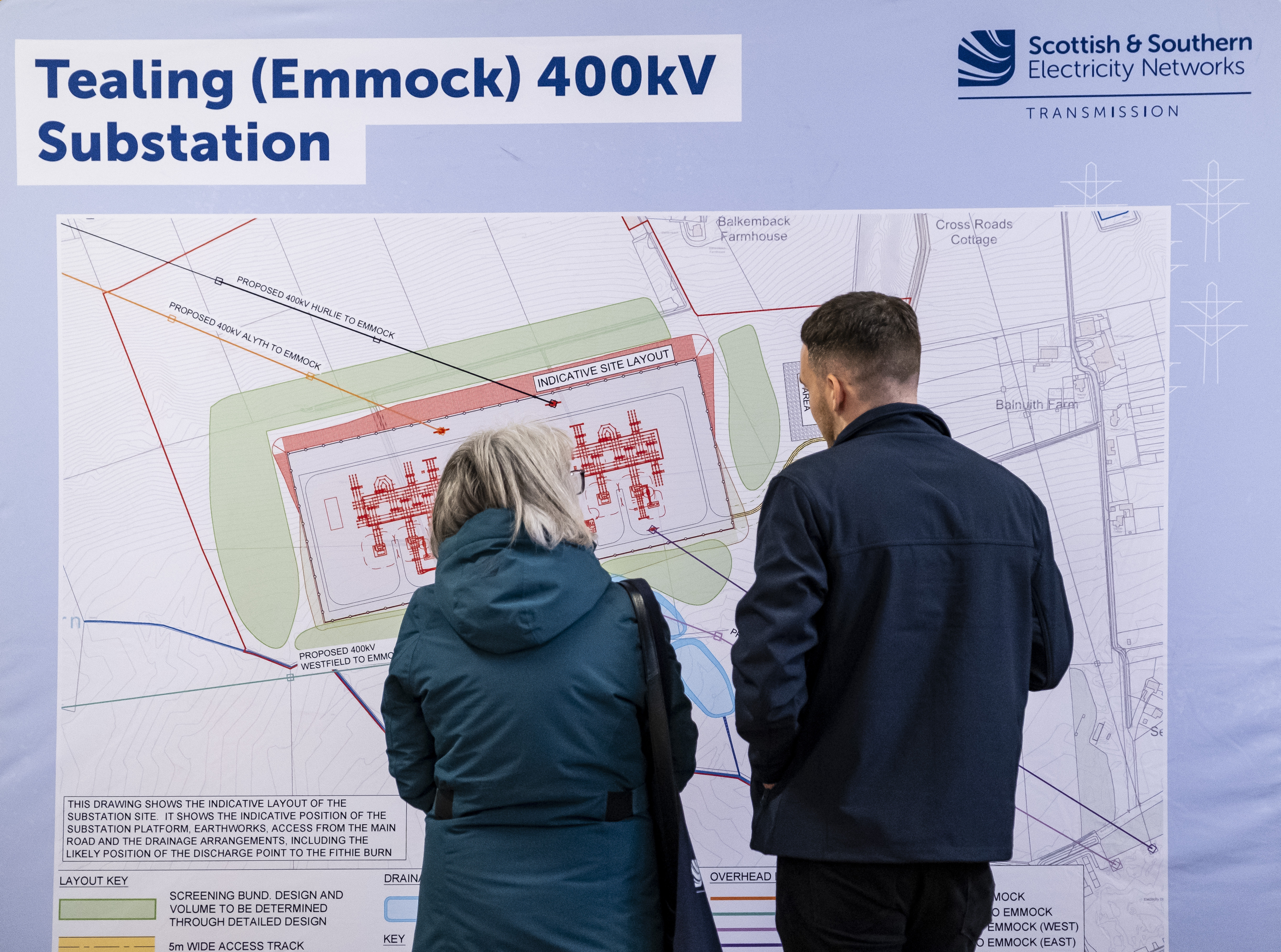
Following the second pre application consultation feedback events that were hosted in June at Tealing Village Hall we can confirm that we have now submitted our planning application to Angus Council for the Emmock 400kV substation.
The Emmock 400kV substation is part of a wider upgrade to the transmission network in the north of Scotland, helping deliver high voltage, clean renewable power for connection to homes and businesses across the UK – helping meet national net zero and energy security ambitions.
Our planning application regarding our proposal to construct and operate a 400kV AC substation on land in the vicinity of Balkemback Farm, Kirkton of Tealing, north of Dundee in Angus has been made to Angus Council under reference 24/00699/FULN. Should you wish to view our application in full and submit formal comment to the council our application is available to be viewed via the Angus Council planning portal, using the above reference. A hard copy of the Environmental Impact Assessment (EIA) is also available to be viewed at the below location:
Forfar Library, 50-56 W High St, Forfar DD8 1BA (opening hours: Monday 10.00am to 4.00pm, Tuesday 2.00pm to 8.00pm, Wednesday 10.00am to 2.00pm, Thursday 10.00am to 4.00pm, Friday 10.00am to 4.00pm and Saturday 10.00am to 1.00pm.
All the documentation submitted as part of the application can also be viewed and downloaded from the documents section of this webpage.
We would like to thank those who provided feedback as part of our pre-application consultation events, which have been key in helping us shape our proposals and we now look forward to working with Angus Council and other key stakeholders as part of the consenting process. -
June 2024 Consultation Feedback Period Closed
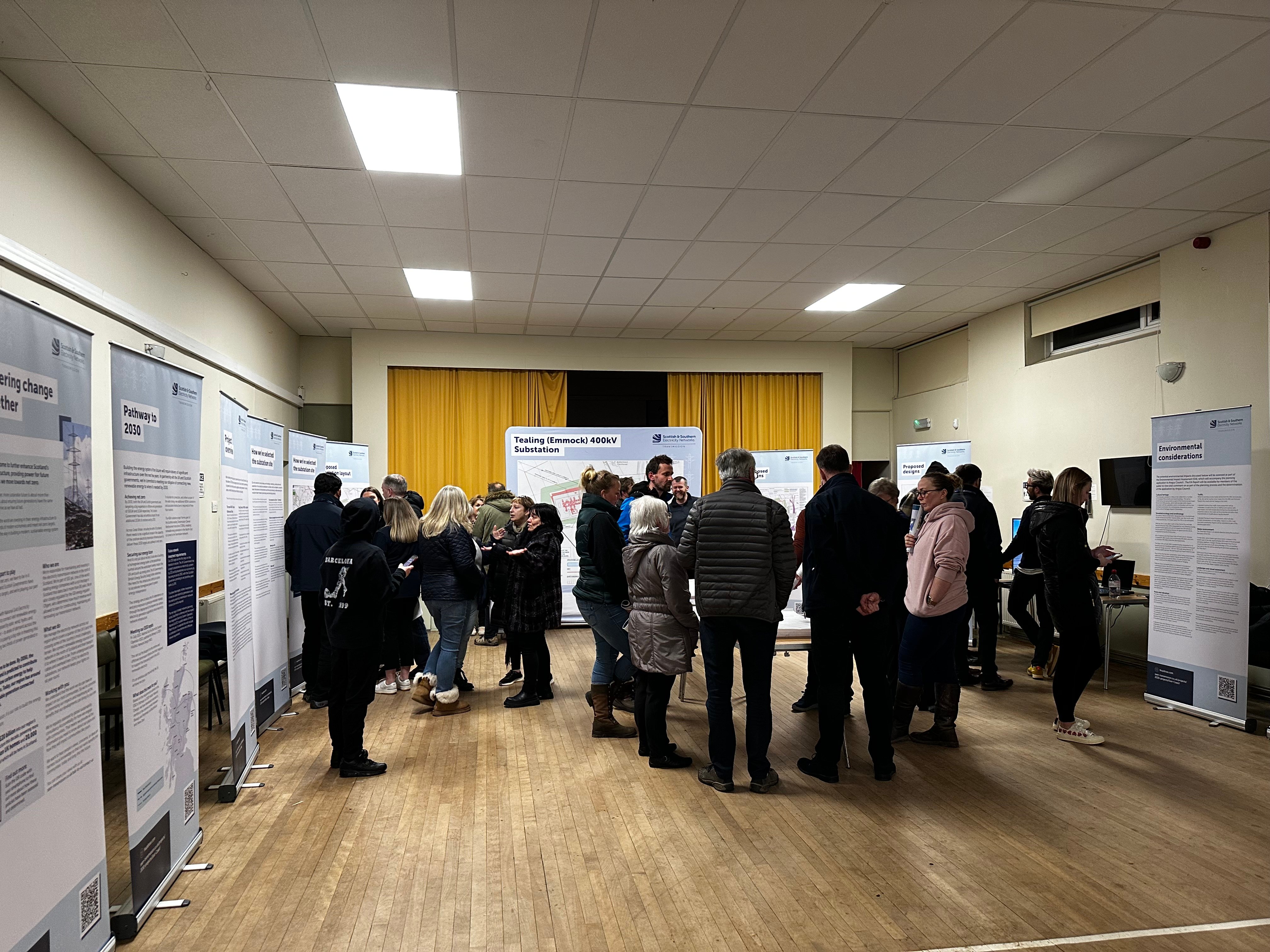
We would like to extend thanks to all members of the public, local stakeholders and other interested parties who took the time to provide feedback on our proposals for the Emmock 400kV substation project.
The feedback period for providing comments following our consultations that we held in June 2024 has now closed. All responses received will now be reviewed by the project team ahead of submission of a planning application to Angus Council. -
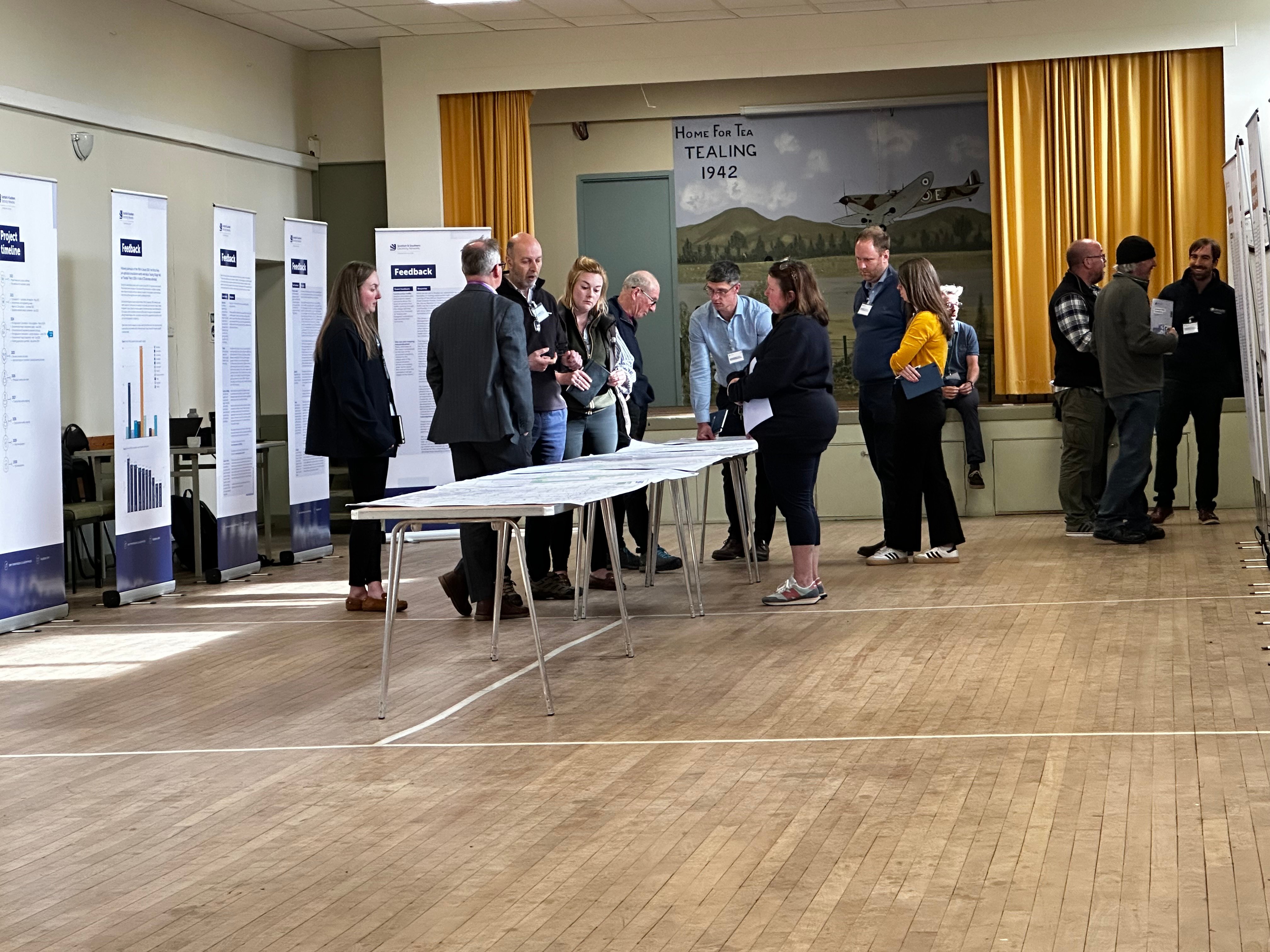
June 2024 Consultation Feedback
We would like to thank all local community members and interested parties who took the time to attend our recent June 2024 consultation events which took place across the 5-6 June.
We will accept feedback from now until 17 July 2024. During our last public consultation events in March 2024, we wanted to know your thoughts on our project plans, where you thought we could make improvements, and any changes and refinements we’d made.
We are now asking for any final comments or feedback ahead of submitting planning applications for the Emmock 400kV substation project. We’ll be actively looking to mitigate the impacts of the site as much as possible over the coming months, but it would be helpful to understand what you believe we should be doing to help minimise these impacts.
Submit your comments and feedback by emailing tkup@sse.com or writing to your Community Liaison Manager Rhiannon Merritt at SSEN Transmission, 10 Henderson Road, Inverness, IV1 1SN.
Any comments made to us as the Applicant are not representations to Angus Council as the planning authority. There will be opportunity to make formal representations to the planning authority following the submission of the planning application. -
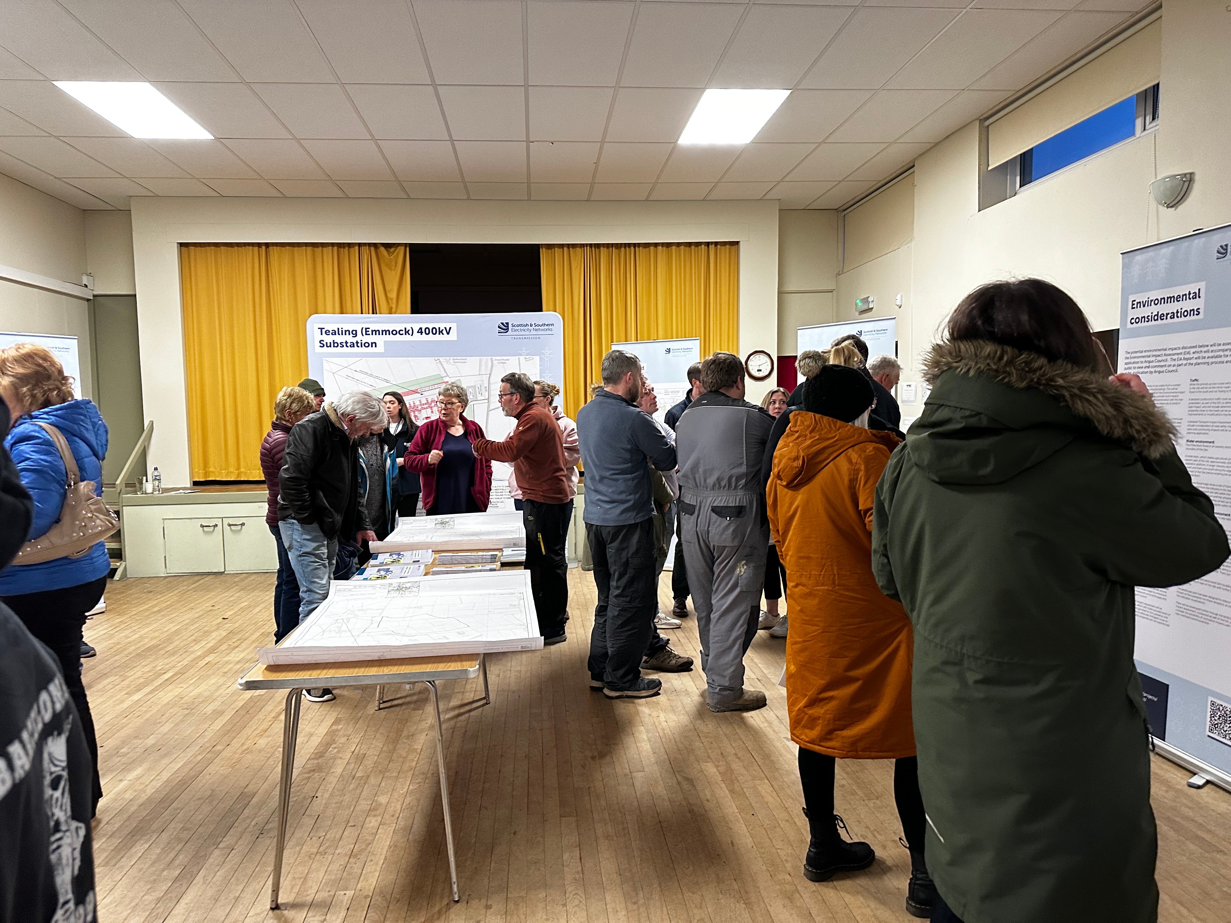
Pre-Application Consultation (PAC) events - June 2024
We are holding the second of our statutory pre-application consultation events for our proposed Emmock 400kV substation project. We would like to thank those who took the time to attend our first events in March this year and submit their feedback.
During our consultation events you will be able to view further information about our proposed substation site, our responses to feedback received from the last events, meet the project team, ask questions and share further comments.
We would encourage members of the local community and all interested parties to attend the events.
The open-door drop-in face to face consultations will be held at the following locations;
Wednesday 5 June, 2-7pm at Tealing Village Hall, Inveraldie, Tealing, DD4 0QW
Thursday 6 June, 2-7pm at Tealing Village Hall, Inveraldie, Tealing, DD4 0QW
-
March 2024 feedback period now closed
We would like to extend thanks to all members of the public, local stakeholders and other interested parties who took the time to provide feedback on our proposals for the Emmock 400kV substation project.
The feedback period for providing comments following our consultations that we held in March 2024 has now closed. All responses received will now be reviewed by the project team ahead of the next round of consultations which is expected to take place in summer.
Although the formal consultation period has closed for the latest events that we held, engagement with affected communities and wider stakeholders will continue beyond the consultation deadline and we will continue to engage with all stakeholders. -
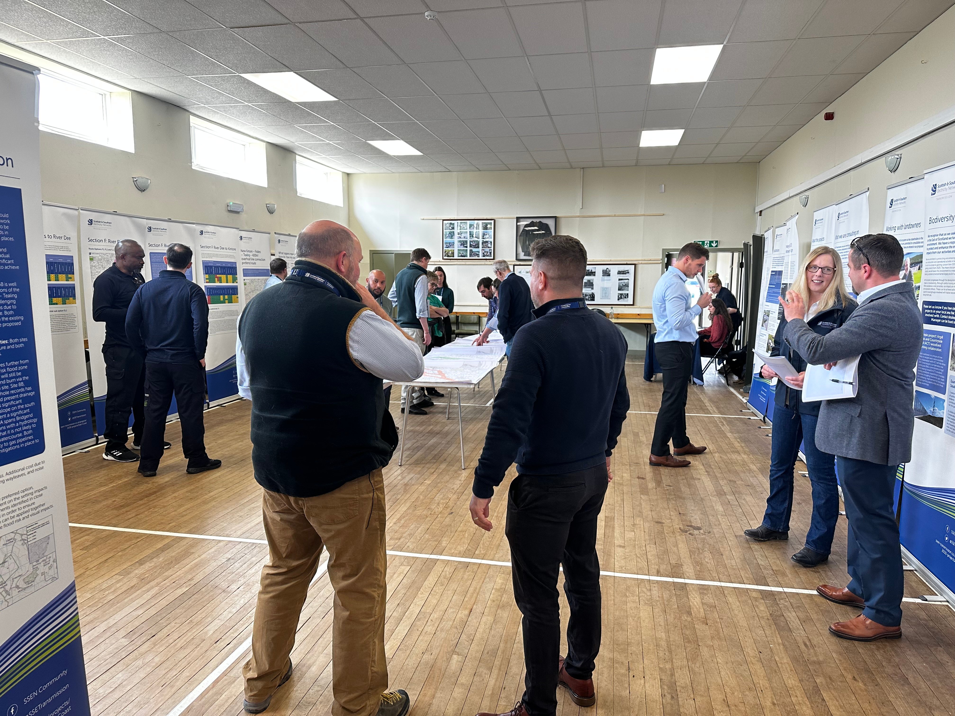
March 2024 public consultations
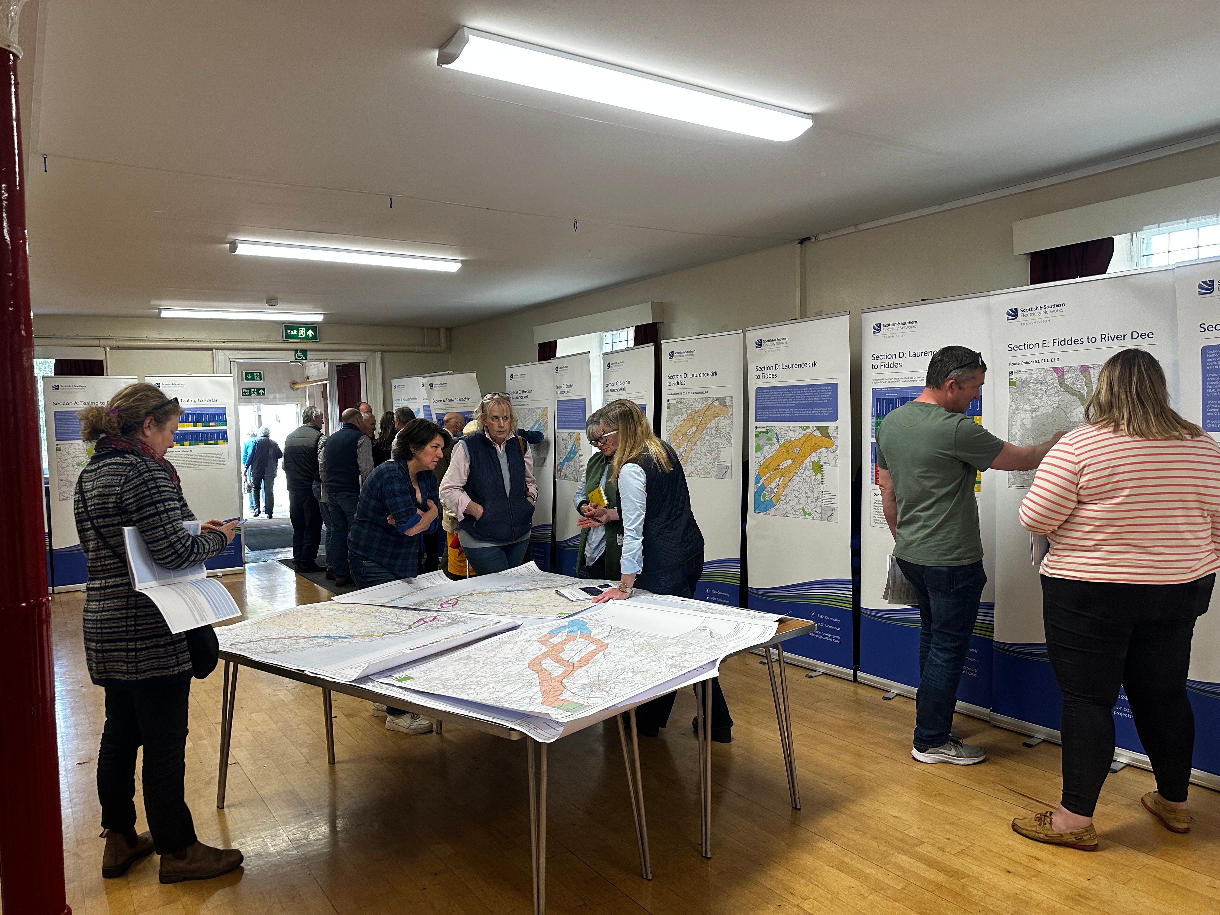
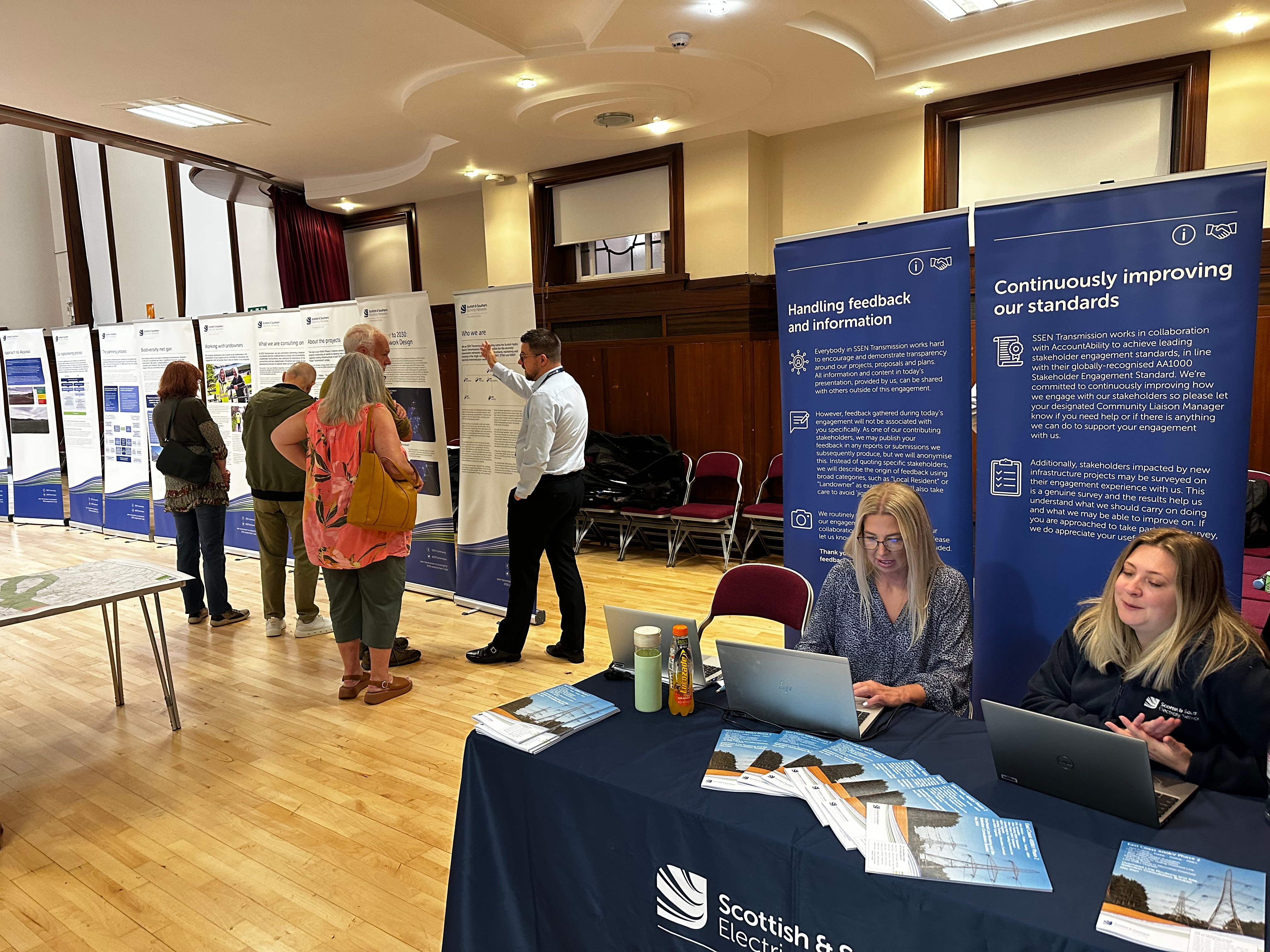
We would like to thank all local community members and stakeholders who took the time to attend our recent March 2024 public consultation events which took place 4 – 21 March with 10 in person events covering the Kintore-Tealing 400kV projects.
Our public consultation remains open until 15 April. We welcome all interested parties to submit their feedback regarding the proposals presented during consultation via;
Online feedback form: Tealing (Emmock) 400kV Substation - Pre-Application Consultation Feedback Form
Email: tkup@sse.com
Post: FAO Rhiannon Merritt, SSEN Transmission, 10 Henderson Road, Inverness, IV1 1SN
Our virtual consultation portal will remain available throughout the consultation period here.
A copy of the consultation booklet is available to download via the ‘Project Documents’ section of this project website.
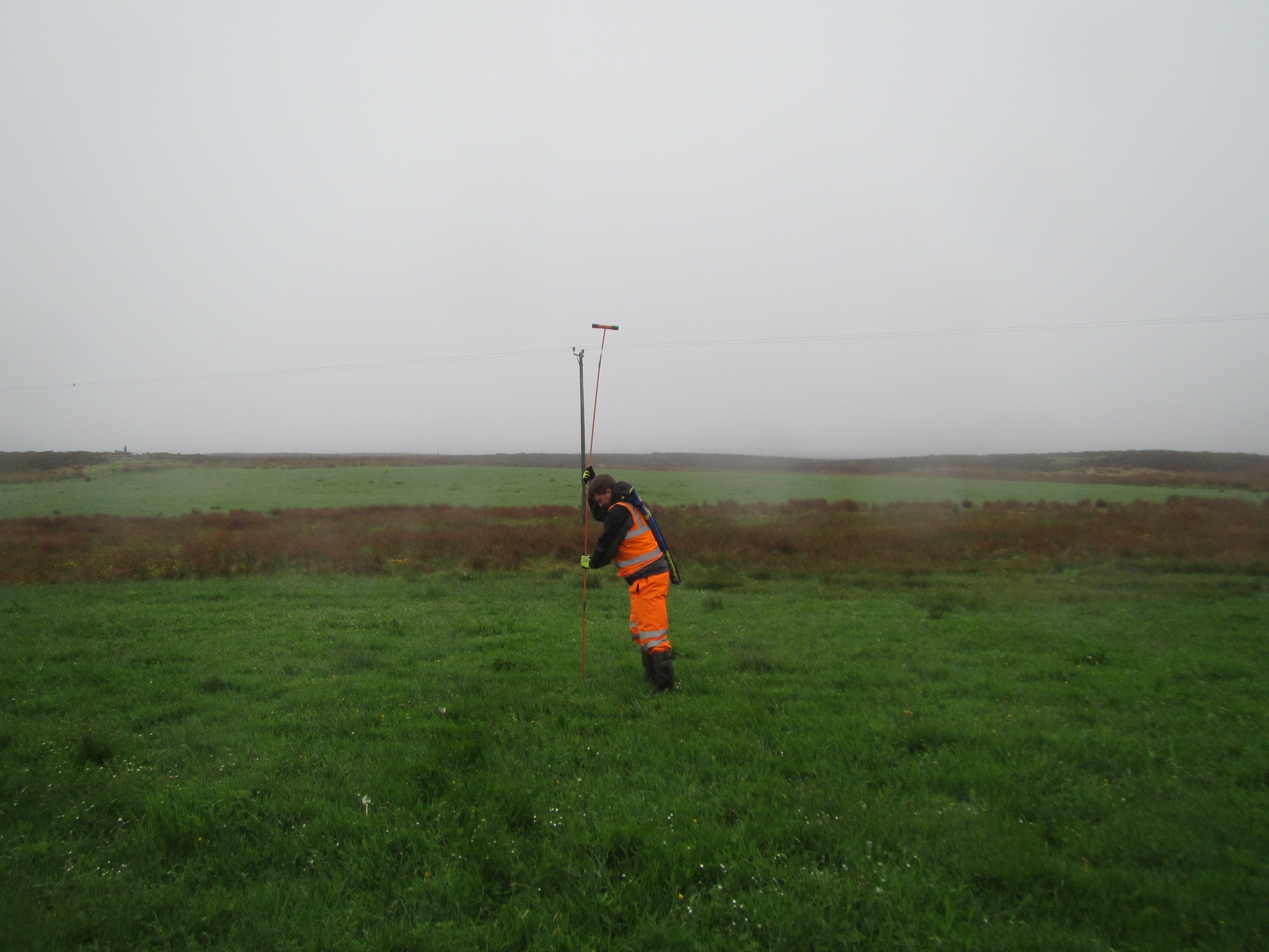
Further Ground Investigations
Further ground investigations have commenced in the area around our proposed site 4 at Tealing to help inform the ongoing development of the Kintore-Tealing 400kV projects.
If you have any queries or concerns please contact the Community Liaison Manager at TKUP@sse.com -
March 2024 public consultation period is now open
We are pleased to announce the commencement of the next period of public consultation.
A public event will be held in March for this project:
7 March 2024 Tealing, Tealing Village Hall, Hall Road, Inveraldie, Tealing, DD4 0QW, 2-7pm
If you are unable to attend the planned in-person event, all the material that will be on display can also be downloaded from the project documents section of this dedicated project website at the start of the consultation period.
You can submit your feedback until 15 April 2024 for this project via the feedback form on the project website, by emailing tkup@sse.com or writing to us at SSEN Transmission, 10 Henderson Road, Inverness, IV1 1SN.
Following the events held in May 2023, many enquiries we received were about the need for the projects, the engagement process, environmental considerations, and what alternative technologies may be available. We have compiled ‘Frequently Asked Questions’ to address many of these points which can be viewed here.
-
Webinar: Update on ‘Pathway to 2030’ Projects
On the 13 December we held a stakeholder webinar ‘Update on Pathway to 2030 Projects’ to hear about some of the primary changes to our ‘Pathway to 2030’ projects which we’ve been working on since our public consultations earlier this year. Thank you to the 500+ stakeholders who were able to join us.The recording of the event and slide packs are available below for those who were unable to attend.
Report on Consultation
Our Reports on Consultation across our three new overhead line projects and associated substation and convertor station developments have now been published. These reports provide a summary of the extensive feedback received during consultation, how this has been considered and confirmation of which routes and substations are now being taken forward to the next stage of development.
Our Reports on Consultation are now available to download from the Project Documentation tab.
Summary Reports on Consultation are also available for each of the three schemes and can be downloaded below:
- Summary Report on Consultation Beauly to Peterhead
- Summary Report on Consultation Spittal to Beauly
- Summary Report on Consultation Kintore to Tealing
A stakeholder webinar available for all to join will be held in the coming weeks to share the changes informed by the feedback. More information about the forthcoming webinar will be shared on our events page shortly.
In further recognition of community feedback, we will seek to rationalise cumulative infrastructure impacts through the removal and undergrounding of existing transmission lines, where technically practical and appropriate, and subject to all necessary planning consents and landowner agreements.
Work to identify and assess potential sections of existing overhead line where their removal will reduce cumulative impacts is ongoing, with an update expected as part of the next round of public consultation on overhead line alignments and more detailed substation designs in early 2024.
We would once again like to thank all stakeholders who took the time to engage with our early consultation process. We will continue to engage with stakeholders ahead of consulting further with local communities and stakeholders in the new year, as we look to refine our proposals.
-
Report on Consultation
Over the course of this year, we have undertaken extensive consultation on plans to upgrade the electricity transmission network across the north of Scotland and have received a considerable amount of feedback from a wide range of stakeholders regarding our proposals.
We recently advised in our next steps for 2030 network developments update that following assessment of consultation feedback and additional options analysis, we would publish our Report on Consultations (RoCs). These reports provide a summary of the feedback received and how it has been considered, which options we will take forward to the next stage of the development process and any changes to options initially consulted on.
It is our intention to publish the RoCs for this project in the coming months. All stakeholders signed up for updates on the project will receive a link to the report and we will also issue Summary Reports to help ensure accessibility.
These Report on Consultations mark the completion of the first round of non-statutory consultation, where we sought feedback on the corridor, route, and substation locations. We will be consulting further with local communities and stakeholders in the new year, as we look to refine the projects, therefore we welcome an open channel of communication and would like to reassure all stakeholders that there will be further opportunities to engage on this project.
Our Reports on Consultation and Summary Reports on Consultation are now available to download from the Project Documentation tab. -
SSEN Transmission sets out next steps for Pathway to 2030 network developments
We have announced our next steps for our Pathway to 2030 programme of projects. We would like to thank everyone who has engaged with our teams and kindly taken the time to respond to our consultations.
Full details of the announcement can be found here:
Next steps for Pathway to 2030 -
Feedback period closed
The feedback period on our recent period of consultation for our East coast 400kV Phase 2 proposals which sought feedback on potential corridor and route options and preferred substation locations has now closed.
Further engagement with affected communities and wider stakeholders will continue beyond this consultation deadline, particularly in areas of local sensitivity, to help with our ongoing project development. The outcomes of the consultation exercise will be reported publicly in a Report on Consultation.
Throughout the development phase we will continue to engage with stakeholders and intend to hold a second public consultation event towards the end of the year.
Ground Investigations
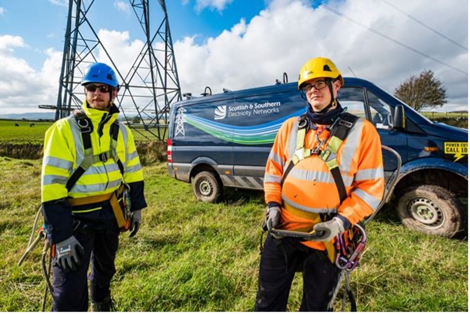
W/c 24 July 2023 works will commence on ground investigations around our proposed site 4 at Tealing to help inform the ongoing development of the Kintore-Fiddes-Tealing project.
These initial surveys have prioritised the potential site which performs the best on initial assessment, based on a balance of the key environmental, technical, and economic factors identified.
Our teams continue to assess and consider the feedback received via our current consultation which has been extended until Friday 28th July. Should we establish viable alternatives that warrant more detailed investigations, they will also be surveyed accordingly.
We would like to continue to reassure all stakeholders and interested parties that no decisions have been taken on either potential overhead line routes or substation locations for this project.
If you have any queries or concerns please contact the Community Liaison Manager at TKUP@sse.com -
Public Consultation Feedback Period Extension
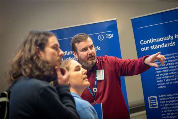
To allow more time for those interested in the East Coast 400kV phase 2 project to share their views we have extended the consultation period until Friday 28 July in recognition of the extent of local interest in the project and to allow stakeholders and members of the community more time to share their views on the initial proposals.
We would also like to reassure stakeholders that no decisions have yet been taken on potential overhead line routes or substation locations and the project remains at the early stages of development. All feedback received through the consultation will be carefully considered to help inform the ongoing development of this project.
If you have been unable to attend one of our consultation events, you can find all of the relevant consultation documentation within the project documents tab on this webpage.
Initial response to consultation
We would like to thank all stakeholders who have taken the time to provide their feedback on our proposals to develop the East Coast 400kV phase 2 projects.
Following an initial review of the feedback received so far, SSEN Transmission has published an initial response to address some of the key themes which have been identified. Once the feedback period closes, a detailed Report on Consultation will also be published to explain how feedback has been considered to inform the more detailed network design.
The consultation period remains open and we continue to encourage anyone with an interest in the project to share their views by Friday 23 June.
The initial response to consultation is available to be downloaded from the project documents section of this website. -
Survey works to help inform next stages of development
We have recently started localised surveys, assessments and ground investigation works at various locations across the Pathway to 2030 projects which will be used to help gather information to inform the next stage of development for a major electricity transmission network upgrade in the north of Scotland.
Over the coming weeks and months, our project teams and contractors will undertake a series of site-specific assessments which include the likes of ground investigations, bird surveys, LiDAR flights, and ecological and archaeological walkovers and assessments.
Ground investigation works have either recently commenced or are set to begin throughout the Summer for the new 400kV substation and converter stations proposed as part of our East Coast 400kV phase 2, Spittal – Loch Buidhe – Beauly 400kV connection, Western Isles connection and Beauly – Blackhillock – New Deer – Peterhead 400kV connection projects. Project teams and contractors will undertake a series of site-specific assessments which will help provide vital information and key data for the next phase of project development.
Some of the geo-technical ground investigations may involve drilling boreholes or digging trial pits, which will allow engineers to understand the geographical make-up and suitability of the ground in certain locations to help inform potential design options.
Site assessments and survey works are a key part of the project development process, and the results of these investigations will provide project teams with valuable information to help inform decisions regarding substation site selections and overhead line routes, which will be subject to further consultation later this year.
Initial surveys will prioritise sites and routes which performed the best based on our initial assessment of key environmental and people, technical, and economic factors, and there have been no decisions taken on locations as yet.
There may be more activity on the ground over the summer, and whilst most assessments are expected to cause very little local disruption, we would like to thank the local community for their patience whilst they are carried out. Where more evasive assessments are required such as ground investigation works, we will work to keep local disruption and environmental impacts to a minimum. Please contact your local Community Liaison Manager if you have any questions.
Public Consultation Feedback Period Extension
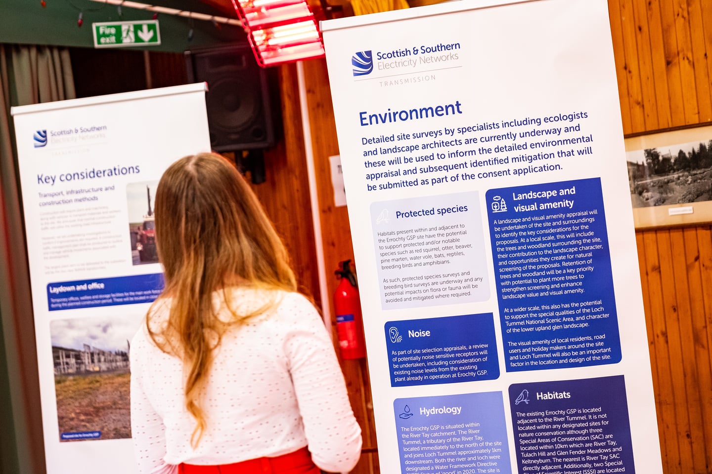
In recognition of the extent of local interest in the project, we have extended the consultation feedback deadline until Friday 23 June and hope this will allow all stakeholders with an interest in the project sufficient time to provide feedback.
Additionally for anyone that wasn't able to attend any of the in person events and would like a copy of the booklet which contains all the information displayed we have distributed copies to the following local businesses:
Farm to Table, Westerton Of Pitarrow, Laurencekirk.
Spar Cetras Energy UK, 3 Academy Street, Forfar, DD8 2XF.
May 2023 consultation feedback
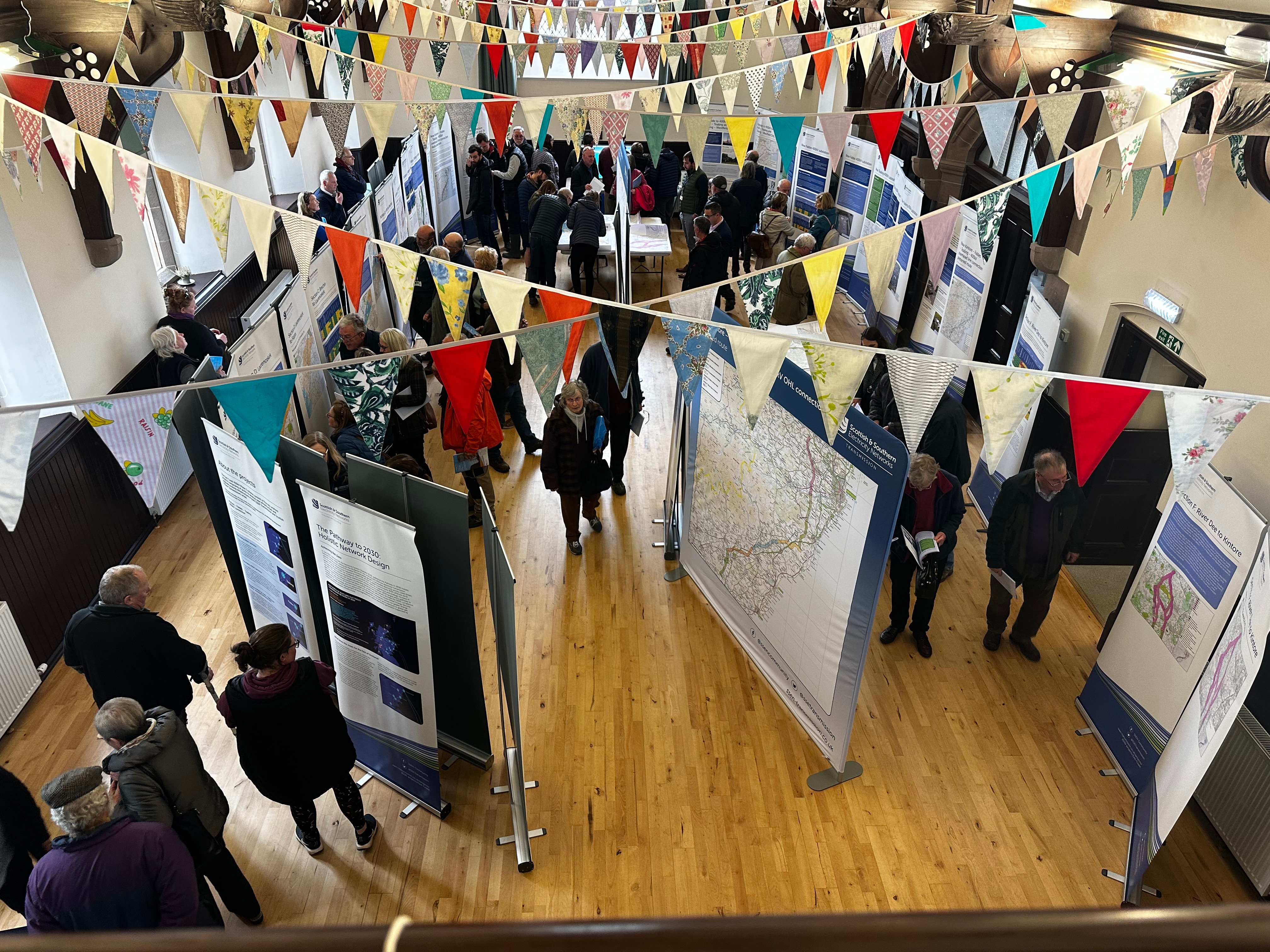
We would like to thank all local community members and stakeholders who took the time to attend our recent May 2023 consultation events which took place between 2-11 May, with 6 in-person consultations between Kirkton of Skene and Tealing, and a virtual live instant messaging session on 17 May.
Our public consultation will remain open until 23 June, and we would welcome all interested parties to submit their views regarding the proposals presented during consultation. Once the consultation period closes all feedback will be assessed and considered, to help determine next steps required ahead of route determination.
Our virtual consultation portal will remain available throughout the consultation period via the following link. The portal contains links to download the consultation booklet and copies of the maps, however these are also available to download via the 'Project Documents' section on the left hand side of this page. -
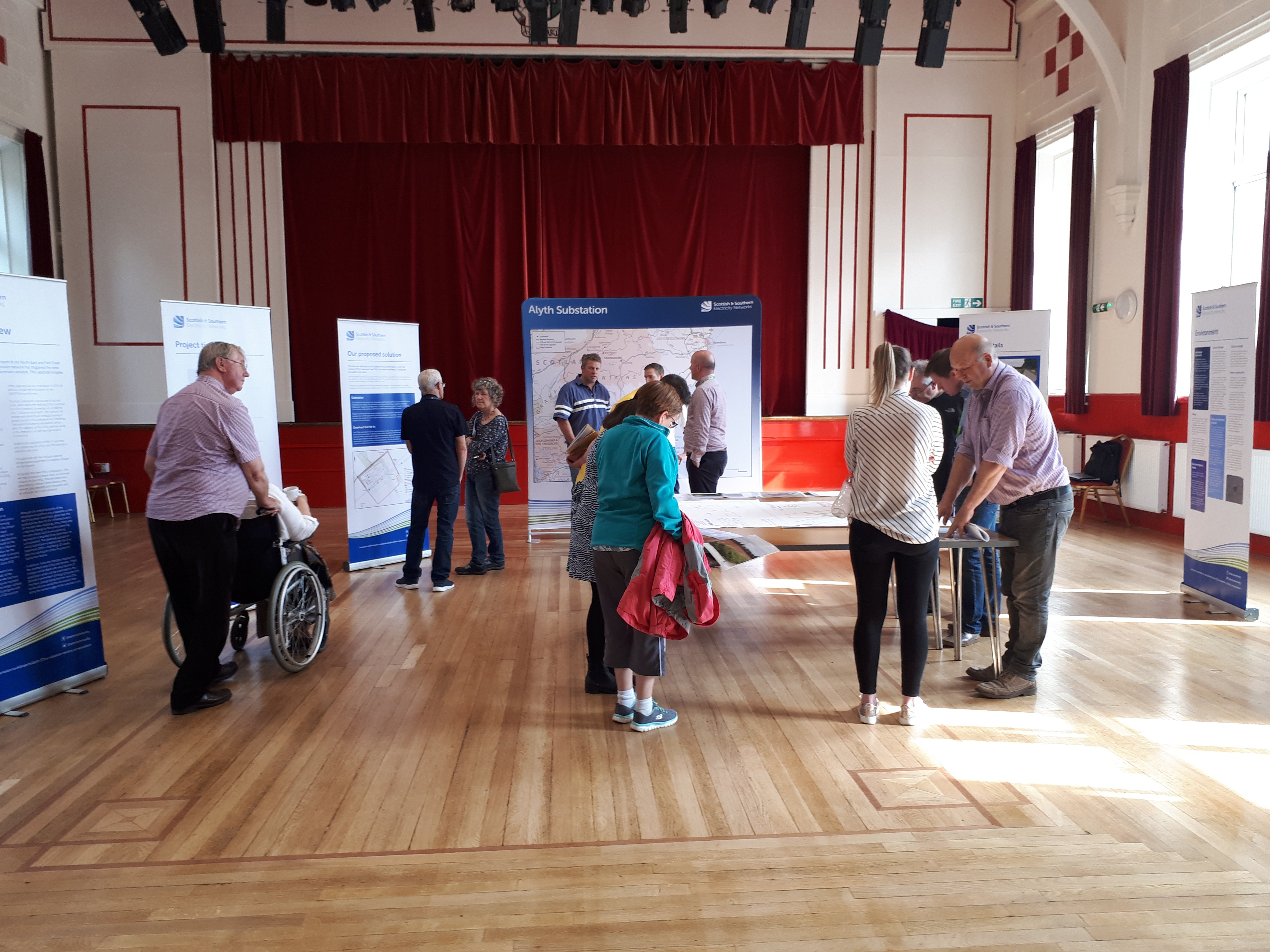
Public consultation events - May 2023
We are pleased to be hosting both face to face public consultations along with a virtual online consultation exhibition to gain views and feedback on our proposals for the East Coast 400kV phase 2 scheme, which the proposed new Tealing 400kV substation project is part of.
We would encourage members of the local communities and all interested parties to attend the events, meet the proejct team and and give their views and provide feedback. The face to face consultations will be held at the following locations:
2 May at Milne Hall, Kirkton of Skene between 2-7pm
3 May at Ardoe House Hotel in the Ogston Suite between 2-7pm
4 May at Dickson Hall, Laurencekirk between 2-7pm
9 May at Brechin City Hall, Brechin between 2-7pm
10 May at Westmuir Hall, Kirriemuir between 2-7pm
11 May at Tealing Village Hall, Tealing between 2-7pmThe virtual consultation event will be taking place on:
17 May between 4-6pm
Click here to enter our virtual consultation room
Should you have any questions regarding the consultations please contact the projects Community Liaison Manager.
-
2023 public consultations
We are intending on launching initial public consultation events in quarter 2 of 2023 to share our approach to develop this project and the rationale behind our proposals. We are keen to hear our stakeholders views regarding our preferred technology options along with your thoughts on our preferred site for the new 400kV electricty substation and if there are further considerations you believe need to be taken into account during the next stage of the development process.
A drop-in event will be arranged in Tealing where we will welcome all interested parties to come meet our project development team, learn more about the project, ask any questions and share your feedback. Information on the consultation date and location will be shared in the New Year.
In the meantime to learn more about the project an information booklet is availabe to be downloaded from the project documents section of this website and to hear from our Senior Development Project Manager Calum describe the approach we are taking to develop our proposals and the opportunities that will be available for stakeholders to feed in to the design process please view our short video here.
Documents
Compulsory Purchase Order (CPO) Documents
-
Benefited Property Map
- Type:
- Date:
- 02 July 2026
- Size:
- 792.5 KB
-
Compulsory Purchase Order
- Type:
- Date:
- 02 July 2026
- Size:
- 182.4 KB
-
Location Plan
- Type:
- Date:
- 02 July 2026
- Size:
- 1.1 MB
-
Order Map
- Type:
- Date:
- 02 July 2026
- Size:
- 890.6 KB
-
Statement of Reasons (SOR)
- Type:
- Date:
- 02 July 2026
- Size:
- 413.5 KB
-
SOR Appendix 1 - Statement on Established Need
- Type:
- Date:
- 02 July 2026
- Size:
- 297.3 KB
Planning Application - Updated Documents
-
250725 Volume 4 - Appendix 12.1 - Transport Assessment (1).pdf
- Type:
- Date:
- 18 August 2025
- Size:
- 43.5 MB
-
Drawing Register July 2025.pdf
- Type:
- Date:
- 18 August 2025
- Size:
- 130.2 KB
-
EIA Volume 1 Non-Technical Summary.pdf
- Type:
- Date:
- 18 August 2025
- Size:
- 2.9 MB
-
EIA Volume 2 Chapter 12 Transport and Access.pdf
- Type:
- Date:
- 18 August 2025
- Size:
- 574.9 KB
-
EIA Volume 3 Chapter 12 Figure 12.2 Construction Access - Outbound.pdf
- Type:
- Date:
- 18 August 2025
- Size:
- 6.1 MB
-
EMMO4-LT382-OMSI-TRAC-XX-D-C-0001 PRI Passing Place 01.pdf
- Type:
- Date:
- 18 August 2025
- Size:
- 549.8 KB
-
EMMO4-LT382-OMSI-TRAC-XX-D-C-0002 PRI Passing Place 02.pdf
- Type:
- Date:
- 18 August 2025
- Size:
- 488.2 KB
-
EMMO4-LT382-OMSI-TRAC-XX-D-C-0003 PRI Passing Place 03.pdf
- Type:
- Date:
- 18 August 2025
- Size:
- 478.1 KB
-
EMMO4-LT382-OMSI-TRAC-XX-D-C-0004 PRI Passing Place 04.pdf
- Type:
- Date:
- 18 August 2025
- Size:
- 538.2 KB
-
EMMO4-LT382-OMSI-TRAC-XX-D-C-0005 PRI Passing Place 05.pdf
- Type:
- Date:
- 18 August 2025
- Size:
- 478.6 KB
-
EMMO4-LT382-OMSI-TRAC-XX-D-C-0006 PRI Passing Place 06.pdf
- Type:
- Date:
- 18 August 2025
- Size:
- 472.6 KB
-
EMMO4-LT382-OMSI-TRAC-XX-D-C-0007 PRI Passing Place 07.pdf
- Type:
- Date:
- 18 August 2025
- Size:
- 468.7 KB
-
EMMO4-LT382-OMSI-TRAC-XX-D-C-0008 PRI Passing Place 08.pdf
- Type:
- Date:
- 18 August 2025
- Size:
- 483.3 KB
-
EMMO4-LT382-OMSI-TRAC-XX-D-C-0009 PRI Passing Place 09.pdf
- Type:
- Date:
- 18 August 2025
- Size:
- 516.3 KB
-
EMMO4-LT382-OMSI-TRAC-XX-D-C-0010 PRI Passing Place 10.pdf
- Type:
- Date:
- 18 August 2025
- Size:
- 472.1 KB
-
EMMO4-LT382-OMSI-TRAC-XX-D-C-0011 PRI Passing Place 11.pdf
- Type:
- Date:
- 18 August 2025
- Size:
- 478 KB
-
EMMO4-LT382-OMSI-TRAC-XX-D-C-0012 PRI Passing Place 12.pdf
- Type:
- Date:
- 18 August 2025
- Size:
- 478.2 KB
-
EMMO4-LT382-OMSI-TRAC-XX-D-C-0013 PRI Passing Place 13.pdf
- Type:
- Date:
- 18 August 2025
- Size:
- 513.1 KB
-
EMMO4-LT382-OMSI-TRAC-XX-DET-C-0001 Typical Construction Details.pdf
- Type:
- Date:
- 18 August 2025
- Size:
- 368 KB
-
EMMO4-LT382-OMSI-TRAC-XX-LAY-C-0001 Location Plan.pdf
- Type:
- Date:
- 18 August 2025
- Size:
- 13.8 MB
-
Emmock file note regarding Angus Council’s Countryside Officer.pdf
- Type:
- Date:
- 18 August 2025
- Size:
- 108.6 KB
-
Emmock Response to NatureScot.pdf
- Type:
- Date:
- 18 August 2025
- Size:
- 184.9 KB
-
Emmock substation_Statement on Established Need for the Proposed Development.pdf
- Type:
- Date:
- 18 August 2025
- Size:
- 297.3 KB
-
Emmock Summary of Transport Doc Updates 31072025.pdf
- Type:
- Date:
- 18 August 2025
- Size:
- 258 KB
-
SC0070-RPS-TS-ZZ-XX-DR-C-7050 Visibility Splays [P01 S4].pdf
- Type:
- Date:
- 18 August 2025
- Size:
- 899.3 KB
Planning Application - Covering Letter
-
Covering letter
- Type:
- Date:
- 06 December 2024
- Size:
- 179.7 KB
This document is the covering letter to Angus Council that accompanied the planning application for the proposed Emmock 400kV substation.
Planning Application - Design and Access Statement
-
Design and Access Statement
- Type:
- Date:
- 06 December 2024
- Size:
- 1.7 MB
This document is the Design and Access Statement (DAS) which has been prepared by David Bell Planning Chartered Town Planners to support the application for planning permission under the Town and Country Planning (Scotland) Act 1997 (as amended) for the proposed Emmock 400kV substation.
Planning Application - EIA Report Volume 1: Non Technical Summary
-
Volume 1 - Non-Technical Summary
- Type:
- Date:
- 06 December 2024
- Size:
- 2.9 MB
This document is the Non-Technical Summary (NTS) and forms part of the Environmental Impact Assessment (EIA) report. It provides an overview and description of the Proposed Development, sets out the project need, describes the site selection, consultation process and design considerations for development of the project, and outlines the EIA assessment process and report structure according to the Regulations.
Planning Application - EIA Report Volume 2: Main Report
-
Volume 2 - Chapter 1 - Introduction
- Type:
- Date:
- 06 December 2024
- Size:
- 347.5 KB
This document introduces the project and explains the project need, strategic planning considerations for delivering the Proposed Development, and structure of the EIA Report.
-
Volume 2 - Chapter 10 - Ornithology
- Type:
- Date:
- 06 December 2024
- Size:
- 621.8 KB
This document is 4 of 7 technical topic-based reports (Chapters 7-13) that assess the likely significant effects of the Proposed Development on receptors of relevance to the topic, as well as cumulative in-combination effects of the Proposed Development with other developments; and cumulative interactive effects on key receptors for different impact types for the Proposed Development.
-
Volume 2 - Chapter 11 - Hydrology and Hydrogeology
- Type:
- Date:
- 06 December 2024
- Size:
- 1.6 MB
This document is 5 of 7 technical topic-based reports (Chapters 7-13) that assess the likely significant effects of the Proposed Development on receptors of relevance to the topic, as well as cumulative in-combination effects of the Proposed Development with other developments; and cumulative interactive effects on key receptors for different impact types for the Proposed Development.
-
Volume 2 - Chapter 12 - Transport and Access
- Type:
- Date:
- 06 December 2024
- Size:
- 501.3 KB
This document is 6 of 7 technical topic-based reports (Chapters 7-13) that assess the likely significant effects of the Proposed Development on receptors of relevance to the topic, as well as cumulative in-combination effects of the Proposed Development with other developments; and cumulative interactive effects on key receptors for different impact types for the Proposed Development.
-
Volume 2 - Chapter 13 - Noise and Vibration
- Type:
- Date:
- 06 December 2024
- Size:
- 1.1 MB
This document is 7 of 7 technical topic-based reports (Chapters 7-13) that assess the likely significant effects of the Proposed Development on receptors of relevance to the topic, as well as cumulative in-combination effects of the Proposed Development with other developments; and cumulative interactive effects on key receptors for different impact types for the Proposed Development.
-
Volume 2 - Chapter 14 - Cumulative Effects Assessment
- Type:
- Date:
- 06 December 2024
- Size:
- 337.5 KB
This document is the Cumulative Effects Assessment and addresses the likely significant effects of the Proposed Development.
-
Volume 2 - Chapter 15 - Schedule of Environmental Mitigation
- Type:
- Date:
- 06 December 2024
- Size:
- 368.8 KB
This document is the Schedule of Environmental Mitigation and addresses the likely significant effects of the Proposed Development.
-
Volume 2 - Chapter 2 - The EIA Team
- Type:
- Date:
- 06 December 2024
- Size:
- 238.1 KB
This document lists the team preparing the EIA Report and their respective disciplines and qualifications.
-
Volume 2 - Chapter 3 - Description of the Proposed Development
- Type:
- Date:
- 06 December 2024
- Size:
- 1.8 MB
This document describes the Proposed Development in detail.
-
Volume 2 - Chapter 4 - Consideration of Alternatives
- Type:
- Date:
- 06 December 2024
- Size:
- 386.3 KB
This document describes the site selection process, the assessment of alternatives, and how the final Site was chosen.
-
Volume 2 - Chapter 5 - EIA Process and Methodology
- Type:
- Date:
- 06 December 2024
- Size:
- 303.9 KB
This document describes the EIA process and methodology used for the EIA Report.
-
Volume 2 - Chapter 6 - Scope and Consultation
- Type:
- Date:
- 06 December 2024
- Size:
- 301.9 KB
This document discusses the consultations that have been undertaken to define the scope of the EIA.
-
Volume 2 - Chapter 7 - Landscape and Visual Impact
- Type:
- Date:
- 06 December 2024
- Size:
- 1.7 MB
This document is one of 7 technical topic-based reports (Chapters 7-13) that assess the likely significant effects of the Proposed Development on receptors of relevance to the topic, as well as cumulative in-combination effects of the Proposed Development with other developments; and cumulative interactive effects on key receptors for different impact types for the Proposed Development.
-
Volume 2 - Chapter 8 - Cultural Heritage
- Type:
- Date:
- 06 December 2024
- Size:
- 640.8 KB
This document is 2 of 7 technical topic-based reports (Chapters 7-13) that assess the likely significant effects of the Proposed Development on receptors of relevance to the topic, as well as cumulative in-combination effects of the Proposed Development with other developments; and cumulative interactive effects on key receptors for different impact types for the Proposed Development.
-
Volume 2 - Chapter 9 - Ecology
- Type:
- Date:
- 06 December 2024
- Size:
- 767.6 KB
This document is 3 of 7 technical topic-based reports (Chapters 7-13) that assess the likely significant effects of the Proposed Development on receptors of relevance to the topic, as well as cumulative in-combination effects of the Proposed Development with other developments; and cumulative interactive effects on key receptors for different impact types for the Proposed Development.
Planning Application - EIA Report Volume 3: Figures and Visualisations
-
Volume 3 - Chapter 1 - Figure 1.1 - Location Plan.pdf
- Type:
- Date:
- 06 December 2024
- Size:
- 1.6 MB
The figures within Volume 3 are the supporting figures referred to in Volume 2 of the EIA Report and photomontage visualisations of the Proposed Development from a series of viewpoints that have been prepared in accordance with the relevant guidance from Angus Council.
-
Volume 3 - Chapter 1 - Figure 1.2 - Supplementary Location Plan.pdf
- Type:
- Date:
- 06 December 2024
- Size:
- 2.4 MB
The figures within Volume 3 are the supporting figures referred to in Volume 2 of the EIA Report and photomontage visualisations of the Proposed Development from a series of viewpoints that have been prepared in accordance with the relevant guidance from Angus Council.
-
Volume 3 - Chapter 10 - Figure 10.1 - Ornithological Designated Sites.pdf
- Type:
- Date:
- 06 December 2024
- Size:
- 4.2 MB
The figures within Volume 3 are the supporting figures referred to in Volume 2 of the EIA Report and photomontage visualisations of the Proposed Development from a series of viewpoints that have been prepared in accordance with the relevant guidance from Angus Council.
-
Volume 3 - Chapter 11 - Figure 11.1 - Hydrology Study Area.pdf
- Type:
- Date:
- 06 December 2024
- Size:
- 6.9 MB
The figures within Volume 3 are the supporting figures referred to in Volume 2 of the EIA Report and photomontage visualisations of the Proposed Development from a series of viewpoints that have been prepared in accordance with the relevant guidance from Angus Council.
-
Volume 3 - Chapter 11 - Figure 11.2 - Flood Risk Areas within Study Area.pdf
- Type:
- Date:
- 06 December 2024
- Size:
- 6.4 MB
The figures within Volume 3 are the supporting figures referred to in Volume 2 of the EIA Report and photomontage visualisations of the Proposed Development from a series of viewpoints that have been prepared in accordance with the relevant guidance from Angus Council.
-
Volume 3 - Chapter 11 - Figure 11.3 - Drainage Layout (Planning Application).pdf
- Type:
- Date:
- 06 December 2024
- Size:
- 1.6 MB
The figures within Volume 3 are the supporting figures referred to in Volume 2 of the EIA Report and photomontage visualisations of the Proposed Development from a series of viewpoints that have been prepared in accordance with the relevant guidance from Angus Council.
-
Volume 3 - Chapter 12 - Figure 12.1 - Construction Access - Inbound.pdf
- Type:
- Date:
- 06 December 2024
- Size:
- 8.3 MB
The figures within Volume 3 are the supporting figures referred to in Volume 2 of the EIA Report and photomontage visualisations of the Proposed Development from a series of viewpoints that have been prepared in accordance with the relevant guidance from Angus Council.
-
Volume 3 - Chapter 12 - Figure 12.2 - Construction Access - Outbound.pdf
- Type:
- Date:
- 06 December 2024
- Size:
- 8.4 MB
The figures within Volume 3 are the supporting figures referred to in Volume 2 of the EIA Report and photomontage visualisations of the Proposed Development from a series of viewpoints that have been prepared in accordance with the relevant guidance from Angus Council.
-
Volume 3 - Chapter 12 - Figure 12.3 - Construction Access - Abnormal Indivisible Load.pdf
- Type:
- Date:
- 06 December 2024
- Size:
- 4.2 MB
The figures within Volume 3 are the supporting figures referred to in Volume 2 of the EIA Report and photomontage visualisations of the Proposed Development from a series of viewpoints that have been prepared in accordance with the relevant guidance from Angus Council.
-
Volume 3 - Chapter 12 - Figure 12.4 - Traffic Survey Locations.pdf
- Type:
- Date:
- 06 December 2024
- Size:
- 3.9 MB
The figures within Volume 3 are the supporting figures referred to in Volume 2 of the EIA Report and photomontage visualisations of the Proposed Development from a series of viewpoints that have been prepared in accordance with the relevant guidance from Angus Council.
-
Volume 3 - Chapter 13 - Figure 13.1 - Study Area and Noise Sensitive Receptors.pdf
- Type:
- Date:
- 06 December 2024
- Size:
- 2 MB
The figures within Volume 3 are the supporting figures referred to in Volume 2 of the EIA Report and photomontage visualisations of the Proposed Development from a series of viewpoints that have been prepared in accordance with the relevant guidance from Angus Council.
-
Volume 3 - Chapter 13 - Figure 13.2 - Noise Measurement Locations.pdf
- Type:
- Date:
- 06 December 2024
- Size:
- 2.1 MB
The figures within Volume 3 are the supporting figures referred to in Volume 2 of the EIA Report and photomontage visualisations of the Proposed Development from a series of viewpoints that have been prepared in accordance with the relevant guidance from Angus Council.
-
Volume 3 - Chapter 13 - Figure 13.3 - Haul Road Assessment.pdf
- Type:
- Date:
- 06 December 2024
- Size:
- 6.6 MB
The figures within Volume 3 are the supporting figures referred to in Volume 2 of the EIA Report and photomontage visualisations of the Proposed Development from a series of viewpoints that have been prepared in accordance with the relevant guidance from Angus Council.
-
Volume 3 - Chapter 13 - Figure 13.4 - Noise Contour Map - Daytime.pdf
- Type:
- Date:
- 06 December 2024
- Size:
- 2.4 MB
The figures within Volume 3 are the supporting figures referred to in Volume 2 of the EIA Report and photomontage visualisations of the Proposed Development from a series of viewpoints that have been prepared in accordance with the relevant guidance from Angus Council.
-
Volume 3 - Chapter 13 - Figure 13.5 - Noise Contour Map - Nighttime.pdf
- Type:
- Date:
- 06 December 2024
- Size:
- 2.3 MB
The figures within Volume 3 are the supporting figures referred to in Volume 2 of the EIA Report and photomontage visualisations of the Proposed Development from a series of viewpoints that have been prepared in accordance with the relevant guidance from Angus Council.
-
Volume 3 - Chapter 3 - Figure 3.1 - Proposed Development.pdf
- Type:
- Date:
- 06 December 2024
- Size:
- 1.7 MB
The figures within Volume 3 are the supporting figures referred to in Volume 2 of the EIA Report and photomontage visualisations of the Proposed Development from a series of viewpoints that have been prepared in accordance with the relevant guidance from Angus Council.
-
Volume 3 - Chapter 3 - Figure 3.2 - Landscape Design.pdf
- Type:
- Date:
- 06 December 2024
- Size:
- 5.7 MB
The figures within Volume 3 are the supporting figures referred to in Volume 2 of the EIA Report and photomontage visualisations of the Proposed Development from a series of viewpoints that have been prepared in accordance with the relevant guidance from Angus Council.
-
Volume 3 - Chapter 5 - Figure 5.1 - Proposed Emmock substation Cumulative Developments.pdf
- Type:
- Date:
- 06 December 2024
- Size:
- 1.4 MB
The figures within Volume 3 are the supporting figures referred to in Volume 2 of the EIA Report and photomontage visualisations of the Proposed Development from a series of viewpoints that have been prepared in accordance with the relevant guidance from Angus Council.
-
Volume 3 - Chapter 7 - Figure 7.1 - LVIA Study Area.pdf
- Type:
- Date:
- 06 December 2024
- Size:
- 1.5 MB
The figures within Volume 3 are the supporting figures referred to in Volume 2 of the EIA Report and photomontage visualisations of the Proposed Development from a series of viewpoints that have been prepared in accordance with the relevant guidance from Angus Council.
-
Volume 3 - Chapter 7 - Figure 7.10 - Viewpoint 06 North of Balnuith.pdf
- Type:
- Date:
- 06 December 2024
- Size:
- 5.1 MB
The figures within Volume 3 are the supporting figures referred to in Volume 2 of the EIA Report and photomontage visualisations of the Proposed Development from a series of viewpoints that have been prepared in accordance with the relevant guidance from Angus Council.
-
Volume 3 - Chapter 7 - Figure 7.11 - Viewpoint 07 Inveraldie.pdf
- Type:
- Date:
- 06 December 2024
- Size:
- 4.6 MB
The figures within Volume 3 are the supporting figures referred to in Volume 2 of the EIA Report and photomontage visualisations of the Proposed Development from a series of viewpoints that have been prepared in accordance with the relevant guidance from Angus Council.
-
Volume 3 - Chapter 7 - Figure 7.12 - Viewpoint 08 Emmock Road.pdf
- Type:
- Date:
- 06 December 2024
- Size:
- 5.3 MB
The figures within Volume 3 are the supporting figures referred to in Volume 2 of the EIA Report and photomontage visualisations of the Proposed Development from a series of viewpoints that have been prepared in accordance with the relevant guidance from Angus Council.
-
Volume 3 - Chapter 7 - Figure 7.13 - Viewpoint 09 Minor Road west of Balnuith.pdf
- Type:
- Date:
- 06 December 2024
- Size:
- 5.1 MB
The figures within Volume 3 are the supporting figures referred to in Volume 2 of the EIA Report and photomontage visualisations of the Proposed Development from a series of viewpoints that have been prepared in accordance with the relevant guidance from Angus Council.
-
Volume 3 - Chapter 7 - Figure 7.2a - Substation Bare Earth Zone of Theoretical Visibility, (ZTV), Viewpoint Locations and Visual Receptors within 3km
- Type:
- Date:
- 06 December 2024
- Size:
- 1.4 MB
The figures within Volume 3 are the supporting figures referred to in Volume 2 of the EIA Report and photomontage visualisations of the Proposed Development from a series of viewpoints that have been prepared in accordance with the relevant guidance from Angus Council.
-
Volume 3 - Chapter 7 - Figure 7.2b - Substation Screening Zone of Theoretical Visibility, (ZTV), Viewpoint Locations and Visual Receptors within 3km
- Type:
- Date:
- 06 December 2024
- Size:
- 1.4 MB
The figures within Volume 3 are the supporting figures referred to in Volume 2 of the EIA Report and photomontage visualisations of the Proposed Development from a series of viewpoints that have been prepared in accordance with the relevant guidance from Angus Council.
-
Volume 3 - Chapter 7 - Figure 7.3a - Landscape Character Types.pdf
- Type:
- Date:
- 06 December 2024
- Size:
- 1.4 MB
The figures within Volume 3 are the supporting figures referred to in Volume 2 of the EIA Report and photomontage visualisations of the Proposed Development from a series of viewpoints that have been prepared in accordance with the relevant guidance from Angus Council.
-
Volume 3 - Chapter 7 - Figure 7.3b - Landscape Character Types with substation Screening Zone of Theoretical Visibility (ZTV).pdf
- Type:
- Date:
- 06 December 2024
- Size:
- 1.4 MB
The figures within Volume 3 are the supporting figures referred to in Volume 2 of the EIA Report and photomontage visualisations of the Proposed Development from a series of viewpoints that have been prepared in accordance with the relevant guidance from Angus Council.
-
Volume 3 - Chapter 7 - Figure 7.4a - Designated Landscapes.pdf
- Type:
- Date:
- 06 December 2024
- Size:
- 1.4 MB
The figures within Volume 3 are the supporting figures referred to in Volume 2 of the EIA Report and photomontage visualisations of the Proposed Development from a series of viewpoints that have been prepared in accordance with the relevant guidance from Angus Council.
-
Volume 3 - Chapter 7 - Figure 7.4b - Designated Landscapes with substation Screening Zone of Theoretical Visibility (ZTV).pdf
- Type:
- Date:
- 06 December 2024
- Size:
- 1.4 MB
The figures within Volume 3 are the supporting figures referred to in Volume 2 of the EIA Report and photomontage visualisations of the Proposed Development from a series of viewpoints that have been prepared in accordance with the relevant guidance from Angus Council.
-
Volume 3 - Chapter 7 - Figure 7.5 - Viewpoint 01 Cairns-Balkello Hill.pdf
- Type:
- Date:
- 06 December 2024
- Size:
- 3.5 MB
The figures within Volume 3 are the supporting figures referred to in Volume 2 of the EIA Report and photomontage visualisations of the Proposed Development from a series of viewpoints that have been prepared in accordance with the relevant guidance from Angus Council.
-
Volume 3 - Chapter 7 - Figure 7.6 - Viewpoint 02 South Balluderon.pdf
- Type:
- Date:
- 06 December 2024
- Size:
- 4.9 MB
The figures within Volume 3 are the supporting figures referred to in Volume 2 of the EIA Report and photomontage visualisations of the Proposed Development from a series of viewpoints that have been prepared in accordance with the relevant guidance from Angus Council.
-
Volume 3 - Chapter 7 - Figure 7.7 - Viewpoint 03 Balkemback Cottages.pdf
- Type:
- Date:
- 06 December 2024
- Size:
- 5.1 MB
The figures within Volume 3 are the supporting figures referred to in Volume 2 of the EIA Report and photomontage visualisations of the Proposed Development from a series of viewpoints that have been prepared in accordance with the relevant guidance from Angus Council.
-
Volume 3 - Chapter 7 - Figure 7.8 - Viewpoint 04 Myreton of Claverhouse.pdf
- Type:
- Date:
- 06 December 2024
- Size:
- 4.6 MB
The figures within Volume 3 are the supporting figures referred to in Volume 2 of the EIA Report and photomontage visualisations of the Proposed Development from a series of viewpoints that have been prepared in accordance with the relevant guidance from Angus Council.
-
Volume 3 - Chapter 7 - Figure 7.9 - Viewpoint 05 North of Wynton.pdf
- Type:
- Date:
- 06 December 2024
- Size:
- 4 MB
The figures within Volume 3 are the supporting figures referred to in Volume 2 of the EIA Report and photomontage visualisations of the Proposed Development from a series of viewpoints that have been prepared in accordance with the relevant guidance from Angus Council.
-
Volume 3 - Chapter 8 - Figure 8.1 - Cultural Heritage Inner Study Area.pdf
- Type:
- Date:
- 06 December 2024
- Size:
- 2 MB
The figures within Volume 3 are the supporting figures referred to in Volume 2 of the EIA Report and photomontage visualisations of the Proposed Development from a series of viewpoints that have been prepared in accordance with the relevant guidance from Angus Council.
-
Volume 3 - Chapter 8 - Figure 8.2 - Designated Cultural Heritage Outer Study Area (Bare-Earth ZTV).pdf
- Type:
- Date:
- 06 December 2024
- Size:
- 8 MB
The figures within Volume 3 are the supporting figures referred to in Volume 2 of the EIA Report and photomontage visualisations of the Proposed Development from a series of viewpoints that have been prepared in accordance with the relevant guidance from Angus Council.
-
Volume 3 - Chapter 8 - Figure 8.3 - Designated Cultural Heritage Outer Study Area (With-Screening ZTV).pdf
- Type:
- Date:
- 06 December 2024
- Size:
- 7.8 MB
The figures within Volume 3 are the supporting figures referred to in Volume 2 of the EIA Report and photomontage visualisations of the Proposed Development from a series of viewpoints that have been prepared in accordance with the relevant guidance from Angus Council.
-
Volume 3 - Chapter 8 - Figure 8.4 - Cultural Heritage Viewpoint 01 Martin’s Stone, Cross Slab (SM 159).pdf
- Type:
- Date:
- 06 December 2024
- Size:
- 690.1 KB
The figures within Volume 3 are the supporting figures referred to in Volume 2 of the EIA Report and photomontage visualisations of the Proposed Development from a series of viewpoints that have been prepared in accordance with the relevant guidance from Angus Council.
-
Volume 3 - Chapter 8 - Figure 8.5 - Cultural Heritage Viewpoint 02 Balkemback Cottages Stone Circle.pdf
- Type:
- Date:
- 06 December 2024
- Size:
- 531.5 KB
The figures within Volume 3 are the supporting figures referred to in Volume 2 of the EIA Report and photomontage visualisations of the Proposed Development from a series of viewpoints that have been prepared in accordance with the relevant guidance from Angus Council.
-
Volume 3 - Chapter 8 - Figure 8.6 - Cultural Heritage Viewpoint 03 Craig Hill, Fort and Broch.pdf
- Type:
- Date:
- 06 December 2024
- Size:
- 588.4 KB
The figures within Volume 3 are the supporting figures referred to in Volume 2 of the EIA Report and photomontage visualisations of the Proposed Development from a series of viewpoints that have been prepared in accordance with the relevant guidance from Angus Council.
Planning Application - EIA Report Volume 4: Appendices
-
Volume 4 - Appendix - 13.1 - Acoustics Glossary.pdf
- Type:
- Date:
- 06 December 2024
- Size:
- 166 KB
Documents within comprises supporting appendices to Volume 2 of the EIA Report. Appendices include further detailed reporting or information to support the EIA Report and technical assessments contained therein.
-
Volume 4 - Appendix - 13.2 - Calibration Certificates.pdf
- Type:
- Date:
- 06 December 2024
- Size:
- 1.1 MB
Documents within comprises supporting appendices to Volume 2 of the EIA Report. Appendices include further detailed reporting or information to support the EIA Report and technical assessments contained therein.
-
Volume 4 - Appendix - 13.3 - Baseline Noise data.pdf
- Type:
- Date:
- 06 December 2024
- Size:
- 119.6 KB
Documents within comprises supporting appendices to Volume 2 of the EIA Report. Appendices include further detailed reporting or information to support the EIA Report and technical assessments contained therein.
-
Volume 4 - Appendix - 13.4 - Construction Noise Impact Assessment.pdf
- Type:
- Date:
- 06 December 2024
- Size:
- 309.6 KB
Documents within comprises supporting appendices to Volume 2 of the EIA Report. Appendices include further detailed reporting or information to support the EIA Report and technical assessments contained therein.
-
Volume 4 - Appendix - 13.5 - Cumulative Assessment.pdf
- Type:
- Date:
- 06 December 2024
- Size:
- 241.2 KB
Documents within comprises supporting appendices to Volume 2 of the EIA Report. Appendices include further detailed reporting or information to support the EIA Report and technical assessments contained therein.
-
Volume 4 - Appendix 10.1 - Ornithology Survey Report.pdf
- Type:
- Date:
- 06 December 2024
- Size:
- 11.3 MB
Documents within comprises supporting appendices to Volume 2 of the EIA Report. Appendices include further detailed reporting or information to support the EIA Report and technical assessments contained therein.
-
Volume 4 - Appendix 11.1 - Flood Risk Assessment and Outline Drainage Strategy.pdf
- Type:
- Date:
- 06 December 2024
- Size:
- 28.5 MB
Documents within comprises supporting appendices to Volume 2 of the EIA Report. Appendices include further detailed reporting or information to support the EIA Report and technical assessments contained therein.
-
Volume 4 - Appendix 11.2 - Watercourse Crossing and Buffers.pdf
- Type:
- Date:
- 06 December 2024
- Size:
- 3.1 MB
Documents within comprises supporting appendices to Volume 2 of the EIA Report. Appendices include further detailed reporting or information to support the EIA Report and technical assessments contained therein.
-
Volume 4 - Appendix 12.1 - Transport Assessment.pdf
- Type:
- Date:
- 06 December 2024
- Size:
- 47.9 MB
Documents within comprises supporting appendices to Volume 2 of the EIA Report. Appendices include further detailed reporting or information to support the EIA Report and technical assessments contained therein.
-
Volume 4 - Appendix 5.1 - Cumulative Developments.pdf
- Type:
- Date:
- 06 December 2024
- Size:
- 313.9 KB
Documents within comprises supporting appendices to Volume 2 of the EIA Report. Appendices include further detailed reporting or information to support the EIA Report and technical assessments contained therein.
-
Volume 4 - Appendix 6.1 - Scoping Report.pdf
- Type:
- Date:
- 06 December 2024
- Size:
- 1.7 MB
Documents within comprises supporting appendices to Volume 2 of the EIA Report. Appendices include further detailed reporting or information to support the EIA Report and technical assessments contained therein.
-
Volume 4 - Appendix 6.2 - Scoping Opinion.pdf
- Type:
- Date:
- 06 December 2024
- Size:
- 5.2 MB
Documents within comprises supporting appendices to Volume 2 of the EIA Report. Appendices include further detailed reporting or information to support the EIA Report and technical assessments contained therein.
-
Volume 4 - Appendix 7.1 - LVIA and Visualisations Methodology.pdf
- Type:
- Date:
- 06 December 2024
- Size:
- 807.6 KB
Documents within comprises supporting appendices to Volume 2 of the EIA Report. Appendices include further detailed reporting or information to support the EIA Report and technical assessments contained therein.
-
Volume 4 - Appendix 7.2 - Residential and Visual Amenity Assessment.pdf
- Type:
- Date:
- 06 December 2024
- Size:
- 23.2 MB
Documents within comprises supporting appendices to Volume 2 of the EIA Report. Appendices include further detailed reporting or information to support the EIA Report and technical assessments contained therein.
-
Volume 4 - Appendix 8.1 - Cultural Heritage Assets in the Inner Study Area.pdf
- Type:
- Date:
- 06 December 2024
- Size:
- 308 KB
Documents within comprises supporting appendices to Volume 2 of the EIA Report. Appendices include further detailed reporting or information to support the EIA Report and technical assessments contained therein.
-
Volume 4 - Appendix 8.2 - Cultural Heritage Assets in the Outer Study Area.pdf
- Type:
- Date:
- 06 December 2024
- Size:
- 405.2 KB
Documents within comprises supporting appendices to Volume 2 of the EIA Report. Appendices include further detailed reporting or information to support the EIA Report and technical assessments contained therein.
-
Volume 4 - Appendix 8.3 - Designated Cultural Heritage Assets in the Outer Study Area with predicted 'With Screening' Visibility of the Proposed Development
- Type:
- Date:
- 06 December 2024
- Size:
- 404.5 KB
Documents within comprises supporting appendices to Volume 2 of the EIA Report. Appendices include further detailed reporting or information to support the EIA Report and technical assessments contained therein.
-
Volume 4 - Appendix 8.4 - Designated Cultural Heritage Assets within Urban Settings or Townscapes.pdf
- Type:
- Date:
- 06 December 2024
- Size:
- 283.4 KB
Documents within comprises supporting appendices to Volume 2 of the EIA Report. Appendices include further detailed reporting or information to support the EIA Report and technical assessments contained therein.
-
Volume 4 - Appendix 9.1 - Desk Study and Legal Context.pdf
- Type:
- Date:
- 06 December 2024
- Size:
- 3.3 MB
Documents within comprises supporting appendices to Volume 2 of the EIA Report. Appendices include further detailed reporting or information to support the EIA Report and technical assessments contained therein.
-
Volume 4 - Appendix 9.2 - Ecology Survey Report.pdf
- Type:
- Date:
- 06 December 2024
- Size:
- 12.3 MB
Documents within comprises supporting appendices to Volume 2 of the EIA Report. Appendices include further detailed reporting or information to support the EIA Report and technical assessments contained therein.
-
Volume 4 - Appendix 9.3 - Biodiversity Net Gain Report.pdf
- Type:
- Date:
- 06 December 2024
- Size:
- 587.6 KB
Documents within comprises supporting appendices to Volume 2 of the EIA Report. Appendices include further detailed reporting or information to support the EIA Report and technical assessments contained therein.
Planning Application - Location Plan
-
Fig_1_1_12257_r0_Site_Location_A3L
- Type:
- Date:
- 06 December 2024
- Size:
- 1.7 MB
This drawing shows the location plan of the proposed Emmock 400kV substation site.
Planning Application - Planning Statement
-
Emmock Substation Planning Statement
- Type:
- Date:
- 06 December 2024
- Size:
- 929.9 KB
The Planning Statement considers the case for approval in land use planning policy terms at the national (National Planning Framework 4 (NPF4)) and local (Angus Council) level, with reference to the Development Plan and national planning and energy policy which supports the delivery of electricity infrastructure that will assist in the delivery of the Government’s legally binding ‘Net Zero’ commitments and will ensure security of supply to customers.
Planning Application - Pre Application Consultation (PAC) Report
-
Pre Application Consultation (PAC) Report
- Type:
- Date:
- 06 December 2024
- Size:
- 1 MB
This document provides an overview of the consultation programme and describes: the findings from the PAC process; the steps taken to meet statutory requirements; the feedback received during the PAC process, and how we responded.
-
Pre Application Consultation (PAC) Report Appendices
- Type:
- Date:
- 06 December 2024
- Size:
- 22 MB
This document provides the appendices for the PAC report to provide evidence of consultation and publicity carried out.
Planning Application - Socio Economic Assessment
-
BiGGAR Economics - Socio-Economic Impact Assessment
- Type:
- Date:
- 06 December 2024
- Size:
- 3.8 MB
This document prepared by BiGGAR Economics assess the potential economic impacts from the development and construction of the Proposed Development.
Planning Application - Supplementary Location Plan
-
Fig_1_2_12257_r0_Supplementary_Location_Plan_A3L
- Type:
- Date:
- 06 December 2024
- Size:
- 2.4 MB
This drawing shows the location plan of the proposed Emmock 400kV substation site.
Planning Application - Other planning submission drawings
-
EMMO4-LT382-OMSI-EWKS-XX-ELE-C-0003 Site Wide Cross Sections Sheet 2.pdf
- Type:
- Date:
- 06 December 2024
- Size:
- 8.2 MB
-
EMMO4-LT382-OMSI-FENC-INT-DET-C-0003 Palisade Fence.pdf
- Type:
- Date:
- 06 December 2024
- Size:
- 260.8 KB
-
EMMO4-LT382-OMSI-ROAD-XX-LAY-C-0002 sheet 1 Access Road Plan.pdf
- Type:
- Date:
- 06 December 2024
- Size:
- 755.5 KB
-
EMMO4-LT382-OMSI-ROAD-XX-LAY-C-0002 sheet 2 Access Road Section.pdf
- Type:
- Date:
- 06 December 2024
- Size:
- 291.5 KB
-
EMMO4-LT382-OMSI-ROAD-XX-LAY-C-0003 Site Access Junction.pdf
- Type:
- Date:
- 06 December 2024
- Size:
- 768 KB
-
EMMO4-LT382-OMSI-SHW-XX-LAY-PM-0002 CDM Welfare Layout.pdf
- Type:
- Date:
- 06 December 2024
- Size:
- 502.2 KB
-
EMMO4-LT382-OMSI-XX-INT-LAY-C-0002 Site Clearance Plan.pdf
- Type:
- Date:
- 06 December 2024
- Size:
- 4.2 MB
-
EMMO4-LT382-OMSI-XX-XX-GA-C-0002 Site General Arrangement.pdf
- Type:
- Date:
- 06 December 2024
- Size:
- 4.9 MB
-
EMMO4-LT382-OMSI-BLDG-CNT-LAY-C-0002 Control Building Floorplan.pdf
- Type:
- Date:
- 06 December 2024
- Size:
- 1.5 MB
-
EMMO4-LT382-OMSI-DRAI-INT-LAY-C-0002 Drainage Layout.pdf
- Type:
- Date:
- 06 December 2024
- Size:
- 1.6 MB
-
EMMO4-LT382-OMSI-EPD-ZZ-LAY-E-0002 Electrical Layout.pdf
- Type:
- Date:
- 06 December 2024
- Size:
- 5.2 MB
-
EMMO4-LT382-OMSI-EWKS-XX-D-C-0002 Earthworks Phasing.pdf
- Type:
- Date:
- 06 December 2024
- Size:
- 2.6 MB
-
EMMO4-LT382-OMSI-EWKS-XX-D-C-0003 Existing Topographical Survey.pdf
- Type:
- Date:
- 06 December 2024
- Size:
- 917.2 KB
-
EMMO4-LT382-OMSI-EWKS-XX-D-C-0004 Proposed Topographical Survey.pdf
- Type:
- Date:
- 06 December 2024
- Size:
- 1.9 MB
-
EMMO4-LT382-OMSI-EWKS-XX-ELE-C-0003 Site Wide Cross Sections Sheet 1.pdf
- Type:
- Date:
- 06 December 2024
- Size:
- 8 MB
-
12371-LUC-EM-XX-DR-L-0011 - Emmock (Tealing) Landscape Zonal Plan.pdf
- Type:
- Date:
- 06 December 2024
- Size:
- 5.7 MB
-
12371-LUC-EM-XX-DR-L-0040 - Emmock (Tealing) Landscape Planting Plan.pdf
- Type:
- Date:
- 06 December 2024
- Size:
- 5.8 MB
-
EMMO4-LT382-OMSI-BLDG-CNT-ELE-C-0002 Control Building Elevations Sheet 1.pdf
- Type:
- Date:
- 06 December 2024
- Size:
- 288.5 KB
-
EMMO4-LT382-OMSI-BLDG-CNT-ELE-C-0002 Control Building Elevations Sheet 2.pdf
- Type:
- Date:
- 06 December 2024
- Size:
- 233.3 KB
June 2024 Public Consultation Material
-
June 2024 Public Consultation Booklet
- Type:
- Date:
- 27 May 2024
- Size:
- 3.8 MB
This document provides information to our stakeholders about the project and was provided during our consultation in June 2024.
-
Fig 4 Image showing site topography and effect of cutting and screening the platform
- Type:
- Date:
- 27 May 2024
- Size:
- 2.7 MB
This figure provides information to our stakeholders about the site topography and the effect of cutting and screening the platform.
-
Fig 5 Indicative Landscape Plan
- Type:
- Date:
- 27 May 2024
- Size:
- 2.7 MB
This map provides information to our stakeholders about the indicative landscape plan for the site.
-
Fig 7 Indicative Construction Access
- Type:
- Date:
- 27 May 2024
- Size:
- 4.5 MB
This map provides information to our stakeholders about the indicative construction access to site.
-
Visualisation from Balnuith - Facing Access Point
- Type:
- Date:
- 27 May 2024
- Size:
- 947.8 KB
This is a visualisation of how the substation may look from Balnuith upon completion and/or in the future.
-
Visualisation from Dunian
- Type:
- Date:
- 27 May 2024
- Size:
- 228.9 KB
This is a visualisation of how the substation may look from Dunian upon completion and/or in the future.
-
Visualisation from Myreton of Claverhouse
- Type:
- Date:
- 27 May 2024
- Size:
- 204.6 KB
This is a visualisation of how the substation may look from Myreton of Claverhouse upon completion and/or in the future.
March 2024 public consultation documents
-
March 2024 substation public consultation booklet
- Type:
- Date:
- 19 February 2024
- Size:
- 3.1 MB
This document provides information to our stakeholders about the project and was provided during our consultation in March 2024.
-
March 2024 public consultation times
- Type:
- Date:
- 19 February 2024
- Size:
- 141.3 KB
This document provides information to our stakeholders about our consultation events in March 2024.
Report on Consultation
-
Report on Consultation Engagement Slides - Kintore to Tealing and substations.
- Type:
- Date:
- 15 December 2023
- Size:
- 7.1 MB
This material provides information to our stakeholders about the project and/or consultation events.
-
RoC Tealing 400kV Substation - Figure 1 - Substation Site Selection Options.
- Type:
- Date:
- 01 December 2023
- Size:
- 4.4 MB
This material provides information to our stakeholders about the project and/or consultation events.
-
Report on Consultation - Tealing 400kV Substation.
- Type:
- Date:
- 01 December 2023
- Size:
- 3.7 MB
This Report on Consultation (and associated appendices/maps) documents the consultation process which has been undertaken for the project at corridor, routeing, alignment or substation site selection stage. It describes the key responses received and provides detail on the actions proposed in response to the issues raised.
Additional Information
-
How we use profits to fund investment
- Type:
- Date:
- 03 June 2026
- Size:
- 225.4 KB
This booklet sets out how we use our profits to fund investment in the electricity network, and how our revenues and returns are tightly regulated by the GB energy regulator Ofgem.
-
Apprentice & Trainee Careers
- Type:
- Date:
- 10 February 2026
- Size:
- 2.9 MB
This booklet sets out apprentice and trainee career opportunities at SSEN Transmission.
-
Biodiversity Net Gain
- Type:
- Date:
- 10 February 2026
- Size:
- 4.8 MB
This booklet explains our approach to protecting and restoring nature.
-
Community Benefit
- Type:
- Date:
- 10 February 2026
- Size:
- 4.8 MB
This booklet provides information on our approach to Community Benefit including Community Benefit Funding, which is funding available to communities close to new transmission infrastructure.
-
Delivering a positive environmental legacy
- Type:
- Date:
- 10 February 2026
- Size:
- 869.3 KB
This booklet sets out our commitments to delivering a positive environmental legacy.
-
Delivering legacy benefits through our projects
- Type:
- Date:
- 10 February 2026
- Size:
- 12.1 MB
This booklet sets out the long term benefits our projects will bring to the North of Scotland.
-
Early Careers
- Type:
- Date:
- 10 February 2026
- Size:
- 5.4 MB
This booklet sets out the different early career opportunities at SSEN Transmission including our graduate, apprenticeship, trainee and summer placement programmes.
-
Electric and Magnetic Fields (EMF)
- Type:
- Date:
- 10 February 2026
- Size:
- 914.1 KB
This booklet explains Electric and Magnetic Fields (EMFs), the latest research, and how we strictly follow all health and safety legislation and guidance when we develop, build and operate our infrastructure.
-
Housing Strategy
- Type:
- Date:
- 10 February 2026
- Size:
- 14.8 MB
This booklet sets out how we will house our workers on upcoming projects and how we are contributing to the development of 1000 affordable homes in the North of Scotland.
-
How Stakeholder feedback influences our proposals
- Type:
- Date:
- 10 February 2026
- Size:
- 4 MB
This booklet sets out how we strive to be accessible to all stakeholders and keep them informed and consulted through a project's lifecycle.
-
HVDC vs HVAC
- Type:
- Date:
- 10 February 2026
- Size:
- 2 MB
This booklet explains why we propose using underground DC cables for our offshore projects but not for onshore AC 400kV overhead lines.
-
Protecting Private Water Supplies
- Type:
- Date:
- 10 February 2026
- Size:
- 5.1 MB
This booklet explains how we protect private water supplies (PWS) during construction and investigation works.
-
Routeing Overhead Lines
- Type:
- Date:
- 10 February 2026
- Size:
- 5.3 MB
This booklet explains our approach to routeing overhead lines to minimise the impacts of new infrastructure on both the environment and on communities who live, work and spend time in these areas.
-
Section 37 Consent
- Type:
- Date:
- 10 February 2026
- Size:
- 4.9 MB
This booklet sets out our Sustainability Strategy and how it is embedded in how we deliver projects.
-
Student and graduate programmes
- Type:
- Date:
- 10 February 2026
- Size:
- 2.4 MB
-
Sustainability Strategy
- Type:
- Date:
- 10 February 2026
- Size:
- 1.5 MB
-
The challenges with undergrounding at 400kv
- Type:
- Date:
- 10 February 2026
- Size:
- 19.1 MB
This booklet provides insight into the technical, operational, environmental and economic challenges in laying underground cables.
-
Tower Crossing Considerations
- Type:
- Date:
- 10 February 2026
- Size:
- 19.5 MB
This booklet explains what we do when new transmission routes need to cross over existing assets.
-
Town and Country Planning
- Type:
- Date:
- 10 February 2026
- Size:
- 5.3 MB
This booklet explains the Town and Country Planning (Scotland) Act 1997, the main legislation we use to apply for consent to deliver our substation and converter station projects.
-
What to expect during the delivery of our projects
- Type:
- Date:
- 10 February 2026
- Size:
- 11.1 MB
This booklet sets out what to expect during the delivery of our projects including pre-consent activity, traffic management, construction, housing, and how we engage with communities.
-
Why are these projects needed and how has this need been assessed
- Type:
- Date:
- 10 February 2026
- Size:
- 3.5 MB
This booklet outlines the policies and targets driving the need for new clean power and the transmission network required to enable it.
-
Why our projects require both onshore and offshore solutions
- Type:
- Date:
- 10 February 2026
- Size:
- 2.3 MB
This booklet sets out that to successfully deliver the Government’s ambition of 50GW of offshore wind by 2030, we require a combination of both new onshore and new offshore electricity transmission network.
-
Working with landowners and occupiers
- Type:
- Date:
- 10 February 2026
- Size:
- 8.9 MB
This booklet sets out to landowners and occupiers why we are asking them to work with us and make them aware of the processes we are required to follow as the licenced transmission operator in the north of Scotland.
May 2023 public consultation documents
-
East Coast 400kV Phase 2 Initial consultation feedback response June 2023
- Type:
- Date:
- 13 June 2023
- Size:
- 314.8 KB
This material provides information to our stakeholders about the project and/or consultation events.
-
Consultation Document Tealing Substation Site Selection
- Type:
- Date:
- 09 May 2023
- Size:
- 10.3 MB
-
May 2023 public consultation information booklet
- Type:
- Date:
- 19 April 2023
- Size:
- 19.4 MB
This material provides information to our stakeholders about the project and/or consultation events.
-
Route sections A-F constraint maps
- Type:
- Date:
- 19 April 2023
- Size:
- 24.4 MB
These maps provide information to our stakeholders about the route options within the project, produced 6 April 2023
-
Corridor options
- Type:
- Date:
- 18 April 2023
- Size:
- 4.4 MB
This Corridor Consultation Document (and associated appendices/maps) explains the project need and summarises the process which has been followed to arrive at the optimal corridor. It forms part of the consultation exercise which provides all interested parties with the opportunity to provide feedback.
-
Fiddes substation site selection
- Type:
- Date:
- 18 April 2023
- Size:
- 4.2 MB
This Site Selection Consultation Document (and associated appendices/maps) explains the project need and summarises the process which has been followed to arrive at the optimal site. It forms part of the consultation exercise which provides all interested parties with the opportunity to provide feedback.
-
Preferred corridor
- Type:
- Date:
- 18 April 2023
- Size:
- 5.6 MB
This Corridor Consultation Document (and associated appendices/maps) explains the project need and summarises the process which has been followed to arrive at the optimal corridor. It forms part of the consultation exercise which provides all interested parties with the opportunity to provide feedback.
-
Preferred route
- Type:
- Date:
- 18 April 2023
- Size:
- 5.3 MB
This Route Consultation Document (and associated appendices/maps) explains the project need and summarises the process which has been followed to arrive at the optimal route. It forms part of the consultation exercise which provides all interested parties with the opportunity to provide feedback.
-
Route options
- Type:
- Date:
- 18 April 2023
- Size:
- 5.4 MB
This Route Consultation Document (and associated appendices/maps) explains the project need and summarises the process which has been followed to arrive at the optimal route. It forms part of the consultation exercise which provides all interested parties with the opportunity to provide feedback.
-
Route options section A
- Type:
- Date:
- 18 April 2023
- Size:
- 4.4 MB
This map provides information to our stakeholders about the route options within Section A, produced 6 April 2023.
-
Route options section B
- Type:
- Date:
- 18 April 2023
- Size:
- 5.8 MB
This map provides information to our stakeholders about the route options within Section B, produced 6 April 2023.
-
Route options section C
- Type:
- Date:
- 18 April 2023
- Size:
- 6 MB
This map provides information to our stakeholders about the route options within Section C, produced 6 April 2023.
-
Route options section D
- Type:
- Date:
- 18 April 2023
- Size:
- 4.5 MB
This map provides information to our stakeholders about the route options within Section D, produced 6 April 2023.
-
Route options section E
- Type:
- Date:
- 18 April 2023
- Size:
- 6.1 MB
This map provides information to our stakeholders about the route options within Section E, produced 6 April 2023.
-
Route options section F
- Type:
- Date:
- 18 April 2023
- Size:
- 6.3 MB
This map provides information to our stakeholders about the route options within Section F, produced 6 April 2023.
-
Tealing substation site selection
- Type:
- Date:
- 18 April 2023
- Size:
- 4.4 MB
This report describes the substation site selection exercise undertaken, the alternatives considered during the identification of search areas, and the identification of a number of potential sites.
Project documents
-
Delivering a positive environmental legacy
- Type:
- Date:
- 28 April 2023
- Size:
- 5 MB
This material provides information to our stakeholders about the project and/or consultation events.
-
2023 Pubic Consultation Times
- Type:
- Date:
- 06 April 2023
- Size:
- 147.2 KB
This material provides information to our stakeholders about the project and/or consultation events.
-
Grantors Charter
- Type:
- Date:
- 15 March 2023
- Size:
- 176.2 KB
This material provides information to our stakeholders about the project and/or consultation events.
-
East Coast 400kV Phase 2 Information Booklet
- Type:
- Date:
- 13 December 2022
- Size:
- 4.4 MB
This material provides information to our stakeholders about the project and/or consultation events.
FAQs
Who we are
-
SSEN Transmission operates, maintains, and improves the high voltage electricity transmission network in the north of Scotland.
Our network extends over a quarter of the UK’s land mass and some of its most challenging terrain. This area has a lot of renewable energy potential such as wind, solar, hydro and marine power.
We work with the National Grid Electricity Systems Operator so that electricity generated in the Highlands and Islands can reach homes and businesses across Britain.
-
SSEN Transmission is owned 75% by SSE plc and 25% by Ontario Teachers’ Pension Plan.
-
We are closely regulated by the independent energy regulator, Ofgem, for the work we do constructing, operating, and maintaining the transmission network in the north of Scotland.
The costs of constructing, operating, and maintaining the transmission network are shared between all those using the transmission system, including generation developers and electricity consumers.
Ofgem set how much money we invest, what return we make on this investment and how these costs are recovered from users of the electricity transmission system.
About the Pathway to 2030 projects
-
What is Pathway to 2030
The Pathway to 2030 is a series of projects to increase capacity of the transmission network in northern Scotland. It is part of a national effort to upgrade power lines across Great Britain to connect and transport renewable electricity, especially from offshore wind farms.These projects contribute towards meeting climate goals and renewable targets, ensuring energy security and supporting Scottish and UK Government targets for a just transition to a net zero future.
Why is it needed?
- Addressing Climate Change: The UK and Scottish Government have ambitious targets to combat climate change and guarantee a secure and reliable supply of energy. The UK is aiming for 50 gigawatts (GW)* of offshore wind-generated electricity by 2030. Our Pathway to 2030 projects have been identified as required to help achieve such targets by delivering the vital infrastructure required.
*For background, A GW is a unit of measurement of electrical power. It is equal to one billion watts. - Promoting Energy Independence: In 2022, the UK Government set out a strategy to reduce dependence on volatile global gas markets, moving to local, sustainable electricity sources instead. Establishing the necessary infrastructure for this is critical.
- Planning for future need: Experts with the National Grid Electricity System Operator carry out extensive analysis and research to predict the UK’s future energy needs. This information is then carefully considered to guide infrastructure upgrade decisions.
- Approved by Ofgem: Britain's independent energy regulator, Ofgem, granted approval for these projects in December 2022 as part of its strategy for accelerated network upgrades.
More information explaining the need for these projects can be found here, for more information on the Government policies that underpin this need and how the need has been identified and assessed please read our information leaflet.
- Addressing Climate Change: The UK and Scottish Government have ambitious targets to combat climate change and guarantee a secure and reliable supply of energy. The UK is aiming for 50 gigawatts (GW)* of offshore wind-generated electricity by 2030. Our Pathway to 2030 projects have been identified as required to help achieve such targets by delivering the vital infrastructure required.
-
To deliver energy security and net zero, further additional investment in new low carbon electricity generation and the enabling electricity transmission network infrastructure will be required across Great Britian, including the north of Scotland.
In March 2024, the independent National Energy System Operator’s (NESO) published its ‘Beyond 2030’ report, which confirmed the need for several new, replacement and upgraded transmission infrastructure projects in the north of Scotland. In December 2024, Ofgem approved the next phase of regulatory funding to take these projects through the development phase.
These additional investments will soon be subject to extensive public consultation and engagement to help inform their development, with early consultation and engagement expected to take place within 2025. Additional regional investments are also likely to be required to deliver the UK Government's Clean Power 2030 ambition. Further details on these will be communicated once the need and scope for these investments has been established.
More details on what this means for projects in the north of Scotland are included on our website here
-
SSEN Transmission is responsible for where and how the high voltage transmission network operates in the north of Scotland. However, we don't determine where energy is generated – nor where it is needed.
We have a legal obligation to provide electricity generators with access to our network, so that the electricity they generate can be transported across GB to meet the energy demand of homes and businesses.
The north of Scotland is rich in renewable energy, especially wind, water, and marine sources meaning this region is vital for the UK and Scotland's climate goals. Our area covers a quarter of the UK landmass and will be crucial in the move towards a low carbon future.
Our approach to routeing and public consultation
-
Our approach to optioneering (routes for overhead lines or sites for substations) is underpinned by our statutory obligations, as set out in the Electricity Act Schedule 9, to ‘develop and maintain an efficient, coordinated and economical electricity transmission system’. Having regard to the “desirability of preserving the natural beauty, of conserving flora, fauna and geological and physiographical features of special interest and protecting sites, buildings and objects of architectural, historic or archaeological interest; and do what we reasonably can to mitigate any effect which the proposals would have on the natural beauty of the countryside or on any such flora, fauna, features, sites buildings or objects’.
As a result, our optioneering process seeks to balance technical and cost considerations with environmental considerations. To select a proposed option which is economically viable, technically feasible, minimises impacts on important resources or features of the environment and reduces disturbance to those living in it, working in it, visiting it or using it for recreational purposes. The option must also be capable of being granted consent by either the Scottish Government (in the case of overhead line projects) or local planning authorities (in the case of substation projects).
To do this we consider specific topic areas within the environmental, technical and cost categories and assess each in terms of the potential for the option to be constrained. We allocate a Red/Amber/Green (RAG) rating to each topic to highlight where potential issues may be present and use this to help compare the different options. The appraisal seeks to compare the wider implications of each option on those topics (both individually and combined) and reach a reasoned conclusion, on balance across all topics, as to the ‘preferred option’ to take forward.
Any weighting of certain criteria as being of more importance than other criteria would depend on project specific considerations. For example, if a particular technical or environmental constraint has been identified as a priority consideration through stakeholder engagement (or engineering specification) and is unable to be overcome, this will inevitably carry greater weight in the comparison of options which may otherwise contain constraint that can be easily designed out or mitigated.
We follow this comparative approach through stages of refinement. For overhead lines this starts with wider corridors and progress to assessment of routes and alignments. For substations, we start with a long list of sites, which is refined through further assessment to identify one site. Consultation with stakeholders is essential throughout this process so that their views can be taken account of in our considerations prior to progressing to the next stage.
The culmination of this process identifies a ‘proposed option’ that will be taken forward to detailed design, environmental assessment and consent applications.
-
Consultations began at an early stage of project development, long before any decisions on power line routes or substation locations were made.
Tower locations were not shown because this information is not yet known. Early feedback is crucial, so potential route options were discussed with key stakeholders.
Our goal at this initial stage is to select routes approximately 1km wide that minimise physical or environmental obstacles and disturbances, while also being practical and cost-effective. We presented these routes to the public, statutory and non-statutory organisations to explain our current assessment and thoughts and listen to feedback.
Stakeholder feedback guides our projects from the start. All feedback is considered, and where possible and feasible, adjustments can be made, in which case we will ensure any changes are presented at future consultation events.
-
Feedback importance: SSEN Transmission values feedback from stakeholders and local communities and considers it throughout the project development process.
Whilst community feedback is not our only consideration, we wish to develop all projects sensitively and to reduce impacts on communities as much as possible. Community feedback provides an essential insight into local issues that helps to refine the design, routes, and substation locations.
What we can do: Following consideration of all feedback, we consider what opportunities there are to modify our project's design, route, and substation locations.
What we can't do: We don't decide on the overall need for the Pathway to 2030 projects; that's National Energy System Operator and Ofgem's role. Therefore, we can't consult on the core necessity of these 2030 plans.
-
In November 2020, SSE became the first company to produce a Just Transition Strategy, introducing 20 key principles to ensure fairness as we move away from carbon-heavy activities and embrace climate-friendly changes.
The Pathway to 2030 projects align with these principles, promoting job opportunities, local suppliers, and preserving cultural heritage. Early in project development, SSEN Transmission made sure to engage with communities for feedback and insight.
To read more about our principals click here
-
There will be no further consultation prior to the submission of the consent applications for the proposed new 400kV OHL’s. We have undertaken public consultations at the corridor, route and alignment stages of the project development. This includes completing two best practice consultation events as part of the pre-application process for Section 37 applications, please see Electricity Act 1989 - sections 36 and 37: applications guidance - gov.scot.
In March 2025 we concluded the alignment stage consultation for the proposed new 400kV overhead line (OHL) projects, where we presented the Proposed Alignments we will submit as part of a Section 37 applications for consent. The Proposed Alignments have been refined from the various options that we have investigated during the development of the project.
Our alignment proposals presented at these consultations were the result of extensive engagement and project design. We plan to submit our Section 37 applications to the Scottish Government’s Energy Consents Unit (ECU) in Spring 2025. Once an application for consent has been submitted, there will be an opportunity for the public to make formal representations to the ECU before it takes a decision.
For our substation proposals, most consultations concluded in May and June 2024, with applications for full planning permission, under the Town and Country Planning (Scotland) Act 1997, now submitted to the relevant local authorities for consideration. In accordance with the Town and Country Planning (Environmental Impact Assessment) (Scotland) Regulations 2017, applications were accompanied by an Environmental Impact Assessment (EIA) Reports, details of which can be viewed on the relevant project web pages.
Environmental considerations
-
Environmental Impact Assessment Reports (EIARs) for the Pathway to 2030 projects will be prepared for the chosen options, in line with the relevant legislation.
Once completed, the EIARs will be accessible online via our project website, the Scottish Government’s Energy Consents Unit applications portal, and relevant Local Authority planning portals (depending on the consent being applied for).
Hard copies will also be available to view locally and these will be advertised at the time.
-
When developing proposed project alignments, we seek to minimise impacts on woodlands and forestry where possible, however given the numerous environmental and technical constraints, some impacts are unavoidable.
Where the proposed alignment passes through woodland and forestry, an Operational Corridor is identified and trees are removed within the Operational Corridor to ensure the safe operation of the overhead line. Detailed forestry assessments are carried out as part of the Environmental Impact Assessment (EIA) reports that are submitted with Section 37 consent applications to Scottish Ministers, and these assessments are used to inform the Operational Corridor design through woodland.
The Operational Corridor width for a 400kV overhead line will typically be 45m either side of the centre line of the overhead line, but this width may vary depending on the type of woodland/forestry and local topography. In accordance with the Scottish Government’s Control of Woodland Removal Policy, we are committed to providing appropriate compensatory planting for any net loss of woodland.
-
We prioritise environmental protection in our infrastructure projects, strictly adhering to environmental policies and regulations.
We follow a mitigation hierarchy strategy of “avoid, minimise, mitigate and restore” to safeguard local, national and international designated environmentally protected areas.
As the first developer to consult upon and implement an award winning approach to deliver Biodiversity Net Gain (BNG) on all new sites, we’re committed to delivering a “greener grid”, focusing on habitat restoration and creating biodiversity growth as we invest in our network. We are committed to delivering 10% Biodiversity Net Gain on all sites gaining consent going forward. This ensures that we don’t just restore our natural habitats but actively improve them for the benefit of local communities, wildlife, flora and fauna.
During our assessments, comprehensive surveys identify potentially affected wildlife, guiding mitigation efforts. For example, bird surveys are ongoing, with winter surveys planned for 2023/24.
We also assess habitats and other species along our routes. Our consultation process to date has highlighted sensitive areas, and we continue to work with environmental experts and seek community feedback to refine our approach.
-
Scotland has protected areas that represent the very best of our landscapes, plants and animals, rocks, fossils, landforms and cultural heritage. These protected areas are also known as designated sites. The purpose of the designated site is to ensure that the features of special interest, for which the site is designated, remain in good health for all to enjoy, now and in the future.
Designated sites are usually identified by a site boundary and a definition explaining why the site has been designated. Designated sites have different levels of protection, some are protected by international and national legislation or through national and local planning policy. Some sites can have more than one designation e.g. A Site of Special Scientific Interest (SSSI) may also be designated as a Special Protection Area (SPA).
Statutory Authorities such as Nature Scot, Historic Environment Scotland (HES) and Local Authorities can identify and designate a site for its special feature(s).
Examples of designated sites are:
Dalroy and Clava Landforms SSSI - This SSSI is renowned for its “high-level shell beds”. These fossil rich marine clays occur at around 150m above present sea-level and were first recorded in the 1800’s. Clava is also noted as a particularly fine example of “flow tills”. The presence and composition of the till provides a key to understanding the location of glaciers during the last ice age as well as the direction in which they moved. SiteLink - Dalroy and Clava Landforms SSSI
Crathes Castle Garden & Designed Landscape (GDL) - Most famous for its outstanding gardens which were started in the early 17th century and were admired by Gertrude Jekyll in the 1930s. The wider 18th-century designed landscape of parkland and woodland makes an impressive setting for the A-listed castle. CRATHES CASTLE (GDL00119)
-
When planning our overhead line and substation projects, we thoroughly consider environmental, cultural, and built heritage factors in potential locations.
We make use of national archives and data sources as well as gathering data from Local Authorities and detailed site surveys to identify and assess the potential impact on archaeological sites, listed buildings, and other heritage assets.
Environmental Impact Assessment Reports (EIARs) detail these findings and recommend ways to lessen any potential adverse effects. We've received feedback about sensitive archaeological and cultural sites from a range of stakeholders, including local heritage and archaeological groups, all of which our environmental experts have considered.
-
We are committed to ensuring that all our access to land is subject to appropriate levels of biosecurity protocol in line with the relevant industry or Government biosecurity guidance, and to ensure that both practical and reasonable measures are adopted.
All of our contractors have been instructed to implement stringent biosecurity measures on taking access to properties for survey and investigation works and then for construction works, as and when our projects reach this stage, to minimise the risk of contamination and the spread of animal and plant diseases, parasites and non-native species. The guidance we provide contractors reflects a two-stage process.
- Stage 1:
- Clean footwear, vehicles, plant, tools, and temporary access materials to remove soil and debris with brush and water.
- Use facilities provided by landowners for cleaning footwear and machinery.
Stage 2:
- Clean footwear and machinery with suitable disinfectant if land is affected by disease or high risk of contamination.
- Clean between different areas within a property if requested by the landowner
Additional measures include soil sampling and testing for Potato Cyst Nematode and Clubroot where there are potato crops, transporting machinery via low-loader for thorough wash-down between properties and frequent internal team meetings to review and update biosecurity measures.
It is important that landowners take any opportunity to engage with our contractors and land managers on biosecurity concerns and inform them of any known disease on the property to allow for appropriate mitigation measures.
- Stage 1:
-
When planning routes for overhead lines and substations, we consider visual impacts and how this may affect the local scenery, visitor experience and communities.
For each project we develop, we conduct a Landscape and Visual Impact Assessment. This is one element of the Environmental Impact Assessment Reports that forms part of our application to the local authorities and Scottish Government. In this assessment, we consider visual impact from centres of population, popular spots, like walking paths and tourist sites, and where possible reduce any potential negative visual impacts.
-
When developing overhead lines and substations, we focus on having a minimal noise impact. Detailed noise assessments are conducted as part of our Environmental Impact Assessment, and include current noise levels, potential new noise as a result of our infrastructure, and mitigation measures where required, to ensure noise is within acceptable levels.
-
The impact of noise on people is heavily dependent on the nature of the noise, time of day and the noise receptor. As such, there is no single decibel level that can be applied. We engage with the relevant Local Authority’s Town and Country Planning Team to agree practical noise limits to ensure that there is no adverse impact on nearby residential properties.
Specifically, noise impacts for overhead lines are assessed having regard to external and internal noise impacts. The impact of external noise is determined by comparing the noise from the overhead line to the existing background noise levels combined with the noise sensitivity of the receptor. This is a complex assessment but dependent on context. An increase at the noise receptor of 10dB is likely to indicate a significant adverse impact and an increase of 5dB is likely to indicate an adverse impact. Internal noise resulting from external noise is calculated assuming a partially open window, that being in accordance with the guidance in BS 8233 (Guidance on sound insulation and noise reduction for buildings)
Construction noise has been assessed using BS 5228-1 (Code of practice for noise and vibration control on construction and open sites – Noise).
A detailed description of how noise impacts have been assessed is included in our submissions for consent under Section 37 of the Electricity Act 1989 to Scottish Ministers.
-
An aviation impact assessment, including engagement with key stakeholders, has determined there is no identified requirement for flashing lights on top of the towers.
In the UK, the lighting of obstacles is guided by two main documents:
- The Air Navigation Order (ANO) Article 222;
- Civil Aviation Publication (CAP) 168
CAP 168: Licensing of Aerodromes | UK Civil Aviation Authority
-
In our early project development, we consider flood risks and drainage. We aim to avoid areas prone to flooding and conduct assessments when necessary.
Our team includes a variety of water and flooding experts who help design systems to manage water flow around our sites. Before construction, we will have a plan in place to protect both surface and groundwater and reduce potential impacts.
-
The Pathway to 2030 and clean power depends upon a safe, reliable and resilient electricity transmission system that connects homes and businesses with renewable generators. The north of Scotland, with its vast renewable energy resource, plays a critical role in the energy transition. Our ambition is for our network to have the capability to meet 20% of Great Britain’s demand for clean power by 2030. This means investing to grow the network, while working with our stakeholders to ensure the transition is fair and sustainable. We recognise that the unprecedented pace and scale of network expansion will have impacts on communities, on the natural environment, and on the climate.
We are committed to leaving a positive legacy, for people, the environment, the economy, and our wider world.
Our Sustainability Strategy sets out our priorities for a transition that is fair and sustainable. Developed through an inclusive and evidence-based process, this Strategy informs our decision making and action up to and including 2030.
In 2024/25 alone, our existing network transmitted 17.1 TWh of renewable electricity, which displaced a total of 3.5 million tonnes of CO2e in one year. This is with 11GW of renewable generation capacity connected to our network. We estimate that our reinforcements out to 2030 will allow the connection of at least another 11GW, with corresponding increases to the amount of renewable electricity transmitted and associated carbon emissions displaced. In contrast, we estimate the total embodied carbon from our Pathway to 2030 construction programme to be around 2 million tonnes of CO2e. On this narrow basis, the carbon payback period for the network infrastructure would be less than a year. Read more here.
Community and landowner considerations
-
Following the publication of UK Government guidance, every transmission project with new substations or overhead line will provide a community benefit fund. Funding will consist of a strategic fund available to all communities across our network area and local funds for communities close to new infrastructure. If our planned projects go ahead, this funding is worth in excess of £100m to communities over the coming years.
Community Benefit Funds enable us to give back to the communities hosting our transmission network and to help fund projects that can leave a lasting, positive legacy in those areas.
Additionally, our projects will boost the economy, supporting local jobs and businesses. Independent studies show our Pathway to 2030 programme could contribute over £6bn to the UK's economy, support 20,000 jobs across the UK, and benefit Scotland by around £2.5bn, supporting 9,000 jobs.
-
The UK Government has proposed that people living near new transmission infrastructure across Great Britain will get money off their energy bills, as part of its Plan for Change for clean power by 2030.
Under powers in the UK Government’s proposed Planning and Infrastructure Bill, households within 500 metres of new or upgraded electricity transmission infrastructure will get electricity bill discounts of up to £2,500 over 10 years.
Details of how and when the bill discount scheme will be implemented are currently under development by the UK Government but are expected to be in place from 2026. More information can be found here.
You can find further information on the separate SSEN Transmission Community Benefit Fund here:
-
We value engaging with local communities and residents to gather feedback on our plans. While our projects can cause some uncertainty, we aim to be transparent and start these discussions early. We always welcome and encourage suggestions on improving our approach and work collaboratively with communities as our projects evolve.
-
We would like to reassure you that we develop, build and operate our infrastructure to meet all health and safety legislation, and guidance set by relevant bodies - including the UK Government, Scottish Government, the Health and Safety Executive and the industry regulator, Ofgem – including guidance associated with EMF exposure.
In respect of EMFs, we strictly follow the guidance set by the UK Government, which is informed by international guidance.
As well as setting exposure limits that protect against known, established effects of EMFs; the UK Government’s guidance includes precautionary measures to protect against possible effects below the exposure limits.
The UK Health Security Agency and Department of Health have a remit to review new research in this area and ensure that current guidelines and policies are reflective of that research.
There have been over four decades of research looking into whether EMFs associated with electricity transmission projects can cause health effects and there are no established effects below the exposure limits. When we design our overhead lines, substations and cables we do so to ensure they will not exceed those exposure limits, even when operating at 100% capacity, and we also ensure that precautionary measures are also applied to the design where required.
The guidance we follow, which remains subject to ongoing review as required, ensures that safety measures will be applied to our 400kV infrastructure protecting us all against EMF exposure, and keeping our network safe for the public.
More information is available in our EMF Leaflet.
-
We understand that there are concerns about the potential impact of our proposed developments on properties within the vicinity of SSEN Transmission’s proposed overhead line alignments and substations sites.
Throughout the development of projects SSEN Transmission has looked to mitigate impacts on residential properties as far as possible, and these impacts will be assessed as part of the Environmental Impact Assessments that accompany our applications for consent. Extensive surveys have been carried out at identified receptors, including selected residential properties so that we are able to model potential impacts on the wider area.
Concerns in relation to impacts on property are being noted by our team. However, as a regulated business, SSEN Transmission is obliged to follow a statutory legal framework under the Electricity Act 1989 and Land Compensation Act 1961. If you are entitled to compensation under the legal framework we will assess any claim on a case-by-case basis under the direction of this legal framework. If this is the case, we will recommend that you engage a professional adviser and SSEN Transmission will generally meet reasonably incurred professional fees in these circumstances. However, for the avoidance of doubt, we should advise that SSEN Transmission will not meet fees incurred in objecting to our proposed developments.
-
We aim to work cooperatively with stakeholders, including landowners, during the development of the projects.
While we might need to acquire land for substations or rights for overhead lines, our preference is to reach voluntary agreements. Using statutory powers is an absolute last resort.
If we do use them, we'll ensure fair compensation based on established industry standards.
-
A Notice of Intended Entry is a formal notice given to landowners and occupiers, based on the Electricity Act 1989.
It grants us and our contractors the right to enter land after 14 days to conduct surveys related to our project, including environmental assessments, engineering walkovers, and drone surveys.
It's essential to note that these letters are not linked to compulsory land purchase. If there are any concerns, recipients can contact us using the information provided in the letter.
-
We have statutory obligations to maintain a minimum ground clearance between conductors and other objects which are included in Regulation 17 of ESQCR 2002. Further guidance of standard clearances for the industry are set out in Energy Networks Association Technical Specification (ENA) TS 43-8.
The minimum clearance from the nearest line conductor to any object which is ordinarily accessible (including permanently mounted ladders and access platforms) or to any surface of a building is 5.3m. This includes temporary structures such as mobile and construction equipment. We provide guidance and information to third parties who intend to develop land near our electricity transmission assets, this includes overhead lines, pylons, substations, and underground cables. Find out more here.
Cost and engineering considerations
-
The required technology for the new 400kV overhead lines which form part of the Pathway to 2030 have been determined to be a new double circuit 400kV HVAC (High Voltage Alternating Current) overhead line.
The overhead line would consist of steel lattice towers with an average height of approx. 57m which would support six conductor bundles on six cross arms and an earth wire between the peaks for lightning protection. The average distance between towers is expected to be 338m. Tower height and the distance between them will vary dependent on several factors such as altitude, climatic conditions and topography.
This is similar to our Beauly—Denny line, where 80% of its 600-plus towers are below 57m, ranging from 42m to 65m in height.
-
The cost of improving the electricity network is covered by GB electricity consumers. It's to balance this cost with environmental, technical, and societal factors.
In April 2025, the Institution of Engineering and Technology published independent research undertaken to determine the difference in cost between different technology options for electricity transmission infrastructure, comparing the typical cost of overhead lines, underground and subsea cables. The study found that, typically:
- Undergroundcables cost around 4.5x more than comparable overhead lines; and
- Subsea cables cost up to 11x more than comparable overhead lines.
We conduct a Cost Benefit Analysis for our projects, but the cheapest options aren't always chosen. Factors like minimising environmental impact or ensuring technical viability also play an important part in this.
SSEN Transmission's return on investment is determined by Ofgem's regulations, no matter what the technology used.
-
In their assessment of the upgrades required to the GB Transmission Network to meet the UK Government’s 50GW of offshore wind 2030 target, National Electricity Operator assessed a number of potential solutions comprising both onshore and offshore schemes. Their Pathway to 2030 Holistic Network Design (HND), which was assessed and recommended as a single integrated GB wide network plan, concluded that a combination of both onshore and offshore schemes is required to transport the volumes of generation necessary to meet 2030 targets to key centres of demand across the country.
Overhead lines can carry roughly three times more power than subsea cables, making them more efficient and cost effective for energy bill payers.
These onshore reinforcements will also strengthen network reliability and security of supply for homes and businesses across the north of Scotland. -
Where a line exists, it doesn’t necessarily mean that it would be appropriate to build a new one next to it, there are many considerations as to why this may not be possible.
Sometimes, there is no space for new infrastructure due to existing constraints, including proximity to homes. However, in some areas, it is possible to place new lines near the old ones.
These aspects are considered in the optioneering phases of our projects for which we also seek stakeholder views.
-
The environmental, technical, and operational constraints associated with undergrounding at extra high voltages, particularly 400kV, make the option extremely challenging to deliver in many areas of Scotland.
Some of the challenges that contribute to this position:
- Technical Limitations: No underground cables for these high voltages (275kV or 400kV) currently exist in our area. Underground cables need specific ground conditions and present challenges in maintenance and power restoration, especially if faults occur.
- Environmental Impact: Undergrounding can have lasting environmental effects, for example impacts on habitats and hydrology, and the area required for laying cables needs to be clear from significant constructions or vegetation for easy access during construction and repairs.
- Terrain Concerns: The region's terrain often has slopes that are difficult to install and finding a suitable route for underground cables without challenges is extremely difficult.
- Infrastructure Needs: For underground cables longer than 1-2km, additional substation infrastructure would be needed, enlarging the project's footprint.
- Operational needs: Restoring power in the event of a cable fault can take significantly longer than for an overhead line. Faults on overhead electricity lines can typically take a few hours to a few days to repair and are generally easy to locate. Underground cable faults often require extensive works, specialist resource, tools and equipment to locate the fault, followed by significant civils work to expose the damage, replace the damaged section and then it can take up to a month to carry out the repairs. This presents significant risks to security of supply and network reliability. It also impacts on our ability to meet our licence obligations of maintaining an efficient transmission network.
- Cost: Underground cables at 400kV are estimated to be between 5 and 10 times more expensive than overhead lines, and since these costs are reflected in consumer bills, it's a factor that needs to be considered.
Even if technically feasible, undergrounding over a significant length of or the entirety of a project would be unreasonable as it would be contrary to our licence obligations to be economic and efficient in respect of additional costs to the end consumer and also have additional risk to the electricity transmission network in the event of cable failure and consequent outages.
Given these constraints and our responsibility for an economical and efficient transmission network, overhead lines are our main choice for the onshore ASTI projects. Where there is a clear evidence base to justify undergrounding, this will be carefully considered.
- Technical Limitations: No underground cables for these high voltages (275kV or 400kV) currently exist in our area. Underground cables need specific ground conditions and present challenges in maintenance and power restoration, especially if faults occur.
-
The choice between underground cables and overhead lines is based on the technology used and the power requirements:
- Technology Type: The Western Isles connection uses High Voltage Direct Current (HVDC) technology, suitable for connecting the Western Isles' power generation. This HVDC technology has low electrical losses and provides better control over the island's network conditions. It requires only two cables for a 1.8GW rating.
- Power Requirements: The Pathway to 2030 projects, including routes like Spittal-Beauly, requires a 400kV onshore overhead line to transport much more power, 5GW. This setup permits the connection of much more generation. Achieving this rating with HVDC would necessitate at least three subsea cables.
- Feasibility: Using underground cables for such high ratings isn't viable technically, economically, or environmentally due to the sheer number of cables needed.
While underground cables work for the Western Isles connection, they aren't practical for the larger Pathway to 2030 projects.
- Technology Type: The Western Isles connection uses High Voltage Direct Current (HVDC) technology, suitable for connecting the Western Isles' power generation. This HVDC technology has low electrical losses and provides better control over the island's network conditions. It requires only two cables for a 1.8GW rating.
-
While the T-Pylon has been developed for use in England and Wales, it is not currently deemed suitable for our projects in the north of Scotland for several reasons:
- Weather Impact: Our region experiences more severe weather conditions, with increased impact from wind and ice. Using T-Pylons would mean shorter spans between structures, resulting in more structures, thus increasing the visual impact, land occupation, and construction traffic.
- Material Lifespan: The composite material used for T-Pylon's diamond insulators might only last about 20 years. In contrast, the glass insulators on our lattice steel towers have a life expectancy of 40-50 years.
- Transport & Delivery: The T-Pylon's large steel sections need a large number of low-loaders for delivery, significantly affecting local traffic. Their design could also force new lines to be closer to major roads, impacting our ability to route away from properties. Lattice steel towers are more compact for transport, minimising traffic disturbance.
- Design Flexibility: T-Pylons can only turn up to 30° angles, while our lattice steel towers can turn up to 90°. This flexibility helps us avoid communities, viewpoints, and environmentally crucial sites. The limited direction change of T-Pylons would hinder our ability to minimise line impact.
- Reliability & Repair: T-Pylons support an entire circuit on a single diamond so in the unlikely event of a failure the entire circuit could be lost, whereas lattice steel pylons use a double circuit. Repairs would take significantly longer, delaying power restoration.
Given these factors, we've determined that T-Pylons aren't currently suitable for our projects, as they might result in greater community and environmental impact and increased construction traffic.
- Weather Impact: Our region experiences more severe weather conditions, with increased impact from wind and ice. Using T-Pylons would mean shorter spans between structures, resulting in more structures, thus increasing the visual impact, land occupation, and construction traffic.
-
The conductor types being utilised for the new overhead lines proposed between Spittal - Beauly, Beauly – Peterhead and Kintore – Tealing are conventional AAAC (All Aluminium Alloy Conductors). This technology is used extensively on our existing network and has a proven record of safe and reliable operation. A conductor selection exercise was carried out considering electrical performance, EMF (Electric and Magnetic Fields) and noise impacts, mechanical performance, reliability and cost. The key advantages over the other conductors considered was proven reliability, the ability to reduce conductor noise and reduce electrical losses.
-
High tension Low Sag (HTLS) conductors are particularly well suited for re-conductoring projects, where existing transmission lines are upgraded by replacing the current conductors with newer, higher capacity alternatives. These projects do not require new towers or structures, making HLTS conductors a practical option due to their reduced sag under load.
Despite these advantages, HTLS conductors also present several significant limitations. Their unique composition introduces challenges in construction, operation and maintenance. These challenges become more pronounced in areas with undulating or uneven terrain; conditions that are present along large sections of our proposed new 400kv overhead lines. Such topography places additional mechanical stress on the conductors, which HTLS types are less capable of handling compared to conventional conductors.
If these challenges are not carefully managed, they can lead to reduced asset lifespans and an increased risk of unplanned outages. In addition, addressing these issues typically extends installation timelines.
Another important consideration is that HTLS conductors tend to exhibit higher electrical losses than conventional conductors (AAACs) – particularly when operating near capacity. These losses reduce the amount of electricity delivered to end users, with the cost of this inefficiency ultimately reflected in consumer energy bills.
Given these factors, HTLS conductors were not considered appropriate for our proposed Pathway to 2030 new overhead line projects but are being utilised for one of our related re-conductoring projects.
-
Limits of Deviation (LoD) comprise an area which defines the practical limits within which movement of the Overhead Line (OHL) towers, conductors and access tracks can be sited and construction can be undertaken within the terms of the Section 37 planning consent.
A vertical and horizontal LoD is typically applied to OHL projects. The vertical LoD relates to the addition of a further section of a tower. It also applies should the foundation design change or the location of the tower move to a higher elevation. Whilst the structure height won’t change these activities can result in the tower height increasing.
The horizontal LoD is a distance either side of the OHL and access tracks. This is typically 100 – 200 metres for OHLs and 50 metres for access tracks. However, the distance applied on either side can vary and be project specific.
LoDs are required to provide the flexibility needed during construction to adapt to unforeseen circumstances. This helps ensure that the consented project design can still be implemented even if unexpected engineering or environmental challenges arise.
An example of where a LoD may be utilised is where poor ground conditions are identified that may make the planned location of infrastructure impractical or less suitable. In such cases, the infrastructure position, initially shown in the plans, can be adjusted to a new location within the LoD, allowing construction to proceed. Any movement of infrastructure within the LoD must be agreed by the project team and assessed against the Environmental Impact Assessment Report submitted with the Section 37 application, before the change in location can proceed.
-
All project documents, which include maps of the suggested routes for the overhead lines can be found on our project webpages. Contact details of your local Community Liaison Manager are also available.
-
The 3D models used at our consultation events are created by combining several datasets with the project's proposed infrastructure integrated into them. The base model consists of a 5m resolution Digital Terrain Model (DTM), overlaid with high quality 25cm aerial imagery and 1:25,000 scale Ordnance Survey mapping. It also includes detailed road layouts. On top of this, our consultants incorporate building shapes and tree locations using specialised national data.
Terrain
The model uses OS Terrain 5 data from Ordnance Survey to shape the group surface in the model.This dataset is created from high-resolution scans and simplified to a 5-metre resolution for use in 3D modelling. You can find more information about the dataset here.
Aerial Imagery
The model uses 25cm resolution aerial photos, also from Ordnance Survey. These images are collected on a rolling three-year cycle and matched to Terrain 5 data for accuracy. You can find more information about the dataset here.
TreesTree locations come from the National Tree Map, supplied by Bluesky. It shows vegetation over 3 metres tall, classifying it as either conifer or broadleaf, and represents them using typical tree shapes. You can find more information about the dataset here.
Buildings
The model uses Level of Detail 2 building data from Bluesky. This includes accurately shaped pitched and flat roof shapes, based on high-resolution stereo aerial imagery. You can find more information about the dataset here.
All of this information is georeferenced using the British National Grid Projection. This ensures that every part of the model lines up correctly , making it accurate when integrating proposed infrastructure.
The 3D models are based on geospatial data at the time of modeling. While the data is regularly reviewed and updated, the model may not reflect recent changes, such as newly constructed buildings, recently removed structures or vegetation. changes (e.g. felled trees). This model is intended to give a general visual impression and may not capture every detail of the current environment.
Project Contacts
Rosie Hodgart | Community Liaison Manager
Address: 120 Bothwell Street, Glasgow, G2 7JS
Daniel Johnston | Senior Land Manager - TKUP South
Address: Grampian House, 200 Dunkeld Road, Perth, PH1 3GH
Recite me
To make use of this function please click on the 3 'A's' button at the bottom left of the website.