Overview
Status: Project Refinement

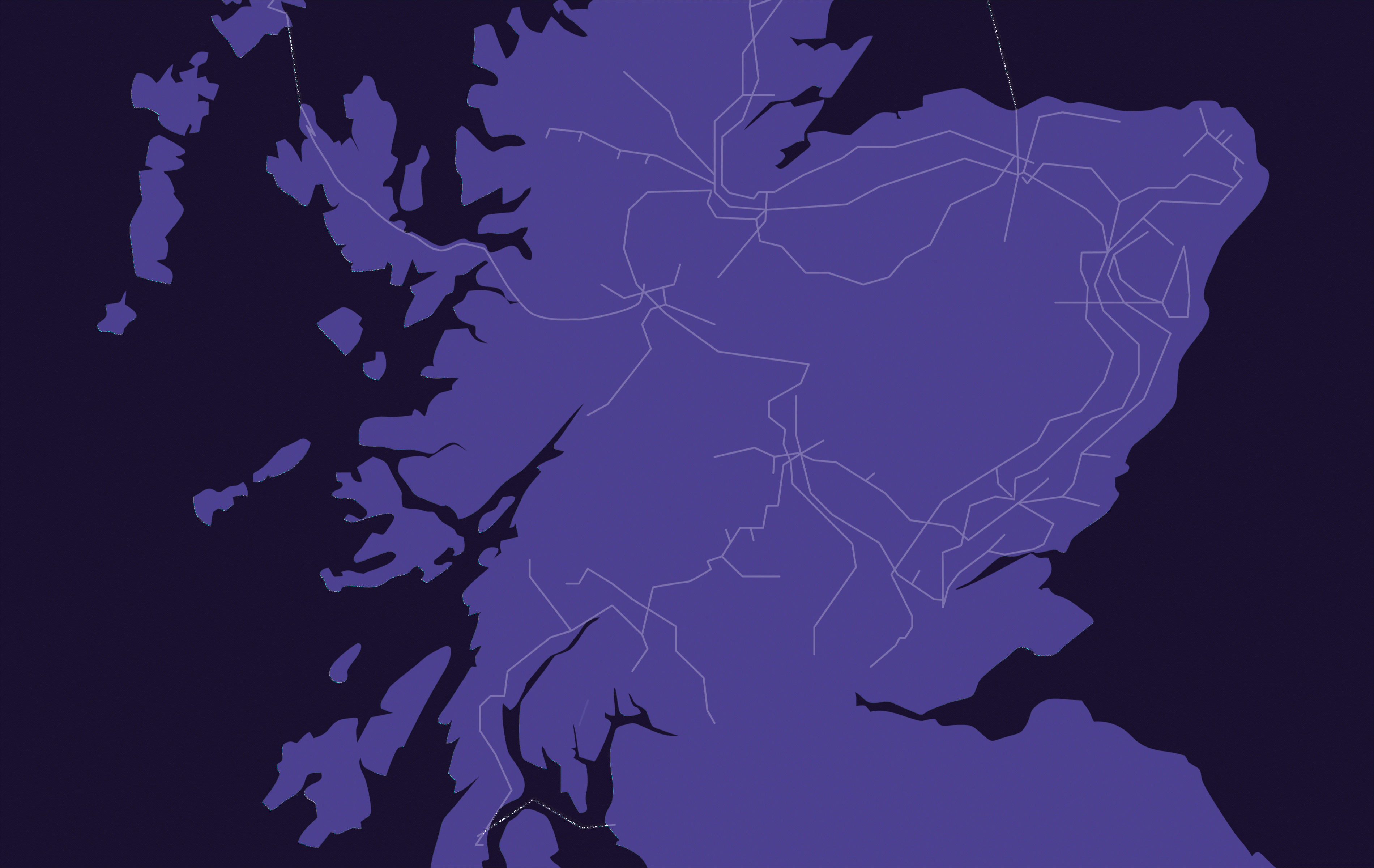
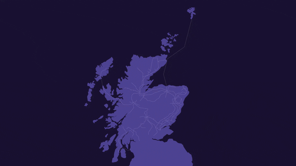
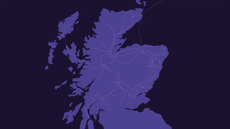
SSEN Transmission has made a Section 37 application to the Scottish Government’s Energy Consents Unit (ECU) for the Kintore – Tealing 400kV Overhead Line (OHL) Connection.
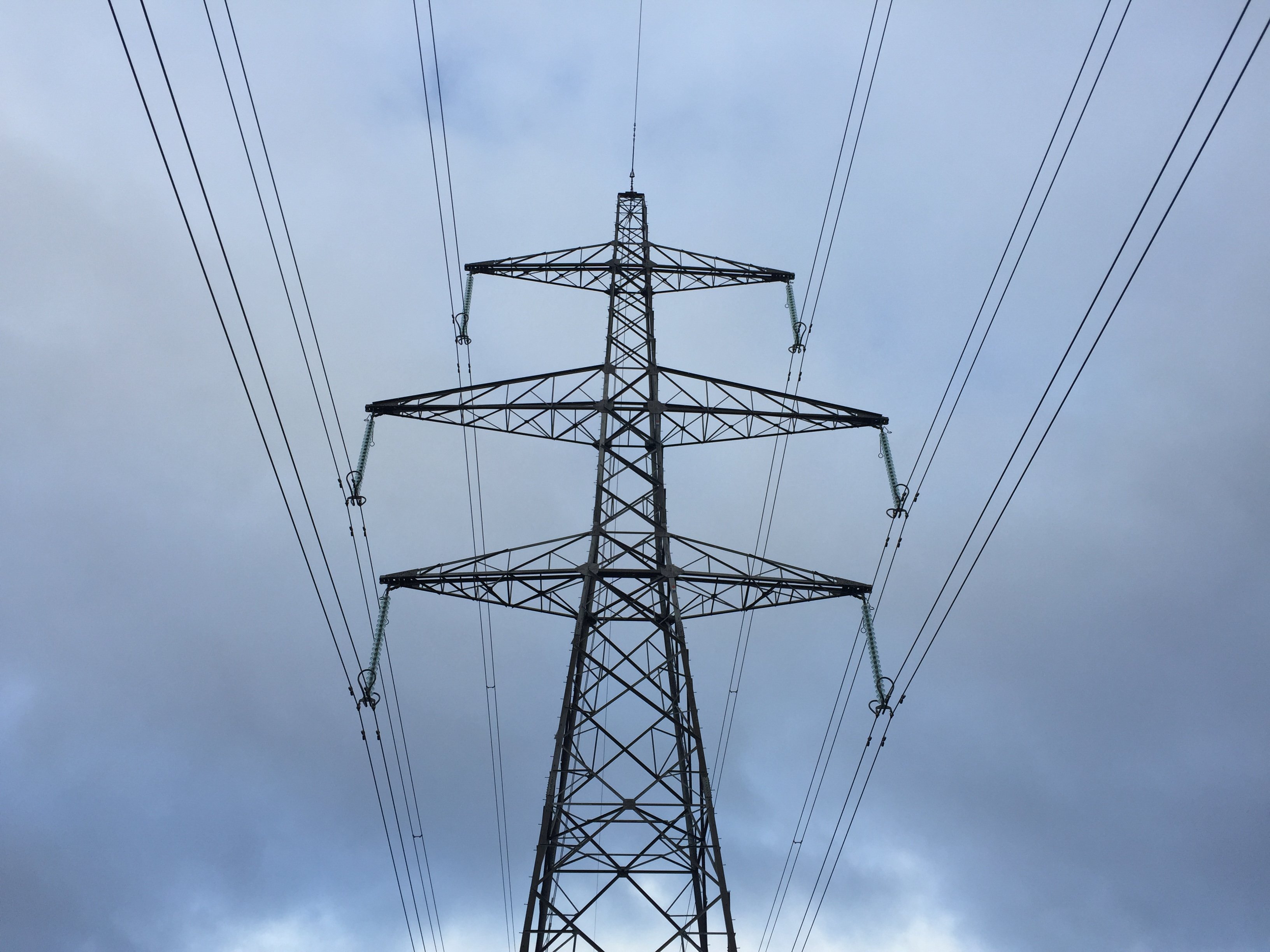
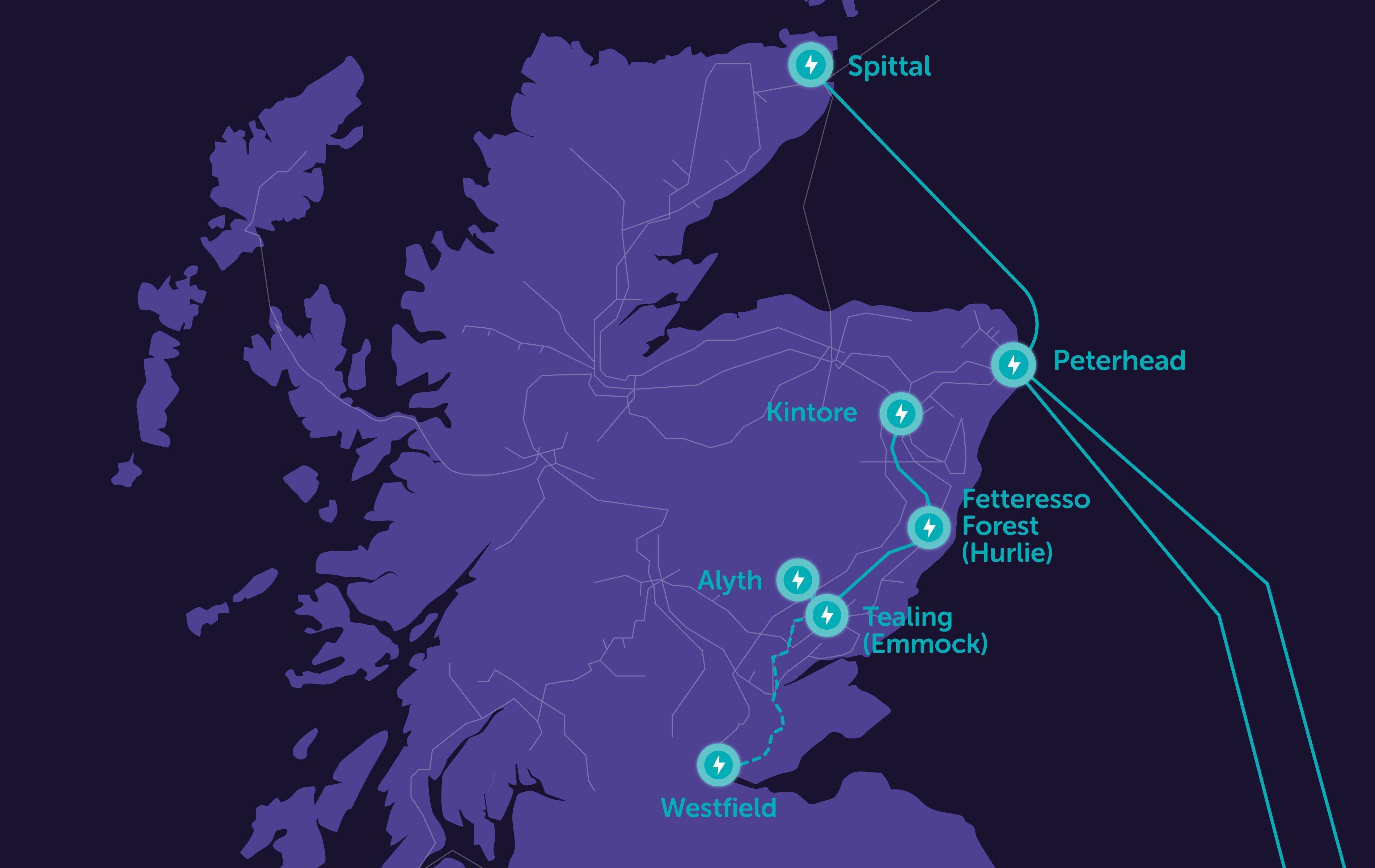
Under Section 37 of the Electricity Act 1989, the application is seeking consent for the installation, operation and maintenance of a new 400kV OHL connection, spanning an approximate length of 106km between Kintore in Aberdeenshire and Tealing in Angus.
The connection will be delivered via an overhead line of steel lattice towers (commonly referred to as pylons) likely to average around 57m in height.
This is split into two sections:
- Approximately 35km of OHL between the 400kV substation currently under construction at Kintore and the proposed new 400kV Hurlie substation.
- Approximately 72km of OHL between Hurlie and the proposed new 400kV Emmock substation.
Viewing the application:
If you wish to view the Section 37 application, you can do so on the Energy Consents Unit’s website: www.energyconsents.scot. The application reference is: ECU00005225.
All the documentation submitted as part of the application can also be viewed and downloaded via our dedicated project webpage.
A hard copy of the application including the Environmental Impact Assessment (EIA) Report and supporting documents will also be available to be viewed at the following locations:
Angus Council – Angus House, Culter Library, Fintry Library, Inverurie Library, Mearns Community Library, Stonehaven Library and Westhill Library.
To assist with further information, we have also produced some Frequently Asked Questions regarding our overhead line Section 37 consent application.
3D Visualisations Portal and Flythrough
To help provide an indication of what the overhead line may look like within the local setting, we've created a 3D visualisation portal. The portal can be accessed via the link below, where you can view various viewpoints from across the proposed development.
Visit the 3D Visualisation Portal
Specialist company 3DW have designed the following video to allow viewers to see what the proposed Kintore - Tealing 400kV connection project will look like when complete.
About the Project
In order to support the continued growth in onshore and offshore renewables across the north of Scotland, supporting the country's drive towards Net Zero, investment in network infrastructure is needed to connect this renewable power and transport it from source to areas of demand across the country.
Extensive studies have confirmed the need for a new 400kV connection between Kintore and Tealing, connecting into new 400kV substation sites at Fetteresso Forest known as Hurlie and at Tealing known as Emmock. The existing overhead line between Kintore and Tealing is currently operating at 275kV, and cannot be upgraded to 400kV as the conductors would not be able to achieve safe clearance distances due to the size of the towers. The project includes the following elements:
- A new 400kV connection between Kintore and Hurlie
- A new 400kV connection between Hurlie and Emmock
- New 400kV substations at Hurlie and Emmock
This is part of the East Coast 400kV projects, a scheme consisting of several onshore reinforcement projects on the east coast of Scotland.
Find out more about Hurlie 400kV substation
Find out more about Emmock 400kV substation
This video outlines how the project contributes to our role in delivering Net Zero.
Pathway to 2030
The Pathway to 2030, published by National Energy System Operator NESO, the electricity system operator for Great Britain, sets the blueprint for the electricity transmission network infrastructure required to enable the forecasted growth in renewable electricity across Great Britain.
The projects identified within the Pathway to 2030 are critical to delivering the UK and Scottish Government’s offshore wind targets. To deliver these targets, we are investing over £20bn to upgrade the network infrastructure across the north of Scotland as the region plays a leading role in the clean energy transition.
As part of this investment, there is a requirement for a new 400kV connection between Kintore and Tealing.
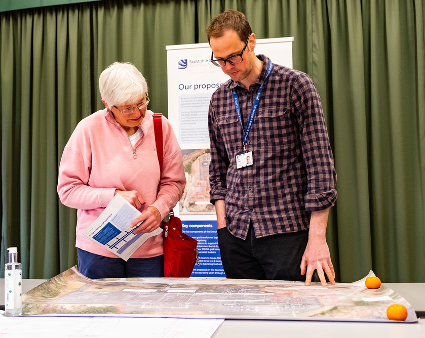
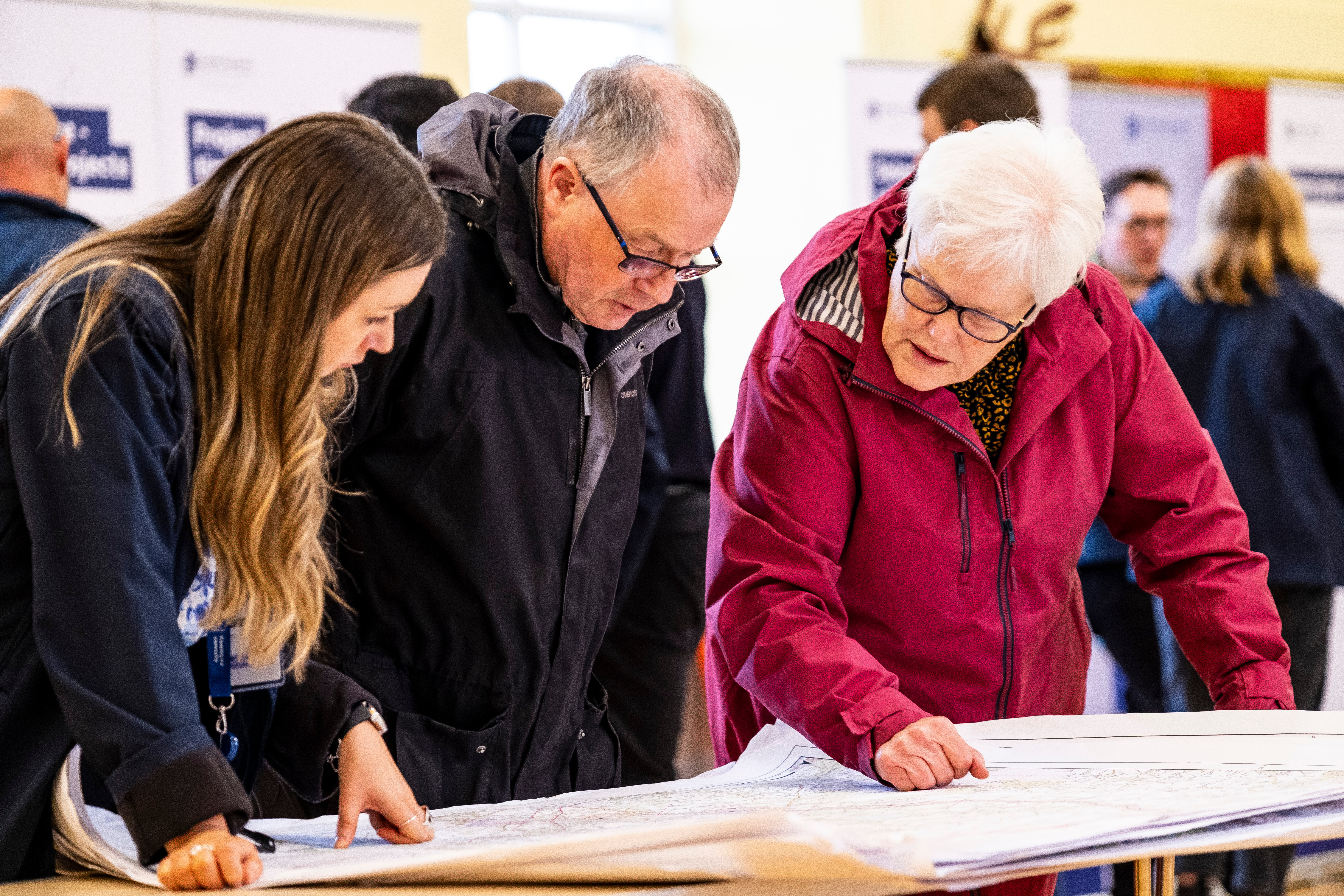
Stakeholder Engagement
In this video, Senior Project Manager Calum Grant describes the approach we are taking to develop our proposals and the opportunities that are available for stakeholders to feed into the design process. This process aims to progress towards an optimal site in a systematic manner, which is technically feasible, economically viable, and could be anticipated to cause the least disturbance to the environment and to those who live, work, and visit the area.
The East Coast 400kV Projects
The East Coast 400kV Projects are a scheme consisting of several onshore reinforcement projects on the east coast of Scotland, comprising new and upgrade of existing infrastructure. The majority of the infrastructure projects are within our operational area in the north of Scotland.
To provide the full 400kV capability that the scheme intends to deliver, there are several projects that contribute to the full scheme:
- An extension to Kintore 400kV substation (currently under construction)
-
A new 400kV substation within the vicinity of the existing Fettersso substation
-
A new 400kV substation within the vicinity of the existing Tealing substation
-
A new 400kV connection between Kintore, Fetteresso and Tealing
-
An upgrade to the existing Alyth - Tealing 275kV Overhead Line
-
An upgrade to the existing Tealing - Westfield 275kV Overhead Line (to the Scottish Power Transmission operational border)
-
Connection of the upgraded Alyth - Tealing and Tealing - Westfield Overhead Lines into the proposed Tealing Substation
Find out more about Kintore 400kV substation
Find out more about Hurlie 400kV substation
Find out more about Emmock 400kV substation
How we’re embracing artificial intelligence (AI)
We intend to use AI to assist our experienced teams in the analysis of your feedback, so we can categorise key points raised more quickly. You can learn more about how we’re utilising AI on this dedicated web page.
Project Updates
Project updates
-
SSEN Transmission has submitted Additional Information for the Section 37 application to the Scottish Government’s Energy Consents Unit (ECU) for the Kintore to Tealing 400kV Overhead Line (OHL) connection.
Following receipt of a request by the Energy Consents Unit on 19 January 2026 for Additional Information on Private Water Supplies (PWS), SSEN Transmission are now formally submitting the requested PWS information as Additional Information. We are also taking the opportunity to make voluntary updates and clarifications to the original 2025 Environmental Impact Assessment (EIA) Report. These cover a number of different chapters and appendices and a covering letter and erratum is provided detailing exactly which changes are being made.
These have been uploaded to the ‘Documents’ section of this project website.
-
SSEN Transmission has made a Section 37 application to the Scottish Government’s Energy Consents Unit (ECU) for the Emmock and Tealing Overhead Line (OHL) Tie-ins project
Under Section 37 of the Electricity Act 1989, the application is seeking consent for the diversion of short sections of the Alyth to Tealing (A-T OHL) and Tealing to Westfield (T-W OHL) 275kV OHLs, which currently connect at their eastern extent with the existing Tealing 275kV substation, to connect with the proposed Emmock 400kV substation.
Consent for this work has been applied for via a standalone Section 37 application under the Electricity Act 1989 to Scottish Ministers. Consent is also sought under the same application for the installation of two short sections of parallel OHL 'tiebacks' between Emmock substation and Tealing substation (one 275kV, one 400kV).
The project is essential to the completion of the Kintore to Tealing projects, as it would provide the tie-ins for the reconductored A-T OHL and T-W OHL to the proposed Emmock substation as part of the upgraded 400kV transmission infrastructure. This would allow power to keep flowing whilst the wider upgrade works are undertaken.
Viewing the application:
If you wish to view the Section 37 application, you can do so on the Energy Consents Unit’s website: www.energyconsents.scot. The application reference is: ECU00005204
All the documentation submitted as part of the application can also be viewed and downloaded via this page.
A hard copy of the application including the Environmental Impact Assessment (EIA) Report and supporting documents will also be available to be viewed at the following locations:
Forfar Library, Angus Mobile Library
-
SSEN Transmission has made a Section 37 application to the Scottish Government’s Energy Consents Unit (ECU) for the Kintore – Tealing 400kV Overhead Line (OHL) Connection.
Under Section 37 of the Electricity Act 1989, the application is seeking consent for the installation, operation and maintenance of a new 400kV OHL connection, spanning an approximate length of 106km between Kintore in Aberdeenshire and Tealing in Angus.
The connection will be delivered via an overhead line of steel lattice towers (commonly referred to as pylons) likely to average around 57m in height.
This is split into two sections:
- Approximately 35km of OHL between the 400kV substation currently under construction at Kintore and the proposed new 400kV Hurlie substation.
- Approximately 72km of OHL between Hurlie and the proposed new 400kV Emmock substation.
Viewing the application:
If you wish to view the Section 37 application, you can do so on the Energy Consents Unit’s website: www.energyconsents.scot. The application reference is: ECU00005225.
All the documentation submitted as part of the application can also be viewed and downloaded via our dedicated project webpage.
A hard copy of the application including the Environmental Impact Assessment (EIA) Report and supporting documents will also be available to be viewed at the following locations:
Angus Council – Angus House, Culter Library, Fintry Library, Inverurie Library, Mearns Community Library, Stonehaven Library and Westhill Library.
We have also provided additional copies at Kirriemuir Library and The Jenner Centre, Brechin.
To assist with further information and the opening times of the venues hosting copies of the EIA, we have also produced some Frequently Asked Questions regarding our overhead line Section 37 consent application.

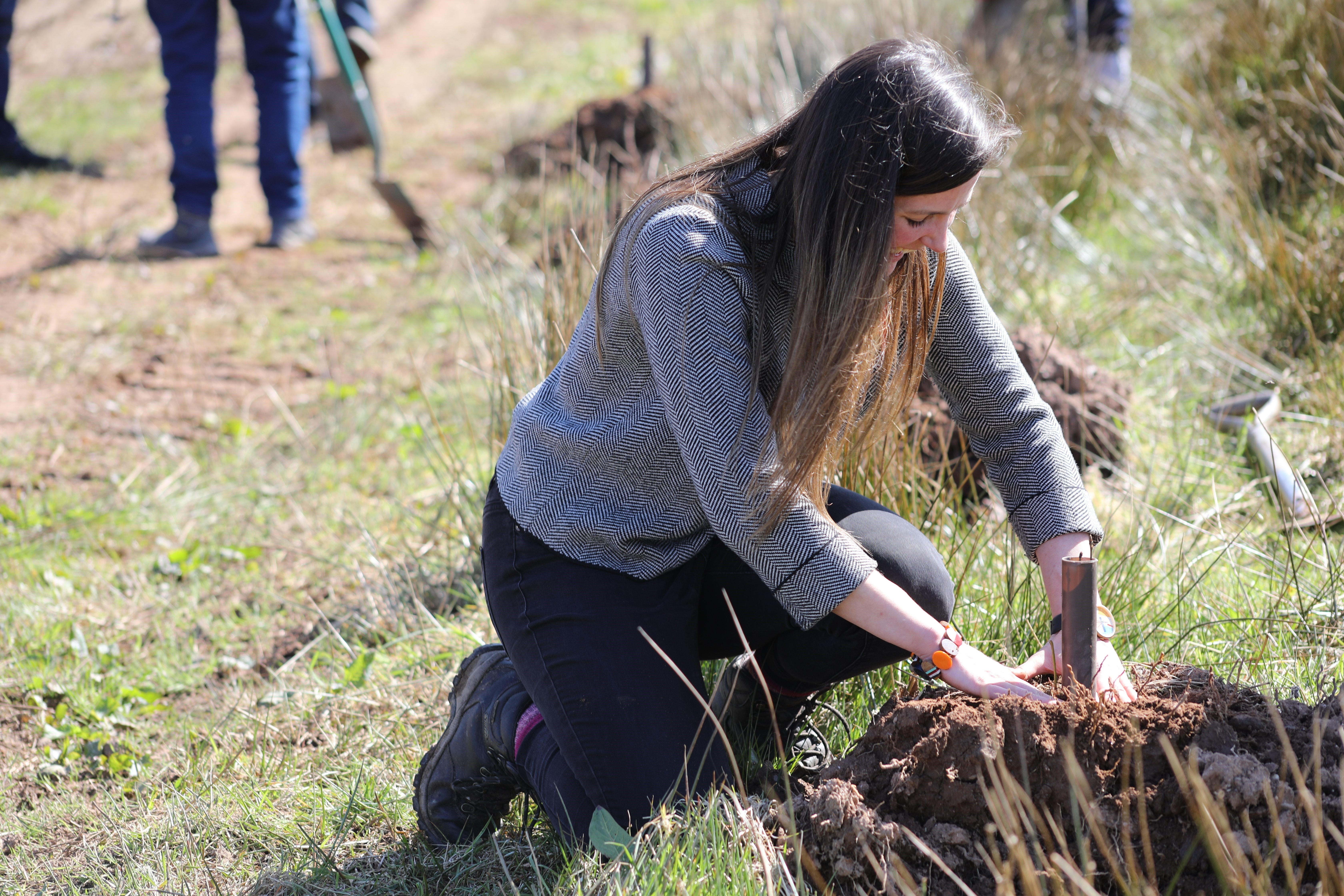
Volunteering in your local community
For many years, volunteering has been part of our commitment to giving back. At SSEN Transmission, we believe in being an active and supportive part of the communities we serve — especially across the north of Scotland where we operate and plan future projects.
Whether it’s planting trees, cleaning beaches, or helping out in community gardens, our teams are proud to lend their time and skills to local groups and charities. We’ve now launched a new Volunteering webpage to make it easier for communities to request support from us.
If you’re part of a local community group or charity that could benefit from a helping hand, we’d love to hear from you. Just complete our online ‘Volunteering Nomination Form’ found on our volunteering webpage. It only takes a couple of minutes to get started.
Please note, it may take us a little while to match volunteering requests with available teams. We really appreciate your patience as we get things moving and work to keep up with demand.
-
Advance notice of intention to submit section 37 (s37) application for the proposed Kintore – Tealing 400kV Overhead Line (OHL) Connection
In accordance with the Priority Applications for Transmission Infrastructure guidance: Section 37 of the Electricity Act 1989, SSEN Transmission has held the Procedural Gatecheck meeting with the Energy Consents Unit (ECU) and is issuing this notice to provide advance notice to the statutory consultees, relevant Planning Authorities, affected landowners and local stakeholders of the date the s37 application is to be made.
We intend to submit the s37 application for the Kintore – Tealing 400kV OHL Connection by 5 September 2025.
Next Steps:
Following s37 submission, the ECU will undertake a validation process to confirm the application is complete. This may take approximately one to two weeks. Upon confirmation the application is complete, SSEN Transmission will issue statutory public notices in National and Local Press in accordance with The Electricity Works (Environmental Impact Assessment) (Scotland) Regulations 2017. In addition, we shall notify our stakeholders and issue a wider general press release.
Alongside the statutory notifications, the s37 application will be available on the ECU Website Scottish Government - Energy Consents Unit, SSEN Transmission Project Website (ssen-transmission.co.uk/TKUP) and printed copies will be provided for members of the public to view at various locations along the length of the proposed overhead line. Details of the viewing locations will be provided in the public notices, within the s37 application, provided to stakeholders on our mailing list and available on our website.
SSEN Transmission will issue further communications, after validation, providing information on how representations can be made to Scottish Ministers.
Further information on the s37 submission process can be found here: 2. Background - Priority Applications for Transmission Infrastructure guidance: Section 37 of the Electricity Act 1989 - gov.scot
-
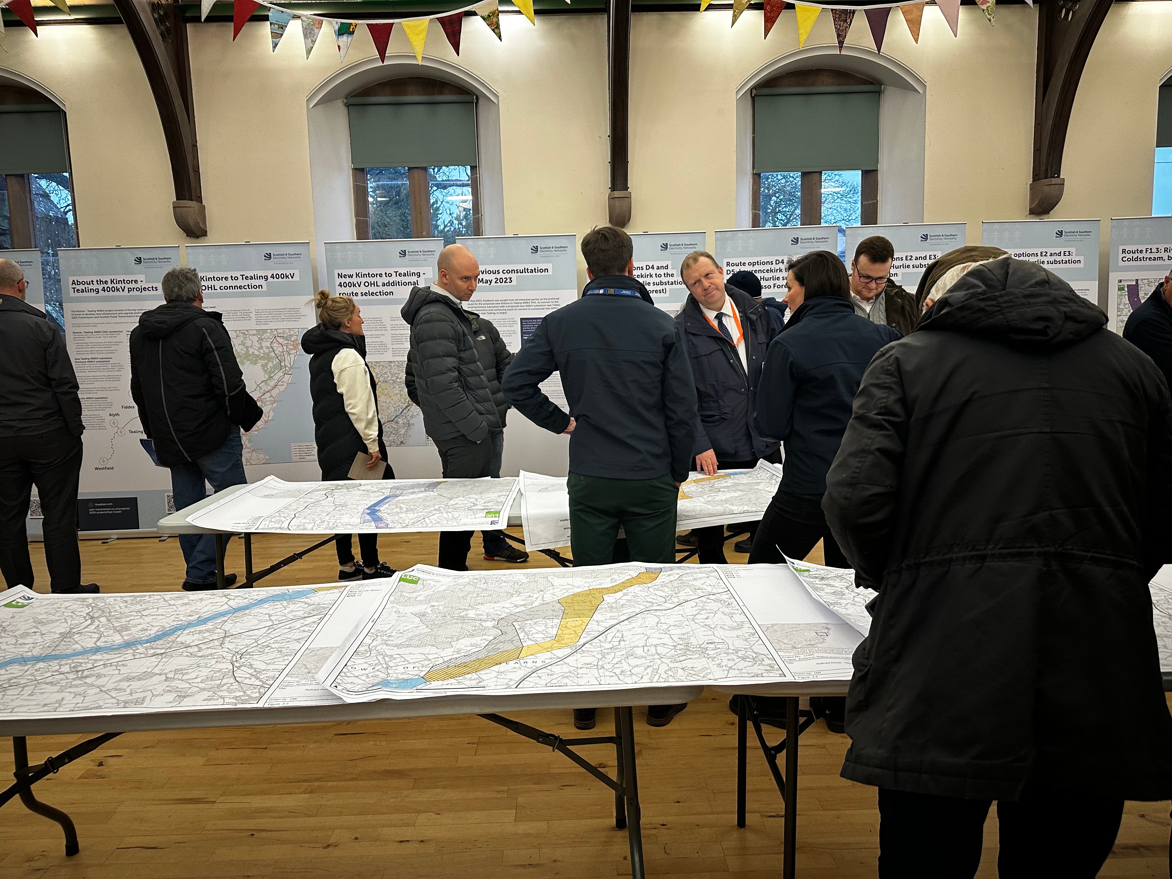
Kintore to Tealing 400kV OHL Section 37 submission update
Following public consultation events on the proposed alignment for our overhead line in February/March 2025, we received feedback from a wide range of stakeholders including, but not limited to local community members, landowners, local heritage groups, statutory consultees and developers.
Once again, we would like to thank all those who took the time to attend our in-person consultation events, read through our consultation materials and provided valuable feedback.
Previous timeline
Our intention, as communicated during the previous public consultation, was to submit our Section 37 planning application in late Spring 2025.
Updated timeline
Due to further consideration of feedback from the final round of consultation earlier in the year and compiling the extensive Environmental Impact Assessment Report which will accompany our consent submission, we will now look to submit our Section 37 planning application in Summer 2025.
We will update interested parties on the submission date closer to the time and we will publicise when the application is live and how and where interested parties can give their views.
Any comments made to us as the Applicant are not representations to Scottish Ministers as the decision makers. There will be opportunity to make formal representations to Scottish Ministers via the Energy Consents Unit following the submission of the Section 37 application in Summer 2025.
-
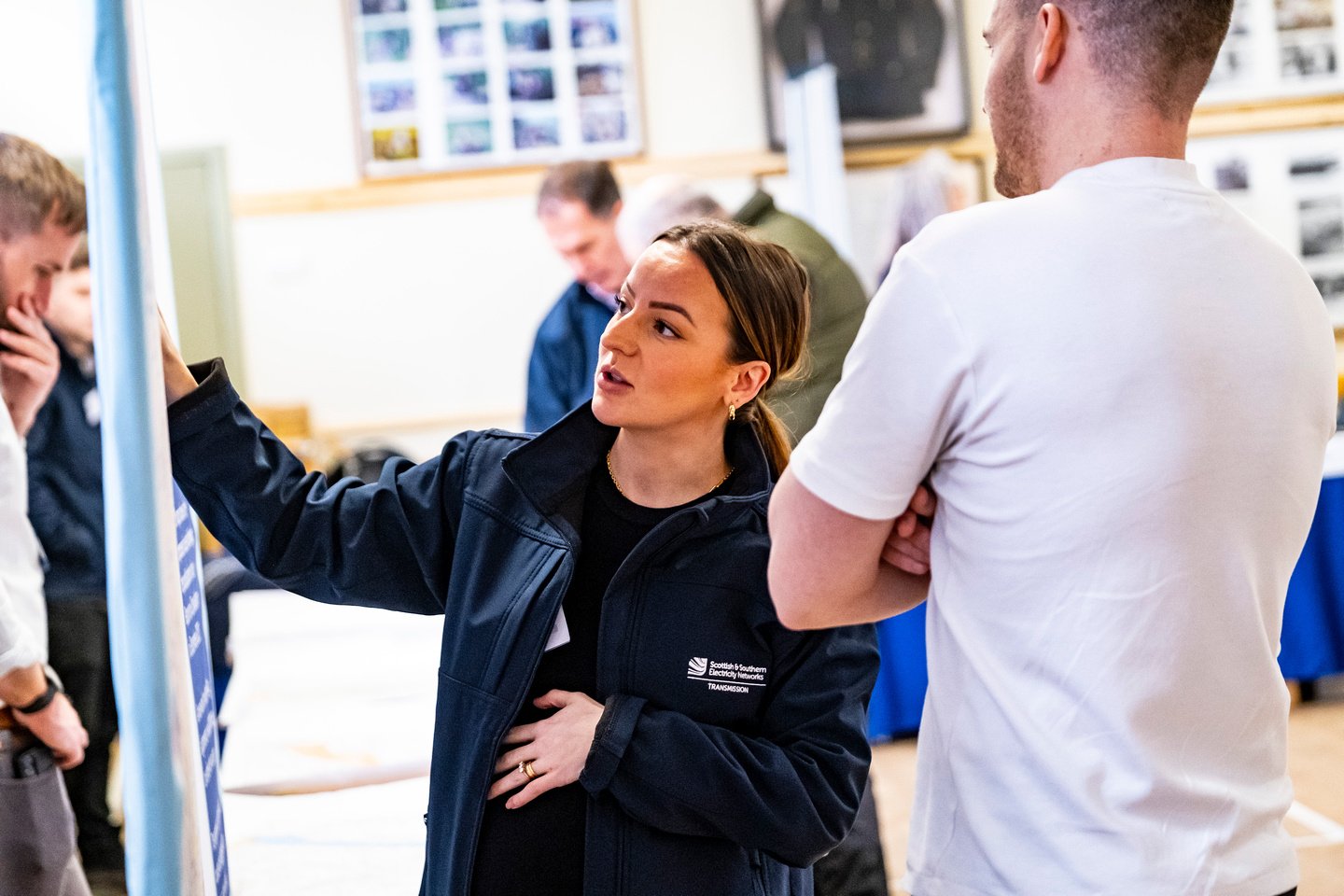
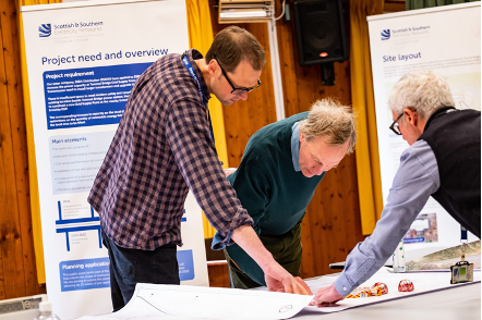
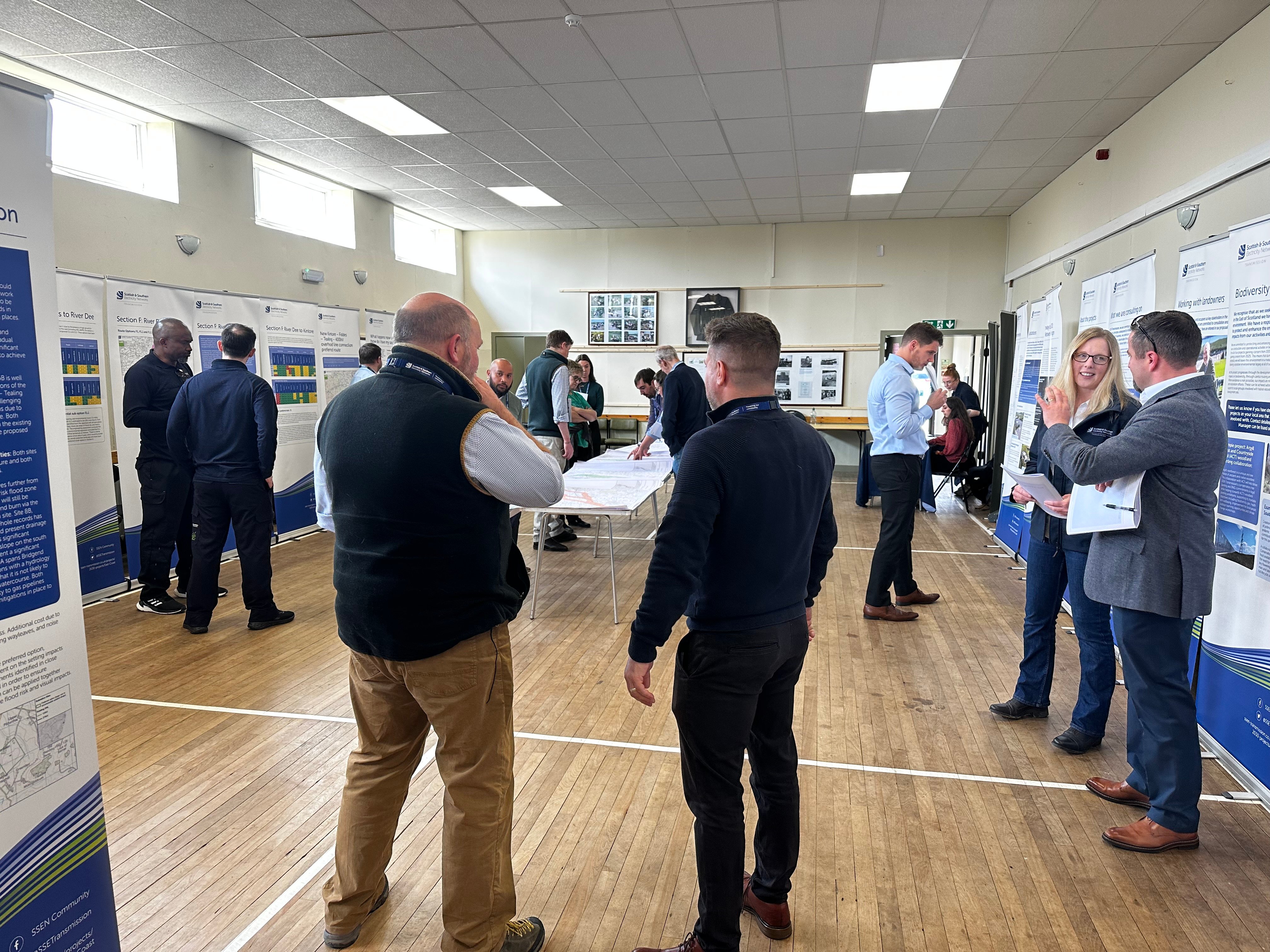
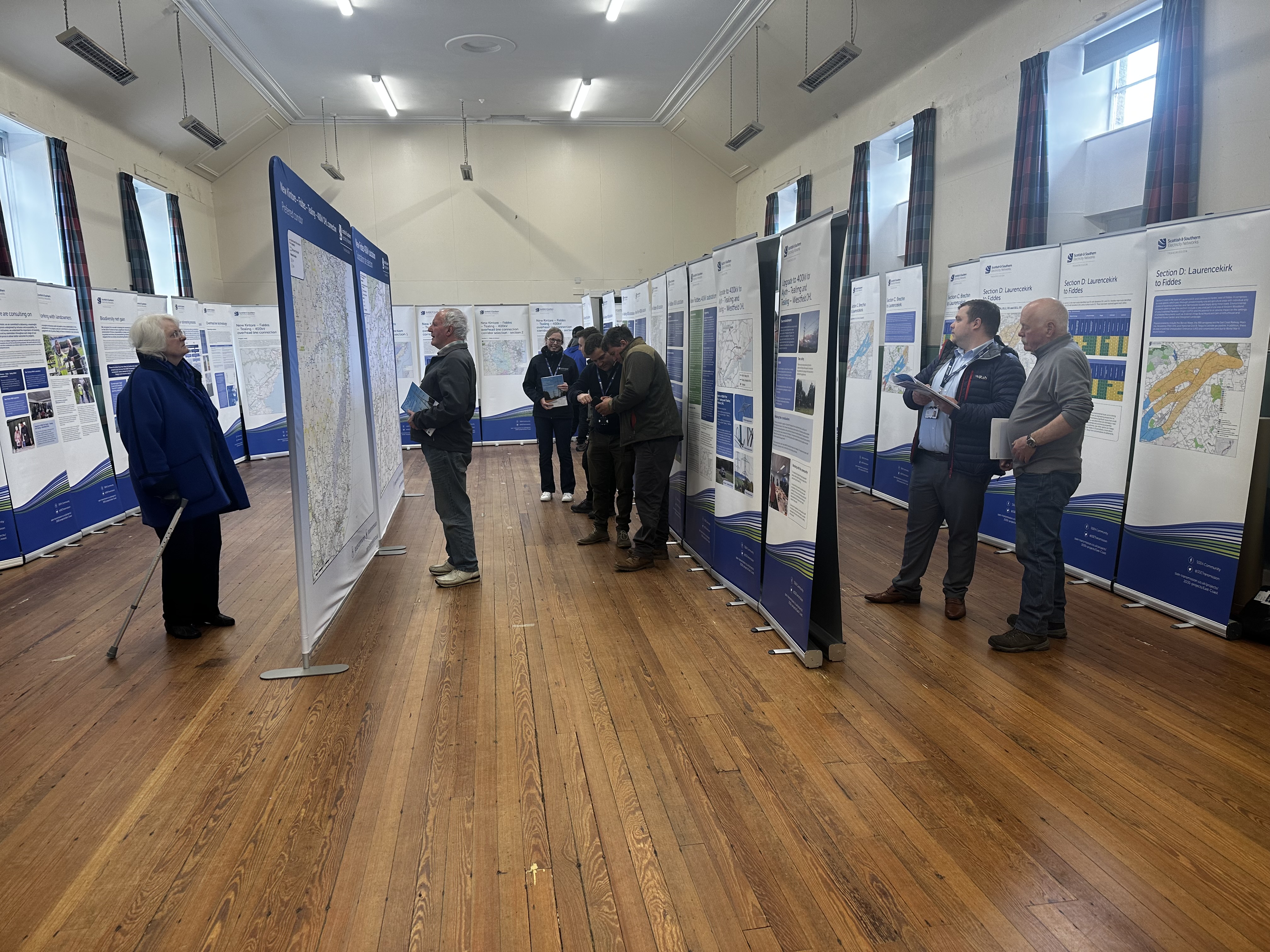
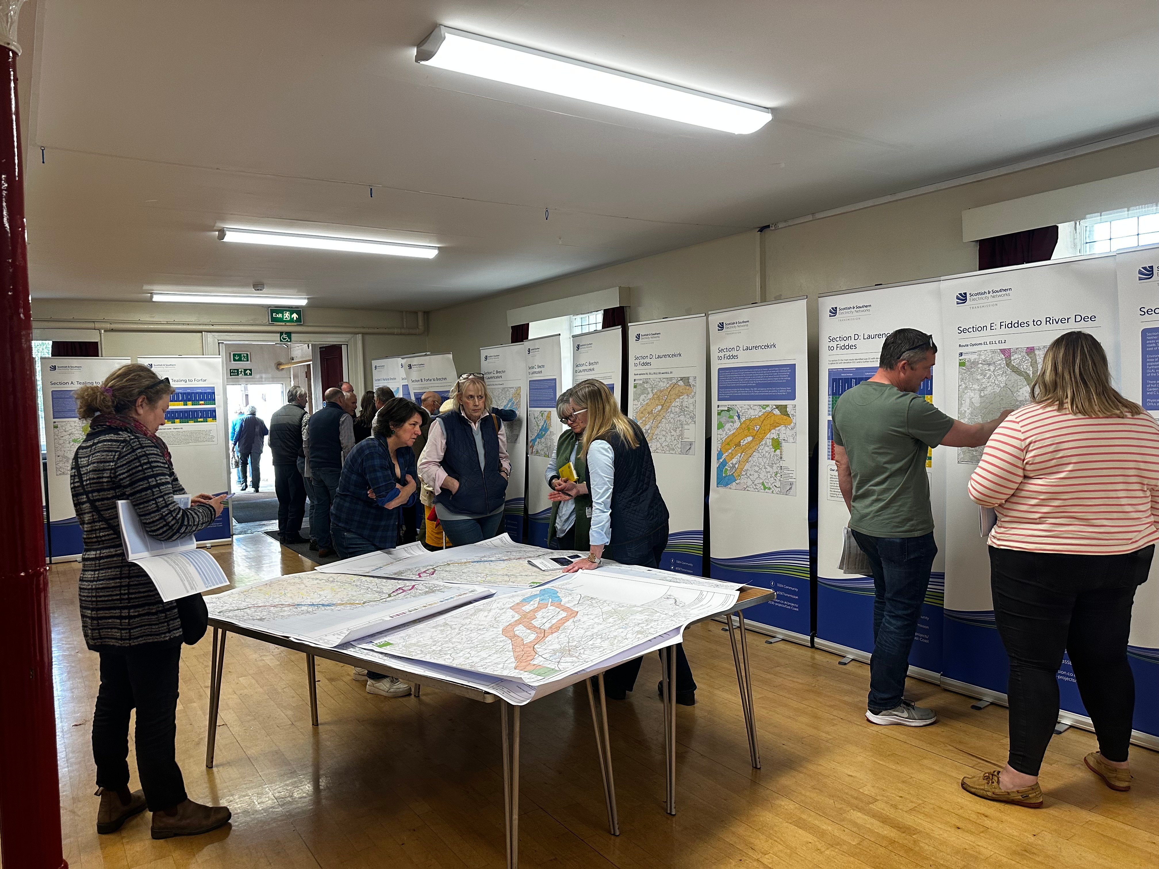
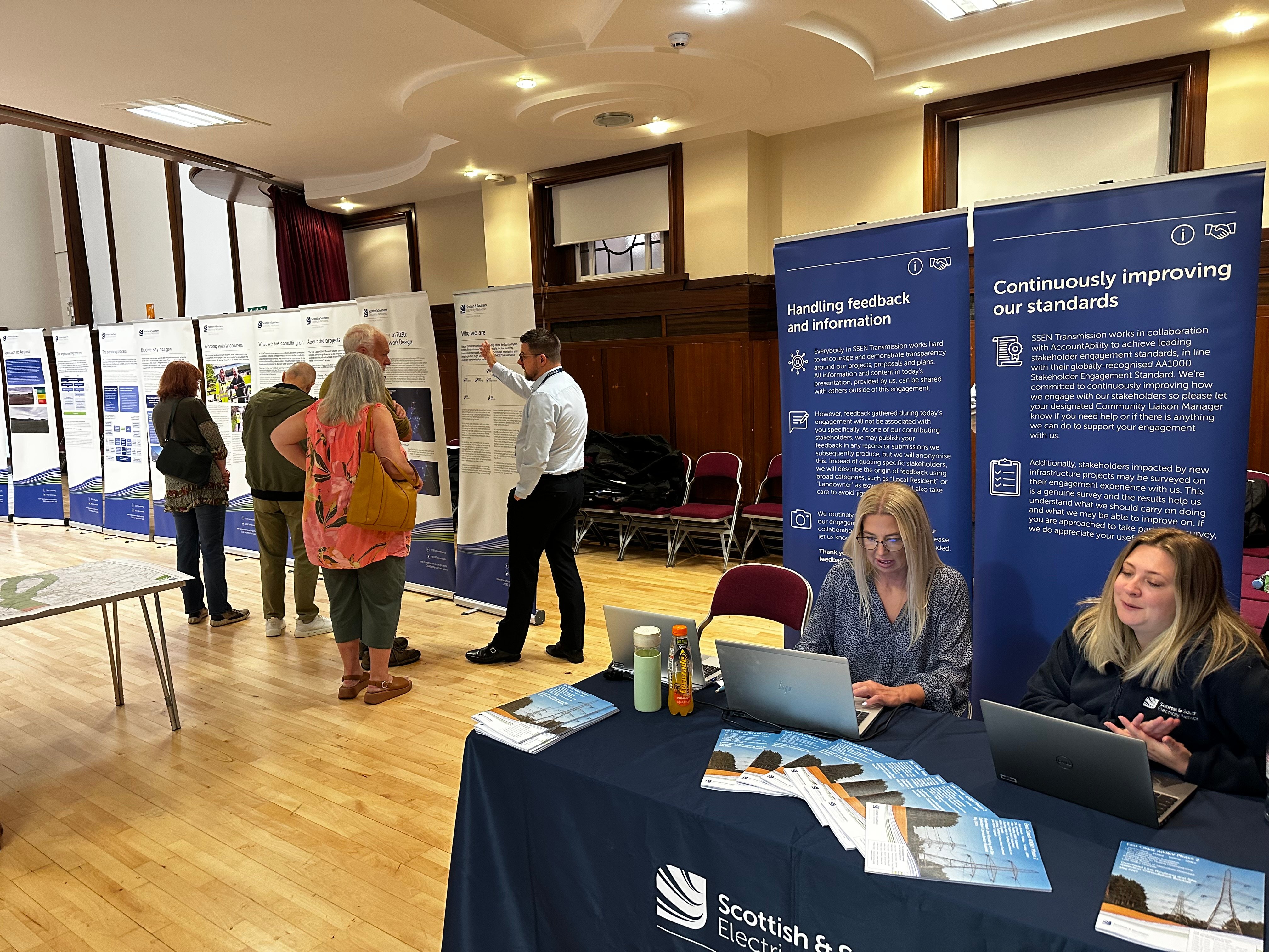
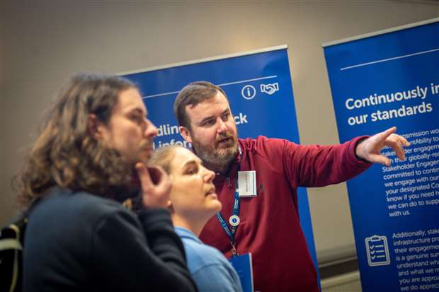
SSEN Transmission thanks you for your engagement at our recent series of public consultation events
We would like to thank all members of the public, local stakeholders and other interested parties who took the time to attend our recent public consultation events which took place between 24 February – 13 March 2025, with 11 in person events covering the Kintore-Tealing 400kV overhead line project.
Our feedback period closed on Friday 28 March 2025 where we welcomed comments regarding our proposed alignment that was presented during the events. Although the formal feedback period has closed, we continue to welcome comments on how we can engage with you during the next phase of the project, you can provide this by getting in touch with us through either of the below methods;
Email: tkup@sse.com
Post: SSEN Transmission, 200 Dunkeld Road, Perth PH1 3GHOur interactive consultation portal and fly through video will remain available. This allows you to view and access photosphere visualisations as well as viewing a flyover video of the whole proposed overhead line.
All of the material that was on display at our events is available to download via the project ‘Documents’ section of this project website. Please let us know if you require information in an adapted format such as paper copy, large print or braille and we will work with you to accommodate your preferences. We are happy to accommodate all reasonable requests for adapted communications.
We plan to submit our section 37 application to the Energy Consents Unit (ECU) in late spring, at which time we will send out notification of the submission for you to view this on the ECU portal. Any comments made to us as the Applicant are not representations to Scottish Ministers as the decision makers. There will be opportunity to make formal representations to Scottish Ministers via the Energy Consents Unit following the submission of the section 37 application.
We are currently working through a large volume of enquiries. We appreciate your patience as the team endeavours to answer these as quickly as we can.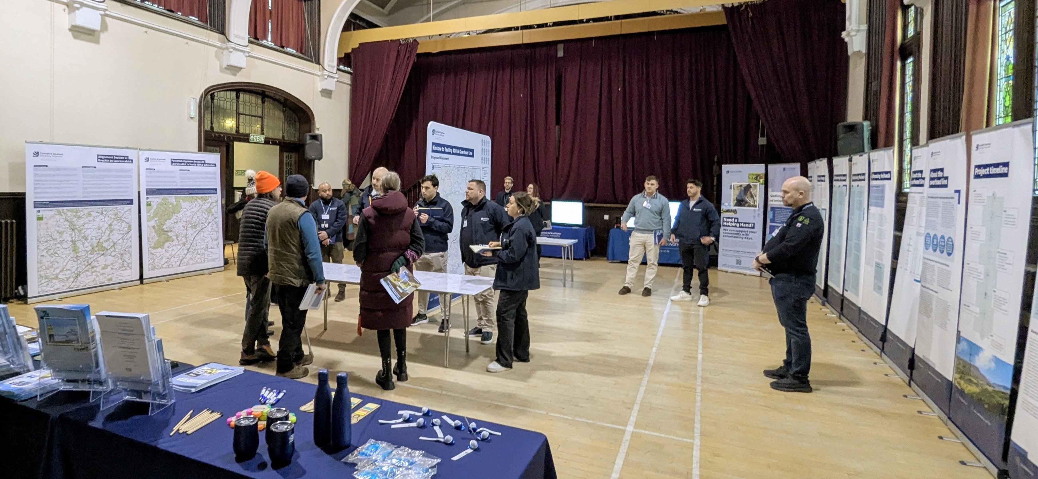
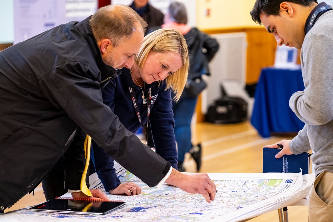
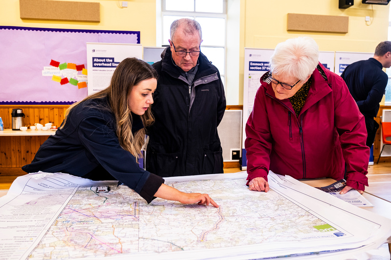
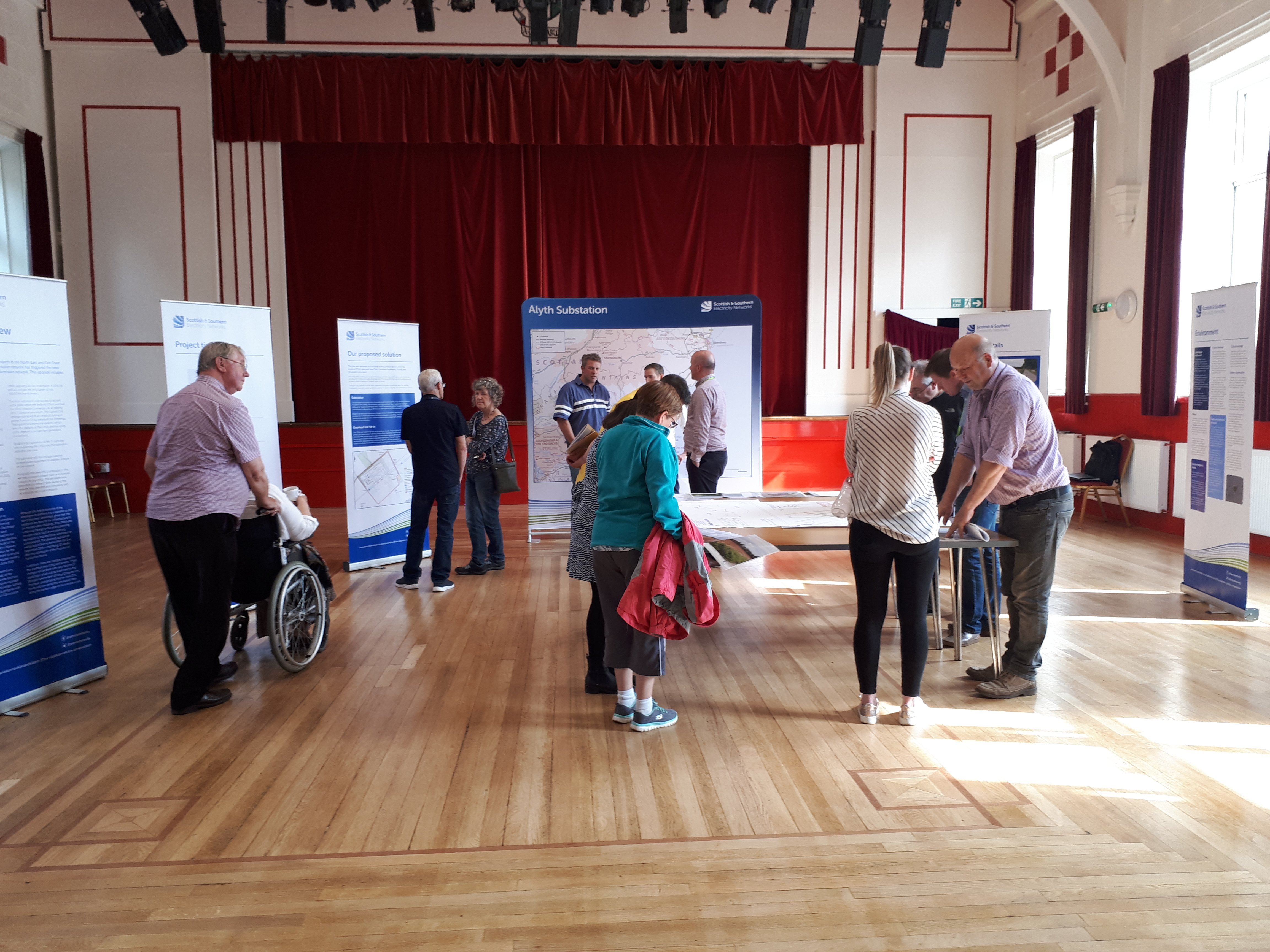
February/March 2025 Public Consultation Feedback Events
We would like to thank all local community members and stakeholders who took the time to attend our recent February/March 2025 public consultation feedback events which took place between 24 February – 13 March 2025 with 11 in person events covering the Kintore-Tealing 400kV connection project.
Our feedback period on the proposed alignment remains open until 28 March 2025. We welcome everyone to submit their feedback regarding the proposed alignment presented during the events and welcome comments on how we can engage with you during the next phase of the project via any of the below methods;
Online: Feedback form
Email: tkup@sse.com
Post: SSEN Transmission, 200 Dunkeld Road, Perth, PH1 3GH
Our interactive consultation portal and fly through will remain available throughout the feedback period, you can access this here. This allows you to view and access photosphere visualisations of the overhead line. You can also access the online feedback from direct via the portal.
All of the material that was on display at our events is available in ‘Documents’. Please let us know if you require information in an adapted format such as paper copy, large print or braille and we will work with you to accommodate your preferences. We are happy to accommodate all reasonable requests for adapted communications.
Any comments made to us as the Applicant are not representations to Scottish Ministers as the decision makers. There will be opportunity to make formal representations to Scottish Ministers via the Energy Consents Unit following the submission of the section 37 application in Spring 2025.
-
We're here to lend a helping hand
We are committed to supporting the communities in the north of Scotland where we operate, both now and in the future. As part of our ongoing efforts to make a difference and have a positive impact on local communities, we are proud to offer volunteering days to local groups and charities, particularly in the areas that host our electricity infrastructure or where our proposed projects are located.
This month, we’re excited to announce the launch of our new Volunteering Webpage, designed to make it easier for local communities to request volunteering support from us. To request our help, simply complete the ‘Volunteering Nomination Form’ linked at the bottom of our new webpage. Please note, as our team works on a voluntary basis, it may take us some time to coordinate our people and match them with opportunities. We kindly ask for your patience as we work to keep up with volunteering demand.
Thank you for considering SSEN Transmission as a partner in your community efforts. Together, we can leave a positive, lasting legacy and help transform communities across the north of Scotland.
February March 2025 feedback period is now open
We are pleased to announce the commencement of the final period of public feedback on the project.
We are hosting these events to present the Proposed Alignment for the overhead line and our responses to feedback received at the last round of consultation events in September and October 2024.
We will be sharing our proposed alignment for the overhead line, presented through maps and visualisations.
Interested parties can attend our drop-in events to discuss our plans with the project team and share views.
We would encourage members of the local community and all interested parties to attend the events.
If you are unable to attend any of the planned in-person events, all the material that will be on display can also be downloaded from the documents section of this dedicated project website.
At this final stage of development, we are not seeking comment or feedback on further refinement to the proposed alignment but welcome comments on how we can engage with you during the next phase of the project. You can submit this until 28 March 2025 via the feedback form on the project website, by emailing tkup@sse.com or writing to us at SSEN Transmission, 200 Dunkeld Rd, Perth, PH1 3GH.
Following the previous rounds of consultation events, we have compiled ‘Frequently Asked Questions’ to address many of these points which can be viewed here. -

Alignment Report on Consultation Publication
SSEN Transmission has today published its final Report on Consultation (ROC) for a proposed new 400kV overhead line running from Kintore to Tealing.
The ROC provides a summary of the feedback received in response to the potential and alternative alignment proposals for the overhead line presented at the public consultations we undertook in September and October last year, how this has been considered, and confirmation of the alignment option intended to be taken forward as the Proposed Alignment in our consent application. The ROC is now available to download from the Documents tab of this website as well as a summary report.
The dates and venues for the upcoming February and March public feedback events can be found on our events page.
We would once again like to thank all stakeholders who took the time to engage with our consultation process.Hard copies will be available during our upcoming public feedback events, and copies left accessible in local village halls where permitted.
February / March 2025 Public Consultation Feedback Events Dates
We are pleased to be hosting the next series of public events across the project route from 24 February until 13 March 2025.
We will be sharing our final proposed alignment for the overhead line, presented through maps and visualisations.
Interested parties can attend our drop-in events to discuss our plans with the project team and share views.
We would encourage members of the local community and all interested parties to attend the events.
The open-door drop-in face to face consultations will be held at the following locations;
Monday 24 February, 2-7pm at Kintore Public Hall, 12 School Road, Kintore, AB51 0UX
Tuesday 25 February, 2-7pm at Echt Hall, Echt, Westhill, AB32 6UL
Wednesday 26 February, 2-7pm at Drumoak, Durris & Crathes Bowling Club, Sunnyside Avenue, Drumoak, AB31 5EF
Thursday 27 February, 2-7pm at Durris Kirkton Hall, Kirkton of Durris, Banchory, AB31 6BP
Monday 3 March, 2-7pm at Drumlithie Village Hall, Station Road, Drumlithie, AB39 3YT
Tuesday 4 March, 1-6pm at Inglis Memorial Hall, High St, Edzell, Brechin DD9 7TF
Wednesday 5 March, 2-7pm at Dickson Memorial Hall, Station Road, Laurencekirk, AB30 1BE
Monday 10 March, 2-7pm at Menmuir Hall, Brechin, DD9 7RN
Tuesday 11 March, 2-7pm at Memus Community Hall, Memus, Forfar, DD8 3TY
Wednesday 12 March, 2-7pm at Forfar Reid Hall, Castle Street, Forfar, DD8 3HX
Thursday 13 March, 2-7pm at Tealing Village Hall, Hall Road, Inveraldie, Tealing, DD4 0QW
We will be publishing our Report on Consultation shortly which documents the last round of the consultation process undertaken in September and October 2024. The Report will confirm the final overhead line alignment being taken forward for planning consent and development. We will update you when this has been published. -
September October 2024 feedback period now closed
We would like to extend thanks to all members of the public, local stakeholders and other interested parties who took the time to provide feedback on our proposals for the Kintore to Tealing 400kV overhead line project.
The feedback period for providing comments following our consultations that we held in September and October 2024 has now closed. All responses received are being reviewed by the project team.
Although the formal consultation period has closed for the latest events that we held, engagement with affected communities and wider stakeholders will continue beyond the consultation deadline and we will continue to engage with all stakeholders. -
WATCH: View SSEN Transmission’s webinar called ‘Overground, underground, or subsea - how decisions are made on where electricity transmission lines go’
This week SSEN Transmission hosted a webinar to outline the differences behind technology options which will help transform the electricity grid in the north of Scotland in the journey to net zero.
The webinar, titled ‘Overground, underground, or subsea - how decisions are made on where electricity transmission lines go’, explore topics such as the comparison between the different transmission technologies and the complexities and challenges that come with transporting the huge amount of renewable energy being generated across the country to where it is needed.
Watch the full webinar within News and Views. Video length is approximately 1 hour 25 minutes.
September/October 2024 Public Consultations
We would like to thank all local community members and stakeholders who took the time to attend our recent September/October 2024 public consultation events which took place between 23 September – 10 October 2024 with 12 in person events covering the Kintore-Tealing 400kV connection project.
Our feedback period on the potential alignment and alternative alignment options remains open until 21 November 2024. We welcome everyone to submit their feedback regarding the alignment proposals presented during consultation via any of the below methods;
Online: Feedback form
Email: tkup@sse.com
Post: SSEN Transmission, 200 Dunkeld Road, Perth, PH1 3GH
Our interactive consultation portal and fly through will remain available throughout the feedback period, you can access this here. This allows you to view and access photosphere visualisations of the overhead line. You can also access the online feedback from direct via the portal.
All of the material that was on display at all of our consultation events is available to download via the project ‘Documents’ section of this project website. Please let us know if you require information in an adapted format such as paper copy, large print or braille and we will work with you to accommodate your preferences. We are happy to accommodate all reasonable requests for adapted communications.
Any comments made to us as the Applicant are not representations to Scottish Ministers as the decision makers. There will be opportunity to make formal representations to Scottish Ministers via the Energy Consents Unit following the submission of the section 37 application.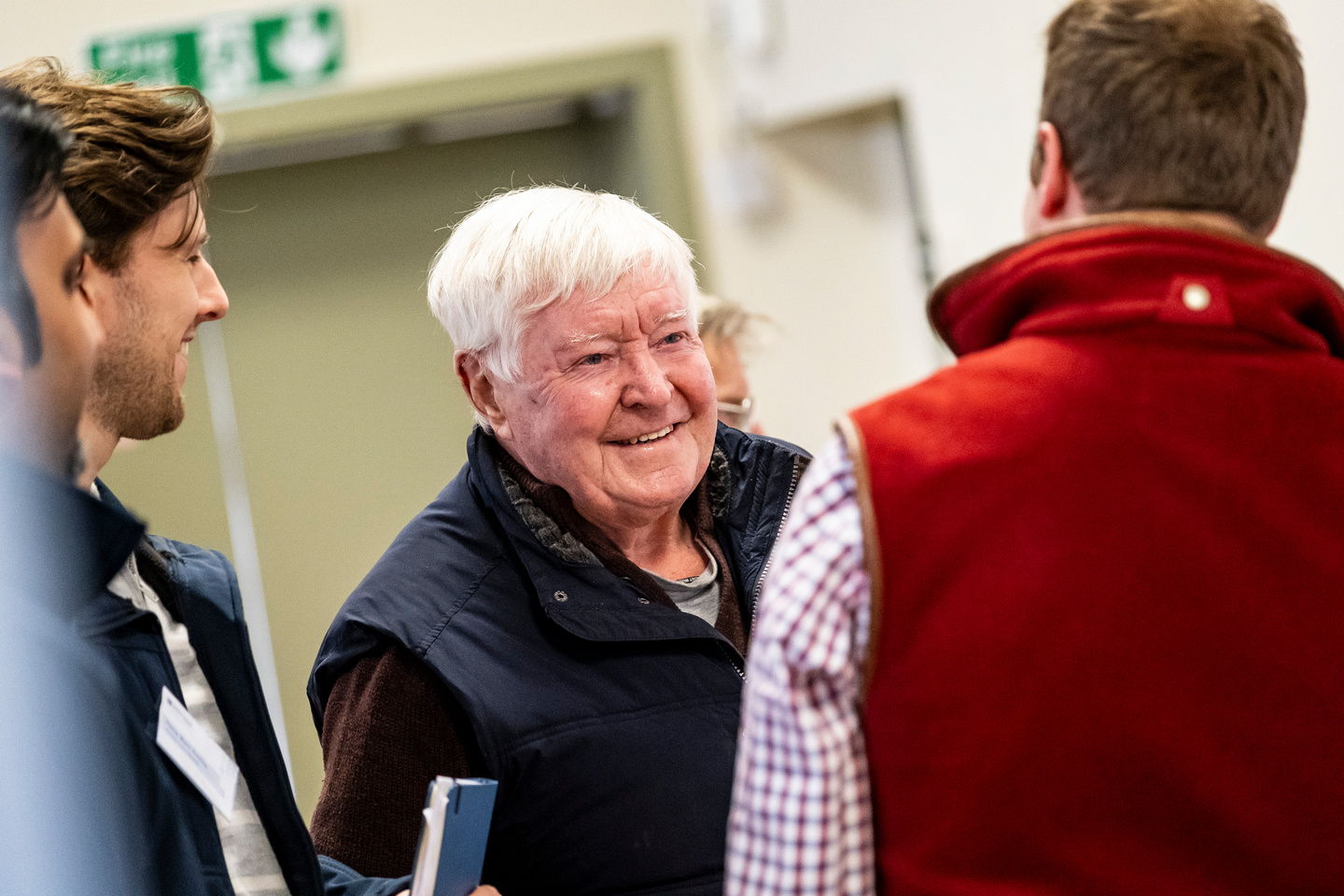
Consultation Portal and Fly Through
We have created an interactive consultation portal where you can view and access photosphere visualisations of the overhead line, this can be accessed here.
Specialist company 3DW have designed the following video to allow viewers to see what the proposed Kintore - Tealing 400kV connection project will look like when complete. -
September October 2024 public consultation period is now open
We are pleased to announce the commencement of the next period of public consultation.
The consultation consists of:
· Formal consultation for newly proposed potential and alternative OHL alignments
We will be sharing our potential alignment for the overhead line, with alternative alignment options in some locations, presented through maps and visualisations.
Interested parties can attend our drop-in events to discuss our plans with the project team and share views.
We would encourage members of the local community and all interested parties to attend the events.If you are unable to attend any of the planned in-person events, all the material that will be on display can also be downloaded from the project documents section of this dedicated project website.
You can submit your feedback until 21 November 2024 for the alignment consultation via the feedback form on the project website, by emailing tkup@sse.com or writing to us at SSEN Transmission, 200 Dunkeld Rd, Perth, PH1 3GH.
Following the events held in March 2024, many enquiries we received were about the need for the project, the engagement process, environmental considerations, and what alternative technologies may be available. We have compiled ‘Frequently Asked Questions’ to address many of these points which can be viewed here.
Consultation Portal
We have created an interactive consultation portal where you can view and access photosphere visualisations of the overhead line, this can be accessed here. -
August 2024 Report on Consultation
We have today published our report on the public consultation we undertook in March and April 2024 on the proposed Kintore to Tealing 400kV overhead line. This ‘Report on Consultation’ confirms the overhead line routes that are now being taken forward to the next stage of development and includes community and landowner proposals around Careston, Drumoak and Echt.
These stakeholder-led proposals are now being progressed in parallel with other overhead line route options that were consulted on in March and April 2024. Potential overhead line alignments along the full Kintore-Tealing route are being finalised ahead of the next round of public consultations which are scheduled to take place in September and October.
The Report on Consultation is now available to download from the Documents tab of this website as well as a summary report.
The dates and venues for the September and October public consultations can be found on our events page.
We would once again like to thank all stakeholders who took the time to engage with our consultation process.
September / October 2024 Public Consultations
We are pleased to be hosting the next series of public events across the project route from 23 September until 10 October 2024.
We will be sharing our potential alignment for the overhead line, with alternative alignment options in some locations, presented through maps and visualisations.
Interested parties can attend our drop-in events to discuss our plans with the project team and share views.
We would encourage members of the local community and all interested parties to attend the events.
The open-door drop-in face to face consultations will be held at the following locations;
Monday 23 September, 1.30-6.30pm at Tealing Village Hall, Hall Road, Inveraldie, Tealing, DD4 0QW
Tuesday 24 September, 2-7pm at Wallace Suite, Royal Hotel, 33 Castle Street, Forfar, DD8 3AE
Wednesday 25 September, 2-7pm at Memus Community Hall, Memus, Forfar, DD8 3TY
Thursday 26 September, 2-7pm at Brechin City Hall, 9 Swan Street, Brechin, DD9 6EE
Monday 30 September, 2-7pm at Menmuir Hall, Brechin, DD9 7RN
Tuesday 1 October, 1.30-6.30pm at Kintore Public Hall, 12 School Road, Kintore, AB51 0UX
Wednesday 2 October, 2-7pm at Echt Hall, Echt, Westhill, AB32 6UL
Thursday 3 October, 2-7pm at Drumoak, Durris & Crathes Bowling Club, Sunnyside Avenue, Drumoak, AB31 5EF
Monday 7 October, 2-7pm at Drumlithie Village Hall, Station Road, Drumlithie, AB39 3YT
Tuesday 8 October, 2-7pm at Stonehaven Town Hall, Allardice Street, Stonehaven, AB39 2BU
Wednesday 9 October, 2-7pm at Dickson Memorial Hall, Station Road, Laurencekirk, AB30 1BE
Thursday 10 October, 2-7pm at Durris Kirkton Hall, Kirkton of Durris, Banchory, AB31 6BP -
SSEN Transmission commits to consider community and landowner proposed alignments on Kintore-Tealing 400kV project
Following the recent consultation on the Kintore-Tealing 400kV overhead line project, SSEN Transmission can confirm it is actively considering overhead line alignments proposed by community representatives and landowners.
These alignments - which will be assessed in parallel with other alignment options within the refined routes we recently consulted on - are around Careston, Drumoak and Echt. To ensure all viable alignments are fully assessed, overhead line alignment consultation will now take place later in the year than previously planned.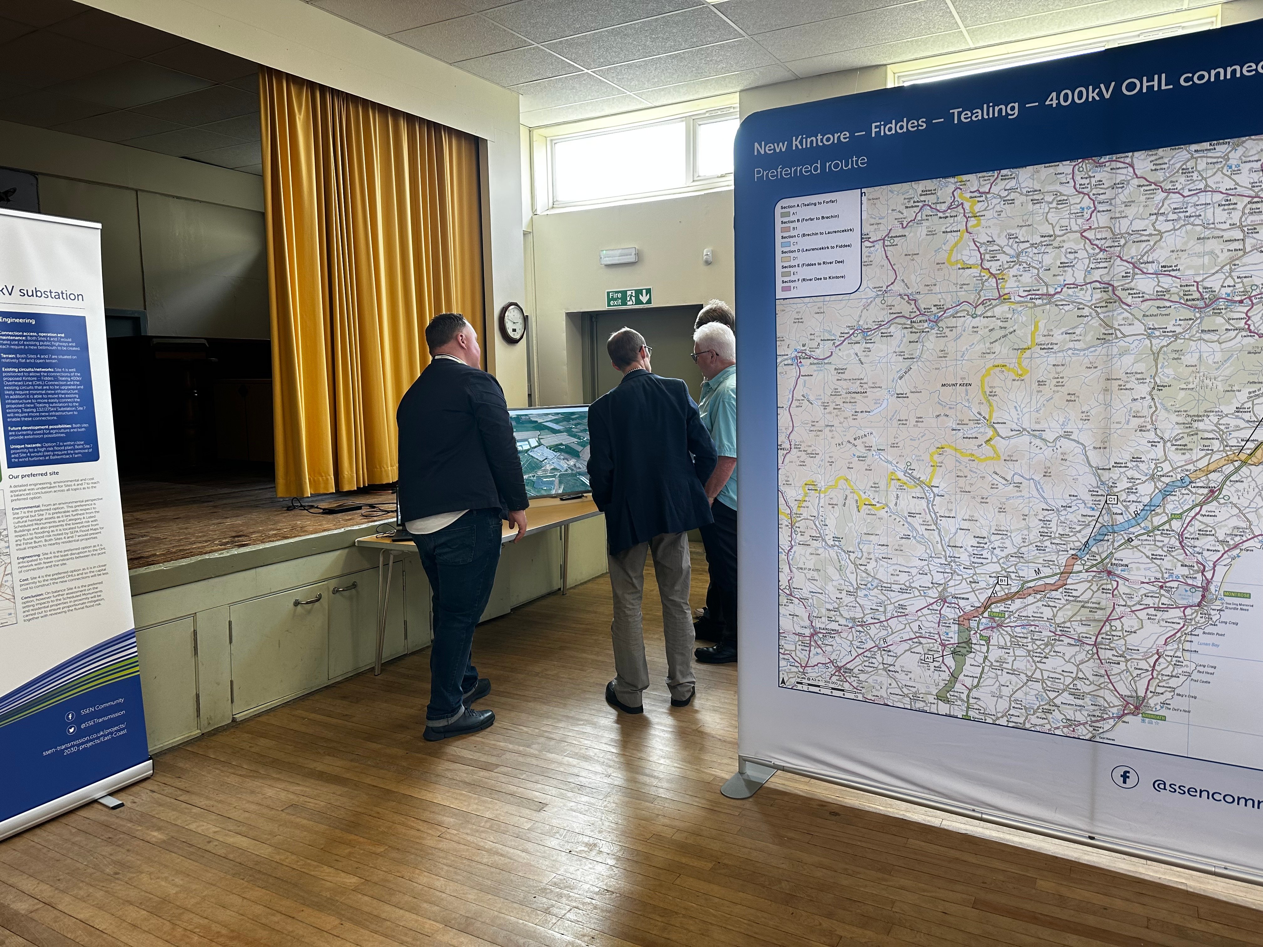
March 2024 feedback period now closed
We would like to extend thanks to all members of the public, local stakeholders and other interested parties who took the time to provide feedback on our proposals for the Kintore to Tealing 400kV overhead line project.
The feedback period for providing comments following our consultations that we held in March 2024 has now closed. All responses received are being reviewed by the project team.
Although the formal consultation period has closed for the latest events that we held, engagement with affected communities and wider stakeholders will continue beyond the consultation deadline and we will continue to engage with all stakeholders. -
March 2024 public consultations
We would like to thank all local community members and stakeholders who took the time to attend our recent March 2024 public consultation events which took place 4 – 21 March with 10 in person events covering the Kintore-Tealing 400kV projects.
Our public consultation on new routes D4, D5, E2, E3 and F1.3 remains open until 30 April. We welcome all interested parties to submit their feedback regarding the proposals presented during consultation via;
Online feedback form: Kintore - Tealing Overhead Line 400kV New Route Consultation Feedback Form
Email: tkup@sse.com
Post: FAO Rhiannon Merritt, SSEN Transmission, 10 Henderson Road, Inverness, IV1 1SN
Our virtual consultation portal will remain available throughout the consultation period here.
Copies of the consultation booklet, maps and consultation document are available to download via the ‘Project Documents’ section of this project website.
-
March 2024 public consultation period is now open
We are pleased to announce the commencement of the next period of public consultation.
The consulation consists of:
- Formal consultation for newly proposed OHL routes:
- D4 & D5 - Laurencekirk to the Proposed Hurlie Substation (at Fetteresso)
- E2 & E3 - Proposed Hurlie Substation to Rickarton
- F1.3 - River Dee to Coldstream, by Drumoak
- An update on all other OHL proposed routes, including refined routes following our consultations in May 2023.
A series of public events will be held in March for this project:
All events will run from 2-7pm.
Kintore-Tealing 400kV new route consultation
14 March Laurencekirk, Dickson Memorial Hall, Station Road, Laurencekirk, AB30 1BE
19 March Drumlithie, Drumlithie Village Hall, Station Road, Drumlithie, AB39 3YT
20 March Drumoak, Drumoak, Durris & Crathes Bowling Club, Sunnyside Avenue, Drumaok, AB31 5EF
21 March Auchenblae, Auchenblae Village Hall, Monboddo Street, Auchenblae, AB30 1XQ
Kintore-Tealing 400kV OHL update events
5 March Tannadice, Memus Community Hall, Memus, DD8 3TY
6 March Forfar, Reid Hall, 163 Castle Street, Forfar, DD8 3HX
7 March Tealing, Tealing Village Hall, Hall Road, Inveraldie, Tealing, DD4 0QW
12 March Brechin, Brechin City Hall, 9 Swan Street, Brechin, DD9 6EE
13 March Echt, Echt Hall, Echt, Westhill, AB32 6UL
If you are unable to attend any of the planned in-person events, all the material that will be on display can also be downloaded from the project documents section of this dedicated project website.
You can submit your feedback until 30 April 2024 for the new route consultation via the feedback form on the project website, by emailing tkup@sse.com or writing to us at SSEN Transmission, 10 Henderson Road, Inverness, IV1 1SN.
Following the events held in May 2023, many enquiries we received were about the need for the projects, the engagement process, environmental considerations, and what alternative technologies may be available. We have compiled ‘Frequently Asked Questions’ to address many of these points which can be viewed here.
- Formal consultation for newly proposed OHL routes:
-
Webinar: Update on ‘Pathway to 2030’ Projects
On the 13 December we held a stakeholder webinar ‘Update on Pathway to 2030 Projects’ to hear about some of the primary changes to our ‘Pathway to 2030’ projects which we’ve been working on since our public consultations earlier this year. Thank you to the 500+ stakeholders who were able to join us.The recording of the event and slide packs are available below for those who were unable to attend.
Report on Consultation
Our Reports on Consultation across our three new overhead line projects and associated substation and convertor station developments have now been published. These reports provide a summary of the extensive feedback received during consultation, how this has been considered and confirmation of which routes and substations are now being taken forward to the next stage of development.
Our Reports on Consultation are now available to download from the Project Documentation tab.
Summary Reports on Consultation are also available for each of the three schemes and can be downloaded below:
- Summary Report on Consultation Beauly to Peterhead
- Summary Report on Consultation Spittal to Beauly
- Summary Report on Consultation Kintore to Tealing
A stakeholder webinar available for all to join will be held in the coming weeks to share the changes informed by the feedback. More information about the forthcoming webinar will be shared on our events page shortly.
In further recognition of community feedback, we will seek to rationalise cumulative infrastructure impacts through the removal and undergrounding of existing transmission lines, where technically practical and appropriate, and subject to all necessary planning consents and landowner agreements.
Work to identify and assess potential sections of existing overhead line where their removal will reduce cumulative impacts is ongoing, with an update expected as part of the next round of public consultation on overhead line alignments and more detailed substation designs in early 2024.
We would once again like to thank all stakeholders who took the time to engage with our early consultation process. We will continue to engage with stakeholders ahead of consulting further with local communities and stakeholders in the new year, as we look to refine our proposals.
-
Report on Consultation
Over the course of this year, we have undertaken extensive consultation on plans to upgrade the electricity transmission network across the north of Scotland and have received a considerable amount of feedback from a wide range of stakeholders regarding our proposals.
We recently advised in our next steps for 2030 network developments update that following assessment of consultation feedback and additional options analysis, we would publish our Report on Consultations (RoCs). These reports provide a summary of the feedback received and how it has been considered, which options we will take forward to the next stage of the development process and any changes to options initially consulted on.
It is our intention to publish the RoCs for this project in the coming months. All stakeholders signed up for updates on the project will receive a link to the report and we will also issue Summary Reports to help ensure accessibility.
These Report on Consultations mark the completion of the first round of non-statutory consultation, where we sought feedback on the corridor, route, and substation locations. We will be consulting further with local communities and stakeholders in the new year, as we look to refine the projects, therefore we welcome an open channel of communication and would like to reassure all stakeholders that there will be further opportunities to engage on this project.
Our Reports on Consultation and Summary Reports on Consultation are now available to download from the Project Documentation tab. -
SSEN Transmission sets out next steps for Pathway to 2030 network developments
We have announced our next steps for our Pathway to 2030 programme of projects. We would like to thank everyone who has engaged with our teams and kindly taken the time to respond to our consultations.
Full details of the announcement can be found here:
Next steps for Pathway to 2030 -
Feedback period closed
The feedback period on our recent period of consultation for our East coast 400kV Phase 2 proposals which sought feedback on potential corridor and route options and preferred substation locations has now closed.
Further engagement with affected communities and wider stakeholders will continue beyond this consultation deadline, particularly in areas of local sensitivity, to help with our ongoing project development. The outcomes of the consultation exercise will be reported publicly in a Report on Consultation.
Throughout the development phase we will continue to engage with stakeholders and intend to hold a second public consultation event towards the end of the year.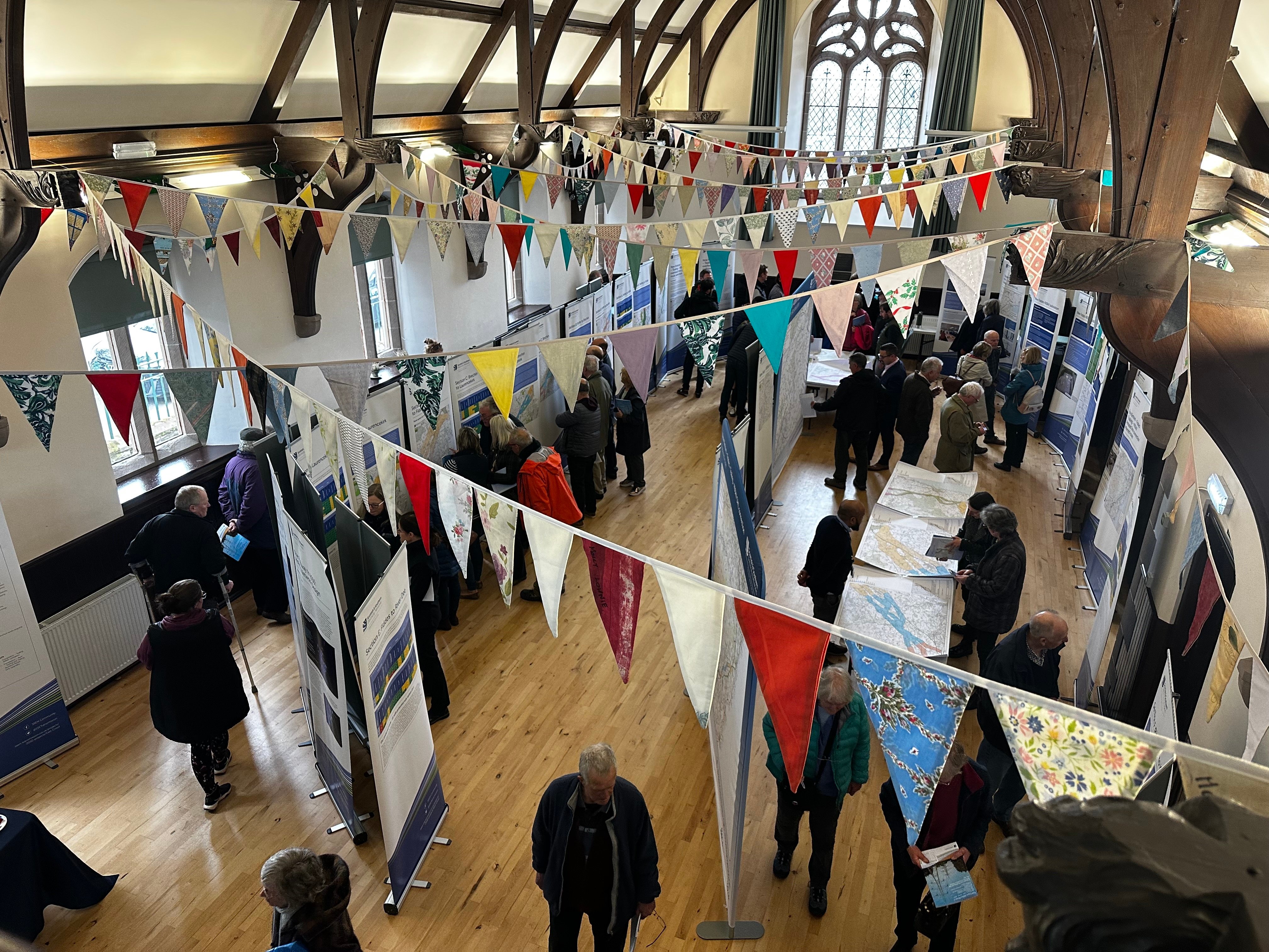
Forfar information event
Following the extension of the feedback period to 28 July 2023 on our proposals for a new 400kV network as well as reinforcing sections of the existing electricity transmission infrastructure between Kintore and Tealing via Fiddes and in response to community feedback in the Forfar and wider areawe we are pleased to be hosting a drop in information event in Forfar for members of the public and all interested parties from in and around the Forfar area to come and meet with members of the project team and give their views on the proposed projects that make up the East Coast 400kV PHASE 2.
The event details are as follows:
Forfar Reid Hall
13 July between 1-7pm
If you are unable to make the above event all the material that will be on display is available to be downloaded from the project documents section of this webpage however, we are aware of low internet speeds in the area and as such if you require information in an adapted format such as paper copy, large print or braille please let us know and we will work with you to accommodate your preferences.
We are happy to accommodate all reasonable requests for adapted communications. -
Public consultation feedback period extension
To allow more time for those interested in the East Coast 400kV phase 2 project to share their views we have extended the consultation period until Friday 28 July in recognition of the extent of local interest in the project and to allow stakeholders and members of the community more time to share their views on the initial proposals.
We would also like to reassure stakeholders that no decisions have yet been taken on potential overhead line routes or substation locations and the project remains at the early stages of development. All feedback received through the consultation will be carefully considered to help inform the ongoing development of this project.
If you have been unable to attend one of our consultation events, you can find all of the relevant consultation documentation within the project documents tab on this webpage.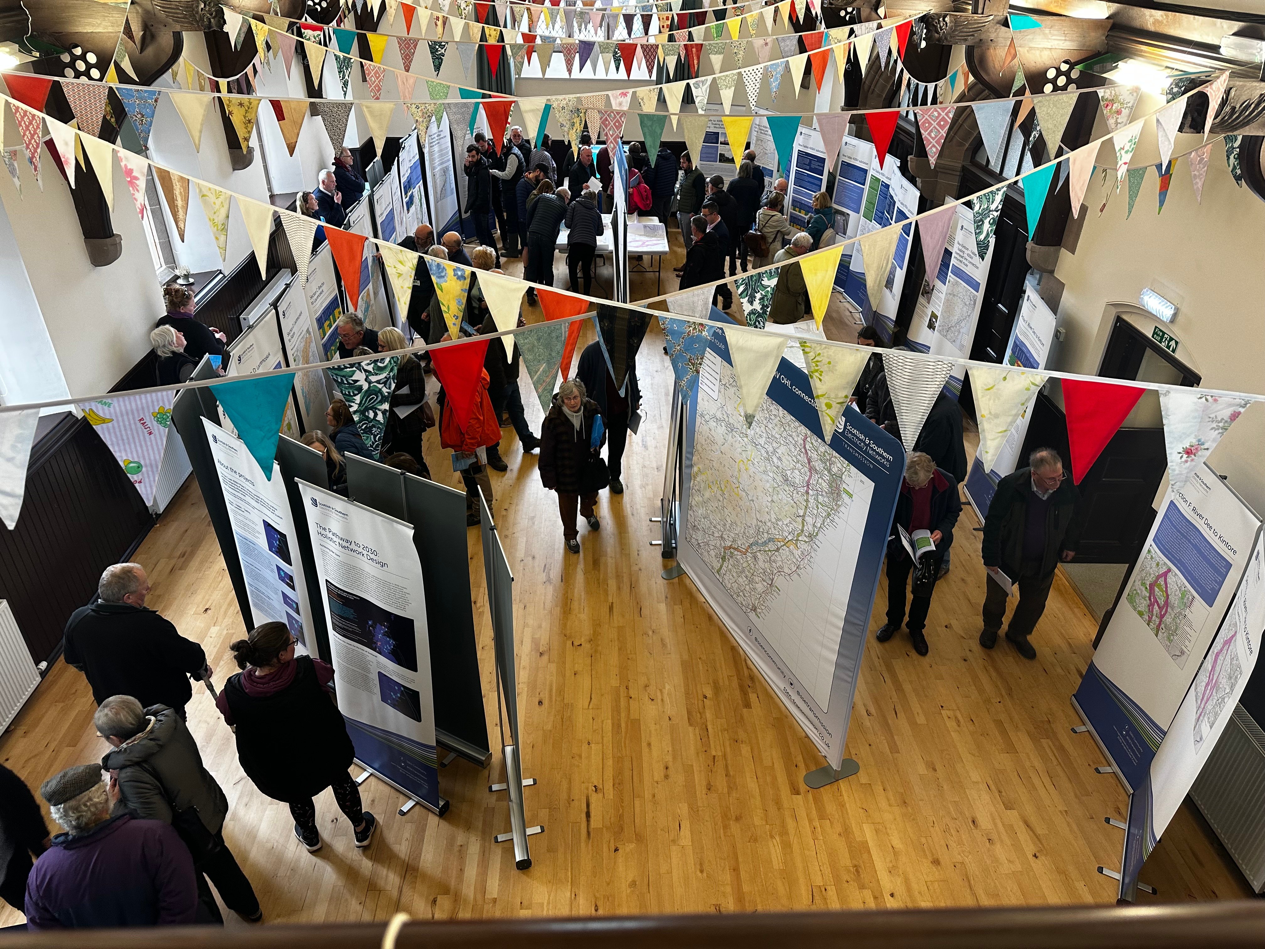
Initial response to consultation
We would like to thank all stakeholders who have taken the time to provide their feedback on our proposals to develop the East Coast 400kV phase 2 projects.
Following an initial review of the feedback received so far, SSEN Transmission has published an initial response to address some of the key themes which have been identified. Once the feedback period closes, a detailed Report on Consultation will also be published to explain how feedback has been considered to inform the more detailed network design.
The consultation period remains open and we continue to encourage anyone with an interest in the project to share their views by Friday 23 June.
The initial response to consultation is available to be downloaded from the project documents section of this website. -
Survey works to help inform next stages of development
We have recently started localised surveys, assessments and ground investigation works at various locations across the Pathway to 2030 projects which will be used to help gather information to inform the next stage of development for a major electricity transmission network upgrade in the north of Scotland.
Over the coming weeks and months, our project teams and contractors will undertake a series of site-specific assessments which include the likes of ground investigations, bird surveys, LiDAR flights, and ecological and archaeological walkovers and assessments.
Ground investigation works have either recently commenced or are set to begin throughout the Summer for the new 400kV substation and converter stations proposed as part of our East Coast 400kV phase 2, Spittal – Loch Buidhe – Beauly 400kV connection, Western Isles connection and Beauly – Blackhillock – New Deer – Peterhead 400kV connection projects. Project teams and contractors will undertake a series of site-specific assessments which will help provide vital information and key data for the next phase of project development.
Some of the geo-technical ground investigations may involve drilling boreholes or digging trial pits, which will allow engineers to understand the geographical make-up and suitability of the ground in certain locations to help inform potential design options.
Site assessments and survey works are a key part of the project development process, and the results of these investigations will provide project teams with valuable information to help inform decisions regarding substation site selections and overhead line routes, which will be subject to further consultation later this year.
Initial surveys will prioritise sites and routes which performed the best based on our initial assessment of key environmental and people, technical, and economic factors, and there have been no decisions taken on locations as yet.
There may be more activity on the ground over the summer, and whilst most assessments are expected to cause very little local disruption, we would like to thank the local community for their patience whilst they are carried out. Where more evasive assessments are required such as ground investigation works, we will work to keep local disruption and environmental impacts to a minimum. Please contact your local Community Liaison Manager if you have any questions.
Public Consultation Feedback Period Extension
In recognition of the extent of local interest in the project, we have extended the consultation feedback deadline until Friday 23 June and hope this will allow all stakeholders with an interest in the project sufficient time to provide feedback.
Additionally for anyone that wasn't able to attend any of the in person events and would like a copy of the booklet which contains all the information displayed we have distributed copies to the following local businesses:
Farm to Table, Westerton Of Pitarrow, Laurencekirk.
Spar Cetras Energy UK, 3 Academy Street, Forfar, DD8 2XF.
May 2023 consultation feedback
We would like to thank all local community members and stakeholders who took the time to attend our recent May 2023 consultation events which took place between 2-11 May, with 6 in-person consultations between Kirkton of Skene and Tealing, and a virtual live instant messaging session on 17 May.
Our public consultation will remain open until 23 June, and we would welcome all interested parties to submit their views regarding the proposals presented during consultation. Once the consultation period closes all feedback will be assessed and considered, to help determine next steps required ahead of route determination.
Our virtual consultation portal will remain available throughout the consultation period via the following link. The portal contains links to download the consultation booklet and copies of the maps, however these are also available to download via the 'Project Documents' section on the left hand side of this page. -
Public consultation events - May 2023
We are pleased to be hosting both face to face public consultations along with a virtual online consultation exhibition to gain views and feedback on our proposals for the East Coast 400kV phase 2 scheme, which the proposed new Kintore to Tealing 400kV overhead line project is part of.
We would encourage members of the local communities and all interested parties to attend the events, meet the proejct team and and give their views and provide feedback. The face to face consultations will be held at the following locations:
2 May at Milne Hall, Kirkton of Skene between 2-7pm
3 May at Ardoe House Hotel in the Ogston Suite between 2-7pm
4 May at Dickson Hall, Laurencekirk between 2-7pm
9 May at Brechin City Hall, Brechin between 2-7pm
10 May at Westmuir Hall, Kirriemuir between 2-7pm
11 May at Tealing Village Hall, Tealing between 2-7pmThe virtual consultation event will be taking place on:
17 May between 4-6pm
Click here to enter our virtual consultation room
Should you have any questions regarding the consultations please contact the projects Community Liaison Manager.
-
Documents
Section 37 Application - Additional Information
Section 37 Application
-
ECU00005225 EIA Section37 Notice.pdf
- Type:
- Date:
- 16 September 2025
- Size:
- 121.8 KB
-
ECU00005225 Kintore to Tealing 400 kV OHL Cover Letter.pdf
- Type:
- Date:
- 16 September 2025
- Size:
- 543 KB
-
Location Plan.pdf
- Type:
- Date:
- 16 September 2025
- Size:
- 4.6 MB
Section 37 Application – Supporting Documents
Section 37 Application – Environmental Impact Assessment (EIA) Report Documentation
EIA Report Preface, Contents and Glossary
EIA Report Non-Technical Summary
EIA Report – Volume 1 Main Text (Chapters 1 to 6)
EIA Report – Volume 2 Technical Chapters (Chapters 7 to 18)
EIA Report – Volume 3 Figures
EIA Report – Volume 4 Visualisations
EIA Report – Volume 5 Appendices
February/March 2025 Final Pre-Application Consultation (PAC) Events
-
Proposed Alignment Tower Heights and Coordinates
- Type:
- Date:
- 29 May 2025
- Size:
- 203.2 KB
These proposed tower heights correlate with the access track and constraints maps available on our web page.
-
Proposed Alignment Consultation Booklet
- Type:
- Date:
- 04 March 2025
- Size:
- 20 MB
This document provides information to our stakeholders about the project, presented during our feedback events in February/March 2025.
-
Proposed Alignment Access Tracks (Simplified)
- Type:
- Date:
- 04 March 2025
- Size:
- 54.2 MB
This material provides information to our stakeholders about the project and/or consultation events.
-
Proposed Alignment Access Tracks
- Type:
- Date:
- 04 March 2025
- Size:
- 54.2 MB
This material provides information to our stakeholders about the project and/or consultation events.
-
Proposed Alignment Constraints Maps
- Type:
- Date:
- 17 February 2025
- Size:
- 34.1 MB
These maps provide information to our stakeholders about the environmental constraints present within the project, produced 14 February 2025.
-
Proposed Alignment A4 Poster
- Type:
- Date:
- 10 February 2025
- Size:
- 882 KB
This document provides information to our stakeholders about our feedback events in February/March 2025.
-
Proposed Alignment A5 Mailer
- Type:
- Date:
- 10 February 2025
- Size:
- 703.6 KB
This document provides information to our stakeholders about our feedback events in February/March 2025.
-
Proposed Alignment Overview Map
- Type:
- Date:
- 10 February 2025
- Size:
- 5.7 MB
This map provides information to our stakeholders about the proposed alignment within the project, presented at our feedback events in February/March 2025.
-
Proposed Alignment Section Maps A-F
- Type:
- Date:
- 10 February 2025
- Size:
- 28.2 MB
These maps provides information to our stakeholders about the proposed alignment within the project, presented at our feedback events in February/March 2025.
-
Proposed Alignment Section Map Section A
- Type:
- Date:
- 10 February 2025
- Size:
- 5.2 MB
This map provides information to our stakeholders about the alignment options within section A, produced 7 February 2025
-
Proposed Alignment Section Map Section B
- Type:
- Date:
- 10 February 2025
- Size:
- 5.5 MB
This map provides information to our stakeholders about the alignment options within section B, produced 7 February 2025
-
Proposed Alignment Section Map Section C
- Type:
- Date:
- 10 February 2025
- Size:
- 5.3 MB
This map provides information to our stakeholders about the alignment options within section C, produced 7 February 2025
-
Proposed Alignment Section Map Section D
- Type:
- Date:
- 10 February 2025
- Size:
- 5.7 MB
This map provides information to our stakeholders about the alignment options within section D, produced 7 February 2025
-
Proposed Alignment Section Map Section E
- Type:
- Date:
- 10 February 2025
- Size:
- 5.8 MB
This map provides information to our stakeholders about the alignment options within section E, produced 7 February 2025
-
Proposed Alignment Section Map Section F
- Type:
- Date:
- 10 February 2025
- Size:
- 6.9 MB
This map provides information to our stakeholders about the alignment options within Section F, produced 7 February 2025
Alignment Report on Consultation
-
Kintore-Tealing Report on Consultation January 2025
- Type:
- Date:
- 31 January 2025
- Size:
- 71.5 MB
This Report on Consultation highlights the feedback we received in response to our consultations held in September and October 2024, and how this has influenced our actions and decision-making.
-
Summary RoC
- Type:
- Date:
- 31 January 2025
- Size:
- 68.1 MB
This document is a summary of our full Report on Consultation which highlights the feedback we received in response to our consultations held in September and October 2024, and how this has influenced our actions and decision-making.
Additional Information
September/October 2024 public consultation documents
August 2024 Report on Consultation
March 2024 public consultation documents
2023 Reports on Consultation
May 2023 public consultation documents
Project documents
GI Works
Ground Investigation (GI) Works
Prior to the submission of our Section 37 Application for the proposed Kintore – Tealing 400kV overhead line project, access to the proposed alignment route has been required to undertake more detailed ground investigations (GI) and inspections of the proposed tower locations. GI works are a necessary step in any new development with the results helping to establish final tower foundation designs, allowing engineers to understand the engineering properties of the soil and rock beneath potential tower locations and their ability to support the structures.
Project teams and contractors have been carrying out walkover surveys and ground investigation works for several months, which are necessary steps in any new development to fully understand the ground conditions in the area and help establish the final tower foundation design.
These works are carried out using Permitted Development rights available to SSEN Transmission under Class 40, (1), (c) of the Town and Country Planning (General Permitted Development) (Scotland) Order 1992 as amended. These are necessary survey works, and we are working closely with relevant departments in the respective Local Authorities (e.g. Road, Planning, Access), Statutory Partners and Landowners.
Going forward, we will communicate important updates through the ‘Project updates’ section of this webpage (see ‘Project Update’ tab above) where the works details will be available.
Our contractors will work to keep local disturbance to a minimum throughout the duration of these works. For any enquiries, please contact TKUP@sse.com.
Current GI Works
What the works involve?
Temporary Welfare Facilities
GI Works April 2026
-
U370 Road Closure and Temporary Traffic Lights 16-17 April
- Type:
- Date:
- 01 April 2026
- Size:
- 570.4 KB
-
U373 U374 C22 U364 Road Closure and Temporary Traffic Lights 13-14 and 21-22 April
- Type:
- Date:
- 01 April 2026
- Size:
- 644.4 KB
-
U360 A94 Road Closures and Temporary Traffic Lights 17-20 and 20-21 April
- Type:
- Date:
- 01 April 2026
- Size:
- 505.4 KB
-
U322 C6 Road Closure and Temporary Traffic Lights 13-15 April
- Type:
- Date:
- 01 April 2026
- Size:
- 439.1 KB
-
C30 U417-1 U429 C35 B966 Road Closures 27 April - 1 May, and 4 May
- Type:
- Date:
- 06 April 2026
- Size:
- 755.2 KB
-
U412 U413 U413-1 Road Closures 27-29 April
- Type:
- Date:
- 06 April 2026
- Size:
- 609.9 KB
-
U414 C33 U417 U418 Road Closures 23, 24, 27, 29, 30 April and 1 May
- Type:
- Date:
- 06 April 2026
- Size:
- 611 KB
-
C31 C32 U407 U408 Road Closures and Temporary Traffic Lights 20-22, 23-24 and 27 April
- Type:
- Date:
- 06 April 2026
- Size:
- 419.7 KB
FAQs
Section 37 Application
Who we are
About the Pathway to 2030 projects
Our approach to routeing and public consultation
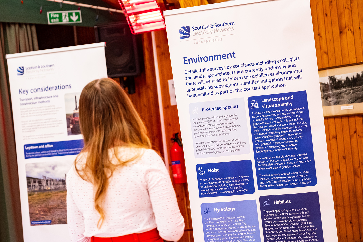
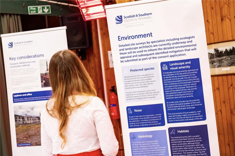
Environmental considerations
Community and landowner considerations
Cost and engineering considerations
Emmock and Tealing S37 Tie Ins
SSEN Transmission has made a Section 37 application to the Scottish Government’s Energy Consents Unit (ECU) for the Emmock and Tealing Overhead Line (OHL) Tie-ins project.
Under Section 37 of the Electricity Act 1989, the application is seeking consent for the diversion of short sections of the Alyth to Tealing (A-T OHL) and Tealing to Westfield (T-W OHL) 275kV OHLs, which currently connect at their eastern extent with the existing Tealing 275kV substation, to connect with the proposed Emmock 400kV substation.
Consent for this work has been applied for via a standalone Section 37 application under the Electricity Act 1989 to Scottish Ministers. Consent is also sought under the same application for the installation of two short sections of parallel OHL 'tiebacks' between Emmock substation and Tealing substation (one 275kV, one 400kV).
The project is essential to the completion of the Kintore to Tealing projects, as it would provide the tie-ins for the reconductored A-T OHL and T-W OHL to the proposed Emmock substation as part of the upgraded 400kV transmission infrastructure. This would allow power to keep flowing whilst the wider upgrade works are undertaken.
Viewing the application:
If you wish to view the Section 37 application, you can do so on the Energy Consents Unit’s website: www.energyconsents.scot. The application reference is: ECU00005204
All the documentation submitted as part of the application can also be viewed and downloaded via this page.
A hard copy of the application including the Environmental Impact Assessment (EIA) Report and supporting documents will also be available to be viewed at the following locations:
Forfar Library, Angus Mobile Library
FAQs - Section 37 Application (Tie-ins)
Section 37 Application - Supporting Documents
Section 37 Application – Environmental Impact Assessment (EIA) Report Documentation
EIA Report – Volume 1 - Non-Technical Summary
EIA Report – Volume 2 Main Chapters
EIA Report – Volume 3 Figures
EIA Report – Volume 4 Appendices
Recite me
To make use of this function please click on the 3 'A's' button at the bottom left of the website.
Latest Links
-

Report on Consultation
Our Reports on Consultation across our three new overhead line projects and associated substation and convertor station developments have now been published. These reports provide a summary of the extensive feedback received during consultation, how this has been considered and confirmation of which routes and substations are now being taken forward to the next stage of development.
Our Reports on Consultation are now available to download from the Project Documentation tab.
Summary Reports on Consultation are also available for each of the three schemes and can be downloaded below:
- Summary Report on Consultation Spittal to Beauly
- Summary Report on Consultation Beauly to Peterhead
- Summary Report on Consultation Kintore to Tealing
A stakeholder webinar available for all to join will be held in the coming weeks to share the changes informed by the feedback. More information about the forthcoming webinar will be shared on our events page shortly.
In further recognition of community feedback, we will seek to rationalise cumulative infrastructure impacts through the removal and undergrounding of existing transmission lines, where technically practical and appropriate, and subject to all necessary planning consents and landowner agreements.
Work to identify and assess potential sections of existing overhead line where their removal will reduce cumulative impacts is ongoing, with an update expected as part of the next round of public consultation on overhead line alignments and more detailed substation designs in early 2024.
We would once again like to thank all stakeholders who took the time to engage with our early consultation process. We will continue to engage with stakeholders ahead of consulting further with local communities and stakeholders in the new year, as we look to refine our proposals.
-
Report on Consultation
Over the course of this year, we have undertaken extensive consultation on plans to upgrade the electricity transmission network across the north of Scotland and have received a considerable amount of feedback from a wide range of stakeholders regarding our proposals.
We recently advised in our next steps for 2030 network developments update that following assessment of consultation feedback and additional options analysis, we would publish our Report on Consultations (RoCs). These reports provide a summary of the feedback received and how it has been considered, which options we will take forward to the next stage of the development process and any changes to options initially consulted on.
It is our intention to publish the RoCs during the week commencing 27 November. All stakeholders signed up for updates on the project will receive a link to the report and we will also issue Summary Reports to help ensure accessibility.
These Report on Consultations mark the completion of the first round of non-statutory consultation, where we sought feedback on the corridor, route, and substation locations. We will be consulting further with local communities and stakeholders in the new year, as we look to refine the projects, therefore we welcome an open channel of communication and would like to reassure all stakeholders that there will be further opportunities to engage on this project.
Our Reports on Consultation and Summary Reports on Consultation are now available to download from the Project Documentation tab. -
SSEN Transmission sets out next steps for Pathway to 2030 network developments
We have announced our next steps for our Pathway to 2030 programme of projects. We would like to thank everyone who has engaged with our teams and kindly taken the time to respond to our consultations.
Full details of the announcement can be found here:
Next steps for Pathway to 2030